 |
|
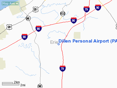
Location & QuickFacts
| FAA Information Effective: | 2008-09-25 |
| Airport Identifier: | PA02 |
| Airport Status: | Operational |
| Longitude/Latitude: | 080-10-59.2100W/41-59-00.1990N
-80.183114/41.983389 (Estimated) |
| Elevation: | 1028 ft / 313.33 m (Estimated) |
| Land: | 4 acres |
| From nearest city: | 3 nautical miles W of Mc Kean, PA |
| Location: | Erie County, PA |
| Magnetic Variation: | 08W (1985) |
Owner & Manager
| Ownership: | Privately owned |
| Owner: | William Dillen |
| Address: | 6301 Van Camp Road
Mc Kean, PA 16426 |
| Phone number: | 814-476-7888 |
| Manager: | William Dillen |
| Address: | 6301 Van Camp Road
Mc Kean, PA 16426 |
| Phone number: | 814-476-7888 |
Airport Operations and Facilities
| Airport Use: | Private |
| Wind indicator: | No |
| Segmented Circle: | No |
| Control Tower: | No |
| Landing fee charge: | No |
| Sectional chart: | Detroit |
| Region: | AEA - Eastern |
| Boundary ARTCC: | ZOB - Cleveland |
| Tie-in FSS: | AOO - Altoona |
| FSS on Airport: | No |
| FSS Toll Free: | 1-800-WX-BRIEF |
Airport Services
| Airframe Repair: | NONE |
| Power Plant Repair: | NONE |
| Bottled Oxygen: | NONE |
Runway Information
Runway 10/28
| Dimension: | 1345 x 104 ft / 410.0 x 31.7 m |
| Surface: | TURF, |
| |
Runway 10 |
Runway 28 |
| Traffic Pattern: | Left | Left |
|
Radio Navigation Aids
| ID |
Type |
Name |
Ch |
Freq |
Var |
Dist |
| CQD | NDB | Cascade | | 372.00 | 08W | 8.9 nm |
| ORJ | NDB | Corry | | 258.00 | 09W | 24.3 nm |
| FKL | VOR | Franklin | | 109.60 | 06W | 35.9 nm |
| JFN | VOR/DME | Jefferson | 099X | 115.20 | 05W | 28.6 nm |
| JHW | VOR/DME | Jamestown | 094X | 114.70 | 07W | 48.9 nm |
| ERI | VORTAC | Erie | 031X | 109.40 | 06W | 5.3 nm |
| TDT | VORTAC | Tidioute | 123X | 117.60 | 09W | 37.9 nm |
| YNG | VORTAC | Youngstown | 027X | 109.00 | 05W | 45.0 nm |
Images and information placed above are from
http://www.airport-data.com/airport/PA02/
We thank them for the data!
| General Info
|
| Country |
United States
|
| State |
PENNSYLVANIA
|
| FAA ID |
PA02
|
| Latitude |
41-59-00.199N
|
| Longitude |
080-10-59.210W
|
| Elevation |
1028 feet
|
| Near City |
MC KEAN
|
We don't guarantee the information is fresh and accurate. The data may
be wrong or outdated.
For more up-to-date information please refer to other sources.
|
|


