 |
|
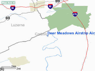
Deer Meadows Airstrip Airport |
Location & QuickFacts
| FAA Information Effective: | 2008-09-25 |
| Airport Identifier: | 8PA3 |
| Airport Status: | Operational |
| Longitude/Latitude: | 075-44-25.6900W/40-59-45.3080N
-75.740469/40.995919 (Estimated) |
| Elevation: | 1210 ft / 368.81 m (Estimated) |
| Land: | 196 acres |
| From nearest city: | 4 nautical miles N of Weatherly, PA |
| Location: | Carbon County, PA |
| Magnetic Variation: | 11W (1990) |
Owner & Manager
| Ownership: | Privately owned |
| Owner: | Thomas Mcbrien |
| Address: | 207 Saw Mill Road
Weatherly, PA 18255 |
| Phone number: | 570-427-8433 |
| Manager: | Thomas Mcbrien |
| Address: | 207 Saw Mill Road
Weatherly, PA 18255 |
| Phone number: | 570-427-8433 |
Airport Operations and Facilities
| Airport Use: | Private |
| Wind indicator: | Yes |
| Segmented Circle: | No |
| Control Tower: | No |
| Sectional chart: | New York |
| Region: | AEA - Eastern |
| Boundary ARTCC: | ZNY - New York |
| Tie-in FSS: | IPT - Williamsport |
| FSS on Airport: | No |
| FSS Toll Free: | 1-800-WX-BRIEF |
Airport Services
Runway Information
Runway 08/26
| Dimension: | 3500 x 100 ft / 1066.8 x 30.5 m |
| Surface: | TURF, |
| |
Runway 08 |
Runway 26 |
| Traffic Pattern: | Left | Left |
| Obstruction: | 50 ft trees, 1000.0 ft from runway | 50 ft trees, 1000.0 ft from runway |
|
Radio Navigation Aids
| ID |
Type |
Name |
Ch |
Freq |
Var |
Dist |
| LQX | NDB | Carbon | | 339.00 | 12W | 11.1 nm |
| HXM | NDB | Humbolt | | 366.00 | 10W | 11.6 nm |
| CYE | NDB | Crystal Lake | | 410.00 | 11W | 13.5 nm |
| UKT | NDB | Quakertown | | 208.00 | 12W | 39.8 nm |
| PIX | NDB | Picture Rocks | | 344.00 | 09W | 47.0 nm |
| DYL | NDB | Doylestown | | 237.00 | 10W | 48.7 nm |
| HZL | VOR | Hazleton | | 109.40 | 09W | 17.5 nm |
| ETX | VOR/DME | East Texas | 039X | 110.20 | 09W | 25.1 nm |
| STW | VOR/DME | Stillwater | 033X | 109.60 | 11W | 39.5 nm |
| CKZ | VOR/DME | Pennridge | 025Y | 108.85 | 12W | 41.8 nm |
| BWZ | VOR/DME | Broadway | 089X | 114.20 | 11W | 43.4 nm |
| LVZ | VORTAC | Wilkes-barre | 053X | 111.60 | 10W | 16.8 nm |
| FJC | VORTAC | Allentown | 122X | 117.50 | 10W | 20.8 nm |
| LHY | VORTAC | Lake Henry | 045X | 110.80 | 10W | 31.1 nm |
| MIP | VORTAC | Milton | 029X | 109.20 | 09W | 42.0 nm |
| PTW | VORTAC | Pottstown | 112X | 116.50 | 09W | 47.2 nm |
| RAV | VORTAC | Ravine | 093X | 114.60 | 11W | 47.3 nm |
Images and information placed above are from
http://www.airport-data.com/airport/8PA3/
We thank them for the data!
| General Info
|
| Country |
United States
|
| State |
PENNSYLVANIA
|
| FAA ID |
8PA3
|
| Latitude |
40-59-45.308N
|
| Longitude |
075-44-25.690W
|
| Elevation |
1210 feet
|
| Near City |
WEATHERLY
|
We don't guarantee the information is fresh and accurate. The data may
be wrong or outdated.
For more up-to-date information please refer to other sources.
|
|


