 |
|
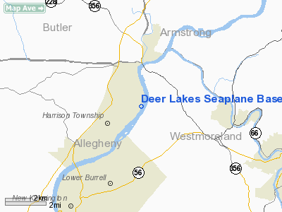
Deer Lakes Seaplane Base Airport |
Location & QuickFacts
| FAA Information Effective: | 2008-09-25 |
| Airport Identifier: | PN65 |
| Airport Status: | Operational |
| Longitude/Latitude: | 079-41-37.0000W/40-38-21.0000N
-79.693611/40.639167 (Estimated) |
| Elevation: | 745 ft / 227.08 m (Estimated) |
| Land: | 0 acres |
| From nearest city: | 1 nautical miles NE of Natrona Hgts, PA |
| Location: | Allegheny County, PA |
| Magnetic Variation: | 08W (1985) |
Owner & Manager
| Ownership: | Privately owned |
| Owner: | Deer Lakes Pilot Club, Inc. |
| Address: | 3058 Leechburg Rd-stes 10/11
Lower Burrell, PA 15068 |
| Phone number: | 412-265-9915 |
| Manager: | David B. Wasson, Secretary |
| Address: | 3058 Leechburg Rd-stes 1o/11
Lower Burrell, PA 15068 |
| Phone number: | 412-337-7170 |
Airport Operations and Facilities
| Airport Use: | Private |
| Wind indicator: | No |
| Segmented Circle: | No |
| Control Tower: | No |
| Landing fee charge: | No |
| Sectional chart: | Detroit |
| Region: | AEA - Eastern |
| Boundary ARTCC: | ZOB - Cleveland |
| Tie-in FSS: | AOO - Altoona |
| FSS on Airport: | No |
| FSS Toll Free: | 1-800-WX-BRIEF |
Runway Information
Runway 02/20
| Dimension: | 8000 x 150 ft / 2438.4 x 45.7 m |
| Surface: | WATER, |
| |
Runway 02 |
Runway 20 |
| Traffic Pattern: | Left | Left |
|
Radio Navigation Aids
| ID |
Type |
Name |
Ch |
Freq |
Var |
Dist |
| MKP | NDB | Mc Keesport | | 287.00 | 07W | 17.5 nm |
| BHU | NDB | Benje | | 382.00 | 07W | 25.0 nm |
| INP | NDB | Indiana | | 242.00 | 08W | 28.6 nm |
| PNU | NDB | Washington County | | 255.00 | 08W | 36.7 nm |
| UCP | NDB | Castle | | 272.00 | 09W | 40.1 nm |
| VV | NDB | Camor | | 299.00 | 08W | 45.5 nm |
| SYS | NDB | Stoystown | | 209.00 | 08W | 48.7 nm |
| HBD | NDB | Hubbard | | 408.00 | 08W | 49.0 nm |
| FKL | VOR | Franklin | | 109.60 | 06W | 48.6 nm |
| AGC | VOR/DME | Allegheny | 037X | 110.00 | 09W | 26.9 nm |
| CIP | VOR/DME | Clarion | 076X | 112.90 | 06W | 32.3 nm |
| REC | VOR/DME | Revloc | 043X | 110.60 | 09W | 43.6 nm |
| HLG | VOR/DME | Wheeling | 059X | 112.20 | 07W | 46.1 nm |
| MMJ | VORTAC | Montour | 057X | 112.00 | 08W | 24.6 nm |
| EWC | VORTAC | Ellwood City | 105X | 115.80 | 08W | 26.1 nm |
| IHD | VORTAC | Indian Head | 019X | 108.20 | 06W | 42.8 nm |
| JST | VORTAC | Johnstown | 077X | 113.00 | 06W | 43.8 nm |
Images and information placed above are from
http://www.airport-data.com/airport/PN65/
We thank them for the data!
|
|


