 |
|
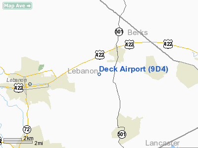
Location & QuickFacts
| FAA Information Effective: | 2008-09-25 |
| Airport Identifier: | 9D4 |
| Airport Status: | Operational |
| Longitude/Latitude: | 076-19-46.7200W/40-21-07.6600N
-76.329644/40.352128 (Estimated) |
| Elevation: | 523 ft / 159.41 m (Surveyed) |
| Land: | 92 acres |
| From nearest city: | 1 nautical miles SW of Myerstown, PA |
| Location: | Lebanon County, PA |
| Magnetic Variation: | 09W (1970) |
Owner & Manager
| Ownership: | Privately owned |
| Owner: | Clyde E Deck |
| Address: | 351 S Ramona Rd
Lebanon, PA 17042 |
| Phone number: | 717-866-6529 |
| Manager: | Clyde E Deck |
| Address: | 3515 S Ramona Rd
Lebanon, PA 17042 |
| Phone number: | 717-866-4388
PHONE AT ARPT 717-866-6529 OR 717-866-2184. |
Airport Operations and Facilities
| Airport Use: | Open to public |
| Wind indicator: | Yes |
| Segmented Circle: | No |
| Control Tower: | No |
| Lighting Schedule: | RDO-CTL
ACTVT MIRL RY 01/19; REIL RYS 01 & 19; ROTG BCN - CTAF. |
| Beacon Color: | Clear-Green (lighted land airport) |
| Sectional chart: | New York |
| Region: | AEA - Eastern |
| Boundary ARTCC: | ZNY - New York |
| Tie-in FSS: | IPT - Williamsport |
| FSS Toll Free: | 1-800-WX-BRIEF |
| NOTAMs Facility: | IPT (NOTAM-d service avaliable) |
Airport Communications
| CTAF: | 122.800 |
| Unicom: | 122.800 |
Airport Services
| Fuel available: | 100LLA |
| Airframe Repair: | MAJOR |
| Power Plant Repair: | MAJOR |
| Bottled Oxygen: | HIGH |
| Bulk Oxygen: | HIGH |
Runway Information
Runway 01/19
| Dimension: | 3786 x 50 ft / 1154.0 x 15.2 m |
| Surface: | ASPH, Good Condition |
| Weight Limit: | Single wheel: 12000 lbs. |
| Edge Lights: | Medium |
| |
Runway 01 |
Runway 19 |
| Longitude: | 076-19-44.2910W | 076-19-49.1600W |
| Latitude: | 40-20-49.0466N | 40-21-26.2700N |
| Elevation: | 511.00 ft | 523.00 ft |
| Alignment: | 127 | 127 |
| Traffic Pattern: | Left | Left |
| Markings: | Basic, Good Condition
RY 01/19 MKGS FADED. | Basic, Good Condition |
| Displaced threshold: | 0.00 ft | 187.00 ft |
| Runway End Identifier: | Yes
& 19 NSTD REIL - STROBE LGTS IDENTIFY RY ENDS. | Yes
RY 01 & 19 NSTD REIL - STROBE LGTS IDENTIFY RY ENDS. |
| Obstruction: | 54 ft tree, 475.0 ft from runway, 229 ft right of centerline, 5:1 slope to clear
FUEL TANK 22 FT OFF AER AND 208 FT LEFT, UNLTD. | , 50:1 slope to clear |
|
Radio Navigation Aids
| ID |
Type |
Name |
Ch |
Freq |
Var |
Dist |
| BZJ | NDB | Bellgrove | | 328.00 | 10W | 11.4 nm |
| EUD | NDB | York | | 254.00 | 11W | 36.2 nm |
| LQX | NDB | Carbon | | 339.00 | 12W | 38.0 nm |
| HXM | NDB | Humbolt | | 366.00 | 10W | 41.2 nm |
| UKT | NDB | Quakertown | | 208.00 | 12W | 47.5 nm |
| ING | NDB | Ambler | | 275.00 | 11W | 49.8 nm |
| HZL | VOR | Hazleton | | 109.40 | 09W | 38.6 nm |
| ETX | VOR/DME | East Texas | 039X | 110.20 | 09W | 32.6 nm |
| CKZ | VOR/DME | Pennridge | 025Y | 108.85 | 12W | 47.7 nm |
| LRP | VORTAC | Lancaster | 120X | 117.30 | 09W | 14.1 nm |
| RAV | VORTAC | Ravine | 093X | 114.60 | 11W | 17.3 nm |
| HAR | VORTAC | Harrisburg | 072X | 112.50 | 10W | 34.0 nm |
| PTW | VORTAC | Pottstown | 112X | 116.50 | 09W | 36.1 nm |
| SEG | VORTAC | Selinsgrove | 041X | 110.40 | 08W | 36.6 nm |
| MXE | VORTAC | Modena | 079X | 113.20 | 09W | 40.0 nm |
| MIP | VORTAC | Milton | 029X | 109.20 | 09W | 43.2 nm |
| FJC | VORTAC | Allentown | 122X | 117.50 | 10W | 45.9 nm |
| MDT | VOT | Harrisburg International | | 110.00 | | 21.9 nm |
Remarks
- FOR PICKUP CLEARANCE - TOLL FREE 800-932-0712.
- ACFT HGR 570 FT BEHIND RY 01 THLD AND 212 FT LEFT UNLTD. ACFT PARKED 57 FT BEHIND RY 01 THLD AND 132 FT LEFT.
- PRVDD VFR ONLY; AND DRIVEWAY SW OF RWY 36 IS EITHER CLOSED; RELOCATED; OR A MEANS IS ESTABLISHED TO CONTROL VEH TRAFFIC.
Images and information placed above are from
http://www.airport-data.com/airport/9D4/
We thank them for the data!
| General Info
|
| Country |
United States
|
| State |
PENNSYLVANIA
|
| FAA ID |
9D4
|
| Latitude |
40-21-06.400N
|
| Longitude |
076-19-46.600W
|
| Elevation |
522 feet
|
| Near City |
MYERSTOWN
|
We don't guarantee the information is fresh and accurate. The data may
be wrong or outdated.
For more up-to-date information please refer to other sources.
|
|


