 |
|
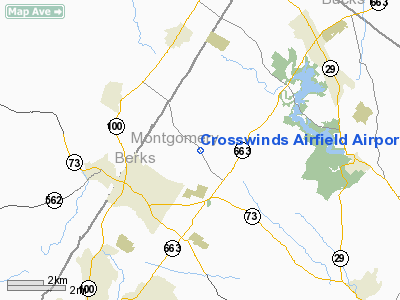
Crosswinds Airfield Airport |
Location & QuickFacts
| FAA Information Effective: | 2008-09-25 |
| Airport Identifier: | PN00 |
| Airport Status: | Operational |
| Longitude/Latitude: | 075-34-21.6500W/40-20-35.3500N
-75.572681/40.343153 (Estimated) |
| Elevation: | 300 ft / 91.44 m (Estimated) |
| Land: | 83 acres |
| From nearest city: | 1 nautical miles E of Sassamansville, PA |
| Location: | Montgomery County, PA |
| Magnetic Variation: | 12W (1995) |
Owner & Manager
| Ownership: | Privately owned |
| Owner: | Louis P Farrell |
| Address: | Po Box 241
Sassamansville, PA 19472 |
| Phone number: | 610-754-6997 |
| Manager: | Louis P Farrell |
| Address: | 220 Sassamansville Rd
Sassamansville, PA 19472 |
| Phone number: | 610-754-9006 |
Airport Operations and Facilities
| Airport Use: | Private |
| Wind indicator: | Yes |
| Segmented Circle: | No |
| Control Tower: | No |
| Sectional chart: | New York |
| Region: | AEA - Eastern |
| Boundary ARTCC: | ZNY - New York |
| Tie-in FSS: | IPT - Williamsport |
| FSS Toll Free: | 1-800-WX-BRIEF |
Runway Information
Runway 02/20
| Dimension: | 2550 x 250 ft / 777.2 x 76.2 m |
| Surface: | TURF, Good Condition |
| |
Runway 02 |
Runway 20 |
| Traffic Pattern: | Left | Left |
| Displaced threshold: | 550.00 ft | 0.00 ft |
| Obstruction: | 35 ft trees, 20.0 ft from runway | |
|
Radio Navigation Aids
| ID |
Type |
Name |
Ch |
Freq |
Var |
Dist |
| UKT | NDB | Quakertown | | 208.00 | 12W | 13.5 nm |
| ING | NDB | Ambler | | 275.00 | 11W | 18.6 nm |
| DYL | NDB | Doylestown | | 237.00 | 10W | 20.6 nm |
| NXX | NDB | Willow Grove | | 388.00 | 12W | 21.7 nm |
| LQX | NDB | Carbon | | 339.00 | 12W | 29.4 nm |
| HXM | NDB | Humbolt | | 366.00 | 10W | 43.3 nm |
| BZJ | NDB | Bellgrove | | 328.00 | 10W | 45.2 nm |
| NXX | TACAN | Willow Grove | 061X | | 10W | 21.5 nm |
| PNE | VOR | North Philadelphia | | 112.00 | 10W | 30.2 nm |
| HZL | VOR | Hazleton | | 109.40 | 09W | 45.6 nm |
| CKZ | VOR/DME | Pennridge | 025Y | 108.85 | 12W | 13.3 nm |
| ETX | VOR/DME | East Texas | 039X | 110.20 | 09W | 15.2 nm |
| ARD | VOR/DME | Yardley | 019X | 108.20 | 10W | 31.0 nm |
| SBJ | VOR/DME | Solberg | 076X | 112.90 | 10W | 40.6 nm |
| BWZ | VOR/DME | Broadway | 089X | 114.20 | 11W | 43.9 nm |
| PTW | VORTAC | Pottstown | 112X | 116.50 | 09W | 7.3 nm |
| FJC | VORTAC | Allentown | 122X | 117.50 | 10W | 23.7 nm |
| MXE | VORTAC | Modena | 079X | 113.20 | 09W | 25.9 nm |
| LRP | VORTAC | Lancaster | 120X | 117.30 | 09W | 35.6 nm |
| DQO | VORTAC | Dupont | 087X | 114.00 | 10W | 40.0 nm |
| OOD | VORTAC | Woodstown | 075X | 112.80 | 10W | 44.3 nm |
| RAV | VORTAC | Ravine | 093X | 114.60 | 11W | 48.6 nm |
| GXU | VORTAC | Mc Guire | 043X | 110.60 | 11W | 49.1 nm |
| PHL | VOT | Philadelphia Intl | | 109.80 | | 32.2 nm |
Remarks
- PRVDD VFR ONLY, NO ACFT OVER 12500 LBS SINGLE ENGINE, RY 33 THLD DSPLCD TO PROVIDE 20:1 APCH, CROSS SLOPE REMOVED, CONDUCT OPNS TO MINIMIZE NOISE.
Images and information placed above are from
http://www.airport-data.com/airport/PN00/
We thank them for the data!
| General Info
|
| Country |
United States
|
| State |
PENNSYLVANIA
|
| FAA ID |
PN00
|
| Latitude |
40-20-35.350N
|
| Longitude |
075-34-21.650W
|
| Elevation |
300 feet
|
| Near City |
SASSAMANSVILLE
|
We don't guarantee the information is fresh and accurate. The data may
be wrong or outdated.
For more up-to-date information please refer to other sources.
|
|


