 |
|
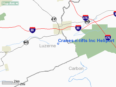
Cranes-n-lifts Inc Heliport |
Location & QuickFacts
| FAA Information Effective: | 2008-09-25 |
| Airport Identifier: | PN07 |
| Airport Status: | Operational |
| Longitude/Latitude: | 075-46-42.6960W/41-01-51.3050N
-75.778527/41.030918 (Estimated) |
| Elevation: | 1360 ft / 414.53 m (Estimated) |
| Land: | 0 acres |
| From nearest city: | 1 nautical miles SW of White Haven, PA |
| Location: | Luzerne County, PA |
| Magnetic Variation: | 12W (1990) |
Owner & Manager
| Ownership: | Privately owned |
| Owner: | Cranes-n-lifts Inc |
| Address: | Rd 1
White Haven, PA 18661 |
| Phone number: | 717-443-7555 |
| Manager: | Floyd C Hoffman - President |
| Address: | Rd 1
White Haven, PA 18661 |
| Phone number: | 717-443-7555 |
Airport Operations and Facilities
| Airport Use: | Private |
| Segmented Circle: | No |
| Control Tower: | No |
| Sectional chart: | New York |
| Region: | AEA - Eastern |
| Boundary ARTCC: | ZNY - New York |
| Tie-in FSS: | IPT - Williamsport |
| FSS on Airport: | No |
| FSS Toll Free: | 1-800-WX-BRIEF |
Runway Information
Helipad H1
| Dimension: | 70 x 70 ft / 21.3 x 21.3 m |
| Surface: | CONC, |
| |
Runway H1 |
Runway |
| Traffic Pattern: | Left | Left |
|
Radio Navigation Aids
| ID |
Type |
Name |
Ch |
Freq |
Var |
Dist |
| HXM | NDB | Humbolt | | 366.00 | 10W | 10.2 nm |
| CYE | NDB | Crystal Lake | | 410.00 | 11W | 11.1 nm |
| LQX | NDB | Carbon | | 339.00 | 12W | 13.2 nm |
| UKT | NDB | Quakertown | | 208.00 | 12W | 42.5 nm |
| PIX | NDB | Picture Rocks | | 344.00 | 09W | 44.7 nm |
| HZL | VOR | Hazleton | | 109.40 | 09W | 16.1 nm |
| ETX | VOR/DME | East Texas | 039X | 110.20 | 09W | 27.4 nm |
| STW | VOR/DME | Stillwater | 033X | 109.60 | 11W | 41.3 nm |
| CKZ | VOR/DME | Pennridge | 025Y | 108.85 | 12W | 44.5 nm |
| BWZ | VOR/DME | Broadway | 089X | 114.20 | 11W | 45.6 nm |
| FQM | VOR/DME | Williamsport | 091X | 114.40 | 09W | 48.7 nm |
| LVZ | VORTAC | Wilkes-barre | 053X | 111.60 | 10W | 15.1 nm |
| FJC | VORTAC | Allentown | 122X | 117.50 | 10W | 23.5 nm |
| LHY | VORTAC | Lake Henry | 045X | 110.80 | 10W | 29.9 nm |
| MIP | VORTAC | Milton | 029X | 109.20 | 09W | 40.2 nm |
| RAV | VORTAC | Ravine | 093X | 114.60 | 11W | 47.1 nm |
| PTW | VORTAC | Pottstown | 112X | 116.50 | 09W | 49.6 nm |
Remarks
- PRVDD TREES TO S OF LNDG AREA ARE CLEARED OR TRIMMED TO PRVD 8:1 APCH SURFACE.
Images and information placed above are from
http://www.airport-data.com/airport/PN07/
We thank them for the data!
| General Info
|
| Country |
United States
|
| State |
PENNSYLVANIA
|
| FAA ID |
PN07
|
| Latitude |
41-01-51.305N
|
| Longitude |
075-46-42.696W
|
| Elevation |
1360 feet
|
| Near City |
WHITE HAVEN
|
We don't guarantee the information is fresh and accurate. The data may
be wrong or outdated.
For more up-to-date information please refer to other sources.
|
|


