 |
|
Location & QuickFacts
| FAA Information Effective: | 2008-09-25 |
| Airport Identifier: | PA53 |
| Airport Status: | Operational |
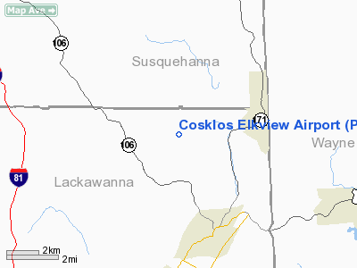
| Longitude/Latitude: | 075-31-41.6650W/41-37-37.2940N
-75.528240/41.627026 (Estimated) |
| Elevation: | 1710 ft / 521.21 m (Estimated) |
| Land: | 70 acres |
| From nearest city: | 3 nautical miles NW of Carbondale, PA |
| Location: | Lackawanna County, PA |
| Magnetic Variation: | 12W (1985) |
Owner & Manager
| Ownership: | Privately owned |
| Owner: | Ronald J. Cosklo, Leasee |
| Address: | Rd 1
Carbondale, PA 18407 |
| Phone number: | 717-282-0319 |
| Manager: | Ronald J. Cosklo |
| Address: | Rd 1
Carbondale, PA 18407 |
| Phone number: | 717-282-0319 |
Airport Operations and Facilities
| Airport Use: | Private |
| Wind indicator: | Yes |
| Segmented Circle: | No |
| Control Tower: | No |
| Landing fee charge: | No |
| Sectional chart: | New York |
| Region: | AEA - Eastern |
| Boundary ARTCC: | ZNY - New York |
| Tie-in FSS: | IPT - Williamsport |
| FSS on Airport: | No |
| FSS Toll Free: | 1-800-WX-BRIEF |
Airport Services
| Airframe Repair: | NONE |
| Power Plant Repair: | NONE |
Runway Information
Runway N/S
| Dimension: | 1600 x 200 ft / 487.7 x 61.0 m |
| Surface: | TURF, |
| |
Runway N |
Runway S |
| Traffic Pattern: | Left | Left |
|
Radio Navigation Aids
| ID |
Type |
Name |
Ch |
Freq |
Var |
Dist |
| CYE | NDB | Crystal Lake | | 410.00 | 11W | 28.5 nm |
| MS | NDB | Monga | | 359.00 | 12W | 31.1 nm |
| HXM | NDB | Humbolt | | 366.00 | 10W | 43.8 nm |
| HZL | VOR | Hazleton | | 109.40 | 09W | 47.6 nm |
| HNK | VOR/DME | Hancock | 115X | 116.80 | 11W | 27.9 nm |
| DNY | VOR/DME | De Lancey | 058X | 112.10 | 11W | 41.8 nm |
| HUO | VOR/DME | Huguenot | 108X | 116.10 | 11W | 44.1 nm |
| STW | VOR/DME | Stillwater | 033X | 109.60 | 11W | 48.2 nm |
| LHY | VORTAC | Lake Henry | 045X | 110.80 | 10W | 9.3 nm |
| LVZ | VORTAC | Wilkes-barre | 053X | 111.60 | 10W | 22.5 nm |
| CFB | VORTAC | Binghamton | 059X | 112.20 | 10W | 41.9 nm |
Remarks
Images and information placed above are from
http://www.airport-data.com/airport/PA53/
We thank them for the data!
| General Info
|
| Country |
United States
|
| State |
PENNSYLVANIA
|
| FAA ID |
PA53
|
| Latitude |
41-37-37.294N
|
| Longitude |
075-31-41.665W
|
| Elevation |
1710 feet
|
| Near City |
CARBONDALE
|
We don't guarantee the information is fresh and accurate. The data may
be wrong or outdated.
For more up-to-date information please refer to other sources.
|
|


