 |
|
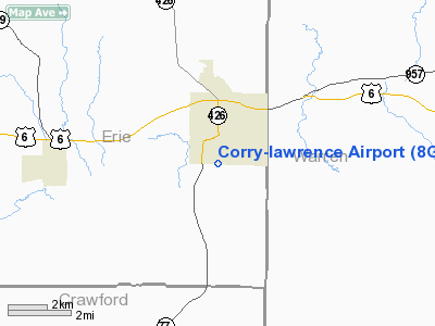
Location & QuickFacts
| FAA Information Effective: | 2008-09-25 |
| Airport Identifier: | 8G2 |
| Airport Status: | Operational |
| Longitude/Latitude: | 079-38-27.7830W/41-54-27.2020N
-79.641051/41.907556 (Estimated) |
| Elevation: | 1766 ft / 538.28 m (Estimated) |
| Land: | 69 acres |
| From nearest city: | 1 nautical miles S of Corry, PA |
| Location: | Erie County, PA |
| Magnetic Variation: | 10W (2005) |
Owner & Manager
| Ownership: | Publicly owned |
| Owner: | Arpt Auth City Of Corry |
| Address: | 100 S Center St
Corry, PA 16407 |
| Phone number: | 814-663-7041 |
| Manager: | Richard Sorenson |
| Address: | 800 Spring St
Corry, PA 16047 |
| Phone number: | 814-664-7111 |
Airport Operations and Facilities
| Airport Use: | Open to public |
| Wind indicator: | Yes |
| Segmented Circle: | Yes |
| Control Tower: | No |
| Lighting Schedule: | DUSK-DAWN
ACTIVATE MIRL RY 14/32 & REIL RYS 14 & 32 - CTAF. |
| Beacon Color: | Clear-Green (lighted land airport) |
| Landing fee charge: | No |
| Sectional chart: | Detroit |
| Region: | AEA - Eastern |
| Boundary ARTCC: | ZOB - Cleveland |
| Tie-in FSS: | AOO - Altoona |
| FSS on Airport: | No |
| FSS Toll Free: | 1-800-WX-BRIEF |
| NOTAMs Facility: | AOO (NOTAM-d service avaliable) |
| Federal Agreements: | NGY |
Airport Communications
| CTAF: | 122.800 |
| Unicom: | 122.800 |
Airport Services
| Fuel available: | 100LLA |
| Airframe Repair: | NONE |
| Bottled Oxygen: | NONE |
| Bulk Oxygen: | NONE |
Runway Information
Runway 14/32
| Dimension: | 4100 x 75 ft / 1249.7 x 22.9 m |
| Surface: | ASPH, Fair Condition
CRACKS DEVELOPING CAUSING SOME UNEVEN PAVEMENT |
| Weight Limit: | Single wheel: 12500 lbs. |
| Edge Lights: | Medium |
| |
Runway 14 |
Runway 32 |
| Longitude: | 079-38-47.7020W | 079-38-07.8390W |
| Latitude: | 41-54-40.9310N | 41-54-13.4730N |
| Elevation: | 1697.00 ft | 1766.00 ft |
| Alignment: | 127 | 127 |
| Traffic Pattern: | Left | Left |
| Markings: | Non-precision instrument, Fair Condition | Non-precision instrument, Fair Condition |
| Runway End Identifier: | Yes | Yes |
| Obstruction: | 13 ft tree, 338.0 ft from runway, 25 ft left of centerline, 11:1 slope to clear | , 50:1 slope to clear |
|
Radio Navigation Aids
| ID |
Type |
Name |
Ch |
Freq |
Var |
Dist |
| ORJ | NDB | Corry | | 258.00 | 09W | 0.4 nm |
| CQD | NDB | Cascade | | 372.00 | 08W | 24.3 nm |
| FKL | VOR | Franklin | | 109.60 | 06W | 29.8 nm |
| JHW | VOR/DME | Jamestown | 094X | 114.70 | 07W | 28.7 nm |
| BFD | VOR/DME | Bradford | 113X | 116.60 | 07W | 46.3 nm |
| CIP | VOR/DME | Clarion | 076X | 112.90 | 06W | 46.5 nm |
| TDT | VORTAC | Tidioute | 123X | 117.60 | 09W | 15.4 nm |
| ERI | VORTAC | Erie | 031X | 109.40 | 06W | 29.9 nm |
| DKK | VORTAC | Dunkirk | 109X | 116.20 | 07W | 38.7 nm |
Remarks
- BIRDS ON & INVOF ARPT.
- NO OBJECTION
Images and information placed above are from
http://www.airport-data.com/airport/8G2/
We thank them for the data!
| General Info
|
| Country |
United States
|
| State |
PENNSYLVANIA
|
| FAA ID |
8G2
|
| Latitude |
41-54-27.202N
|
| Longitude |
079-38-27.783W
|
| Elevation |
1766 feet
|
| Near City |
CORRY
|
We don't guarantee the information is fresh and accurate. The data may
be wrong or outdated.
For more up-to-date information please refer to other sources.
|
|


