 |
|
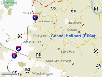
Location & QuickFacts
| FAA Information Effective: | 2008-09-25 |
| Airport Identifier: | PS04 |
| Airport Status: | Operational |
| Longitude/Latitude: | 080-03-29.1940W/40-20-52.2500N
-80.058109/40.347847 (Estimated) |
| Elevation: | 1190 ft / 362.71 m (Estimated) |
| Land: | 15 acres |
| From nearest city: | 6 nautical miles SW of Pittsburgh, PA |
| Location: | Allegheny County, PA |
| Magnetic Variation: | 07W (1985) |
Owner & Manager
| Ownership: | Privately owned |
| Owner: | Consolidation Coal Company |
| Address: | 1800 Washington Road
Pittsburgh, PA 15241 |
| Phone number: | 412-469-0443 |
| Manager: | Fred J. Stowitzky |
| Address: | Allegheny County Airport
West Mifflin, PA 15122 |
| Phone number: | 412-831-4000 |
Airport Operations and Facilities
| Airport Use: | Private |
| Wind indicator: | Yes |
| Segmented Circle: | No |
| Control Tower: | No |
| Landing fee charge: | No |
| Sectional chart: | Detroit |
| Region: | AEA - Eastern |
| Boundary ARTCC: | ZOB - Cleveland |
| Tie-in FSS: | AOO - Altoona |
| FSS on Airport: | No |
| FSS Toll Free: | 1-800-WX-BRIEF |
Runway Information
Helipad H1
| Dimension: | 100 x 100 ft / 30.5 x 30.5 m |
| Surface: | CONC, |
| |
Runway H1 |
Runway |
| Traffic Pattern: | Left | Left |
|
Radio Navigation Aids
| ID |
Type |
Name |
Ch |
Freq |
Var |
Dist |
| MKP | NDB | Mc Keesport | | 287.00 | 07W | 12.7 nm |
| PNU | NDB | Washington County | | 255.00 | 08W | 13.1 nm |
| VV | NDB | Camor | | 299.00 | 08W | 31.4 nm |
| BHU | NDB | Benje | | 382.00 | 07W | 36.1 nm |
| UCP | NDB | Castle | | 272.00 | 09W | 43.7 nm |
| CFX | NDB | Cadiz | | 239.00 | 07W | 44.3 nm |
| TSO | NDB | Tolson | | 395.00 | 07W | 48.4 nm |
| INP | NDB | Indiana | | 242.00 | 08W | 48.5 nm |
| AGC | VOR/DME | Allegheny | 037X | 110.00 | 09W | 4.2 nm |
| HLG | VOR/DME | Wheeling | 059X | 112.20 | 07W | 24.0 nm |
| AIR | VOR/DME | Bellaire | 118X | 117.10 | 07W | 40.1 nm |
| MMJ | VORTAC | Montour | 057X | 112.00 | 08W | 10.5 nm |
| EWC | VORTAC | Ellwood City | 105X | 115.80 | 08W | 29.5 nm |
| IHD | VORTAC | Indian Head | 019X | 108.20 | 06W | 39.2 nm |
| MGW | VORTAC | Morgantown | 053X | 111.60 | 05W | 48.4 nm |
Images and information placed above are from
http://www.airport-data.com/airport/PS04/
We thank them for the data!
| General Info
|
| Country |
United States
|
| State |
PENNSYLVANIA
|
| FAA ID |
PS04
|
| Latitude |
40-20-52.250N
|
| Longitude |
080-03-29.194W
|
| Elevation |
1190 feet
|
| Near City |
PITTSBURGH
|
We don't guarantee the information is fresh and accurate. The data may
be wrong or outdated.
For more up-to-date information please refer to other sources.
|
|


