 |
|
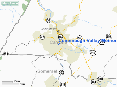
Conemaugh Valley Memorial Hospital Heliport |
Location & QuickFacts
| FAA Information Effective: | 2008-09-25 |
| Airport Identifier: | PS91 |
| Airport Status: | Operational |
| Longitude/Latitude: | 078-55-14.0900W/40-18-16.2680N
-78.920581/40.304519 (Estimated) |
| Elevation: | 1302 ft / 396.85 m (Estimated) |
| Land: | 0 acres |
| From nearest city: | 0 nautical miles S of Johnstown, PA |
| Location: | Cambria County, PA |
| Magnetic Variation: | 08W (1985) |
Owner & Manager
| Ownership: | Privately owned |
| Owner: | Conemaugh Valley Meml Hosp. |
| Address: | 1086 Franklin Street
Johnstown, PA 15905 |
| Phone number: | 814-533-9130 |
| Manager: | Mark Jaeger |
| Address: | 1086 Franklin Street
Johnstown, PA 15905 |
| Phone number: | 814-533-9730
SECURITY. |
Airport Operations and Facilities
| Airport Use: | Private
MEDICAL USE. |
| Wind indicator: | Yes |
| Segmented Circle: | No |
| Control Tower: | No |
| Lighting Schedule: | PHONE REQ
FOR ARPT BCN CALL 814-533-9730. |
| Beacon Color: | Clear-Green-Yellow (heliport) |
| Landing fee charge: | No |
| Sectional chart: | Detroit |
| Region: | AEA - Eastern |
| Boundary ARTCC: | ZOB - Cleveland |
| Tie-in FSS: | AOO - Altoona |
| FSS on Airport: | No |
| FSS Toll Free: | 1-800-WX-BRIEF |
Runway Information
Helipad H1
| Dimension: | 45 x 36 ft / 13.7 x 11.0 m |
| Surface: | CONC,
ROOFTOP. |
| |
Runway H1 |
Runway |
| Traffic Pattern: | Left | Left |
|
Radio Navigation Aids
| ID |
Type |
Name |
Ch |
Freq |
Var |
Dist |
| SYS | NDB | Stoystown | | 209.00 | 08W | 13.2 nm |
| BHU | NDB | Benje | | 382.00 | 07W | 16.6 nm |
| INP | NDB | Indiana | | 242.00 | 08W | 20.8 nm |
| MKP | NDB | Mc Keesport | | 287.00 | 07W | 39.5 nm |
| CBE | NDB | Cumberland | | 317.00 | 07W | 40.3 nm |
| VV | NDB | Camor | | 299.00 | 08W | 45.6 nm |
| AOO | VOR | Altoona | | 108.80 | 07W | 28.3 nm |
| REC | VOR/DME | Revloc | 043X | 110.60 | 09W | 16.6 nm |
| GRV | VOR/DME | Grantsville | 070X | 112.30 | 06W | 40.7 nm |
| JST | VORTAC | Johnstown | 077X | 113.00 | 06W | 4.0 nm |
| IHD | VORTAC | Indian Head | 019X | 108.20 | 06W | 28.3 nm |
| TON | VORTAC | Tyrone | 096X | 114.90 | 07W | 37.3 nm |
| THS | VORTAC | St Thomas | 097X | 115.00 | 07W | 49.8 nm |
Images and information placed above are from
http://www.airport-data.com/airport/PS91/
We thank them for the data!
|
|


