 |
|
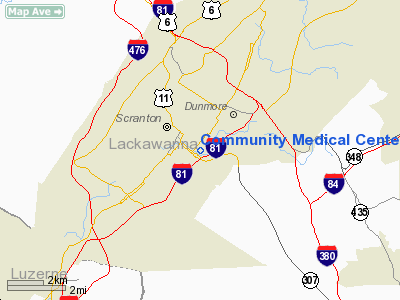
Community Medical Center Heliport |
Location & QuickFacts
| FAA Information Effective: | 2008-09-25 |
| Airport Identifier: | 8PS7 |
| Airport Status: | Operational |
| Longitude/Latitude: | 075-38-48.6810W/41-24-00.2890N
-75.646856/41.400080 (Estimated) |
| Elevation: | 1055 ft / 321.56 m (Estimated) |
| Land: | 0 acres |
| From nearest city: | 1 nautical miles NW of Scranton, PA |
| Location: | Lackawanna County, PA |
| Magnetic Variation: | 12W (1985) |
Owner & Manager
| Ownership: | Privately owned |
| Owner: | Community Medical Center |
| Address: | 1822 Mulberry St
Scranton, PA 18510 |
| Phone number: | 717-969-8000 |
| Manager: | James P Fitzgerald |
| Address: | 1822 Mulberry St
Scranton, PA 18510 |
| Phone number: | 717-969-8000 |
Airport Operations and Facilities
| Airport Use: | Private
MEDICAL USE |
| Wind indicator: | Yes |
| Segmented Circle: | No |
| Control Tower: | No |
| Sectional chart: | New York |
| Region: | AEA - Eastern |
| Boundary ARTCC: | ZNY - New York |
| Tie-in FSS: | IPT - Williamsport |
| FSS Toll Free: | 1-800-WX-BRIEF |
Runway Information
Helipad H1
| Dimension: | 64 x 64 ft / 19.5 x 19.5 m |
| Surface: | CONC,
ROOFTOP |
| |
Runway H1 |
Runway |
| Traffic Pattern: | Left | Left |
|
Radio Navigation Aids
| ID |
Type |
Name |
Ch |
Freq |
Var |
Dist |
| CYE | NDB | Crystal Lake | | 410.00 | 11W | 14.1 nm |
| HXM | NDB | Humbolt | | 366.00 | 10W | 29.4 nm |
| LQX | NDB | Carbon | | 339.00 | 12W | 35.7 nm |
| MS | NDB | Monga | | 359.00 | 12W | 41.6 nm |
| PIX | NDB | Picture Rocks | | 344.00 | 09W | 48.6 nm |
| HZL | VOR | Hazleton | | 109.40 | 09W | 33.5 nm |
| HNK | VOR/DME | Hancock | 115X | 116.80 | 11W | 42.5 nm |
| STW | VOR/DME | Stillwater | 033X | 109.60 | 11W | 42.8 nm |
| HUO | VOR/DME | Huguenot | 108X | 116.10 | 11W | 47.6 nm |
| ETX | VOR/DME | East Texas | 039X | 110.20 | 09W | 49.3 nm |
| LVZ | VORTAC | Wilkes-barre | 053X | 111.60 | 10W | 7.9 nm |
| LHY | VORTAC | Lake Henry | 045X | 110.80 | 10W | 8.7 nm |
| FJC | VORTAC | Allentown | 122X | 117.50 | 10W | 41.4 nm |
Images and information placed above are from
http://www.airport-data.com/airport/8PS7/
We thank them for the data!
| General Info
|
| Country |
United States
|
| State |
PENNSYLVANIA
|
| FAA ID |
8PS7
|
| Latitude |
41-24-00.289N
|
| Longitude |
075-38-48.681W
|
| Elevation |
1055 feet
|
| Near City |
SCRANTON
|
We don't guarantee the information is fresh and accurate. The data may
be wrong or outdated.
For more up-to-date information please refer to other sources.
|
|


