 |
|
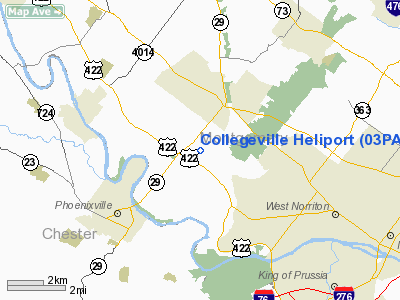
Location & QuickFacts
| FAA Information Effective: | 2008-09-25 |
| Airport Identifier: | 03PA |
| Airport Status: | Operational |
| Longitude/Latitude: | 075-27-56.6650W/40-09-46.3760N
-75.465740/40.162882 (Estimated) |
| Elevation: | 197 ft / 60.05 m (Estimated) |
| Land: | 0 acres |
| From nearest city: | 2 nautical miles SW of Collegeville, PA |
| Location: | Montgomery County, PA |
| Magnetic Variation: | 12W (2000) |
Owner & Manager
| Ownership: | Privately owned |
| Owner: | Rhone-poulene Rorer |
| Address: | 500 Areola Rd
Collegeville, PA 19426-0107 |
| Phone number: | 215-454-8619 |
| Manager: | Craig Clapper |
| Address: | 500 Areola Rd
Collegeville, PA 19426-0107 |
| Phone number: | 215-454-8619 |
Airport Operations and Facilities
| Airport Use: | Private |
| Wind indicator: | Yes |
| Segmented Circle: | No |
| Control Tower: | No |
| Lighting Schedule: | PHONE REQ
FOR PERIMETER LGTS CALL 215-454-8619. |
| Sectional chart: | New York |
| Region: | AEA - Eastern |
| Boundary ARTCC: | ZNY - New York |
| Tie-in FSS: | IPT - Williamsport |
| FSS on Airport: | No |
| FSS Toll Free: | 1-800-WX-BRIEF |
Runway Information
Helipad H1
| Dimension: | 130 x 80 ft / 39.6 x 24.4 m |
| Surface: | ASPH, |
| |
Runway H1 |
Runway |
| Traffic Pattern: | Left | Left |
|
Radio Navigation Aids
| ID |
Type |
Name |
Ch |
Freq |
Var |
Dist |
| ING | NDB | Ambler | | 275.00 | 11W | 8.6 nm |
| NXX | NDB | Willow Grove | | 388.00 | 12W | 14.8 nm |
| UKT | NDB | Quakertown | | 208.00 | 12W | 17.5 nm |
| DYL | NDB | Doylestown | | 237.00 | 10W | 18.9 nm |
| LQX | NDB | Carbon | | 339.00 | 12W | 41.3 nm |
| RNB | NDB | Rainbow | | 363.00 | 11W | 47.3 nm |
| APG | NDB | Aberdeen | | 349.00 | 11W | 47.9 nm |
| NXX | TACAN | Willow Grove | 061X | | 10W | 14.8 nm |
| PNE | VOR | North Philadelphia | | 112.00 | 10W | 21.5 nm |
| CKZ | VOR/DME | Pennridge | 025Y | 108.85 | 12W | 15.9 nm |
| ARD | VOR/DME | Yardley | 019X | 108.20 | 10W | 26.2 nm |
| ETX | VOR/DME | East Texas | 039X | 110.20 | 09W | 27.0 nm |
| SBJ | VOR/DME | Solberg | 076X | 112.90 | 10W | 41.7 nm |
| BWZ | VOR/DME | Broadway | 089X | 114.20 | 11W | 48.2 nm |
| PTW | VORTAC | Pottstown | 112X | 116.50 | 09W | 5.6 nm |
| MXE | VORTAC | Modena | 079X | 113.20 | 09W | 17.5 nm |
| DQO | VORTAC | Dupont | 087X | 114.00 | 10W | 29.9 nm |
| OOD | VORTAC | Woodstown | 075X | 112.80 | 10W | 32.5 nm |
| FJC | VORTAC | Allentown | 122X | 117.50 | 10W | 33.9 nm |
| LRP | VORTAC | Lancaster | 120X | 117.30 | 09W | 38.0 nm |
| GXU | VORTAC | Mc Guire | 043X | 110.60 | 11W | 41.0 nm |
| VCN | VORTAC | Cedar Lake | 099X | 115.20 | 10W | 44.1 nm |
| RBV | VORTAC | Robbinsville | 085X | 113.80 | 10W | 44.6 nm |
| PHL | VOT | Philadelphia Intl | | 109.80 | | 20.3 nm |
Remarks
- PRVDD VFR OPNS ONLY; IF NIGHT OPNS CONDUCTED, INSTALL PERIMETER LGTS & LGTD WIND SOCK; COORDINATE WITH MGMT OF KLENDA & MILICKSON AIRPORTS; SINCE SITE UNDERLIES PHL TCA FOLLOW GUIDELINES IN OPERATING IN A TCA.
Images and information placed above are from
http://www.airport-data.com/airport/03PA/
We thank them for the data!
| General Info
|
| Country |
United States
|
| State |
PENNSYLVANIA
|
| FAA ID |
03PA
|
| Latitude |
40-09-46.376N
|
| Longitude |
075-27-56.665W
|
| Elevation |
197 feet
|
| Near City |
COLLEGEVILLE
|
We don't guarantee the information is fresh and accurate. The data may
be wrong or outdated.
For more up-to-date information please refer to other sources.
|
|


