 |
|
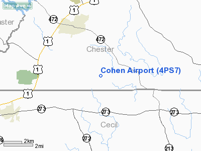
Location & QuickFacts
| FAA Information Effective: | 2008-09-25 |
| Airport Identifier: | 4PS7 |
| Airport Status: | Operational |
| Longitude/Latitude: | 075-56-36.7970W/39-44-10.3950N
-75.943555/39.736221 (Estimated) |
| Elevation: | 418 ft / 127.41 m (Estimated) |
| Land: | 26 acres |
| From nearest city: | 5 nautical miles SE of Oxford, PA |
| Location: | Chester County, PA |
| Magnetic Variation: | 11W (1985) |
Owner & Manager
| Ownership: | Privately owned |
| Owner: | Philip Cohen |
| Address: | 256 Wiltshire Rd
Wynnewood, PA 19096 |
| Phone number: | 215-544-7100 |
| Manager: | Philip Cohen |
| Address: | 256 Wiltshire Rd
Wynnewood, PA 19096 |
| Phone number: | 215-544-7100 |
Airport Operations and Facilities
| Airport Use: | Private |
| Wind indicator: | Yes |
| Segmented Circle: | No |
| Control Tower: | No |
| Sectional chart: | Washington |
| Region: | AEA - Eastern |
| Boundary ARTCC: | ZNY - New York |
| Tie-in FSS: | IPT - Williamsport |
| FSS Toll Free: | 1-800-WX-BRIEF |
Runway Information
Runway 16/34
| Dimension: | 1887 x 100 ft / 575.2 x 30.5 m |
| Surface: | TURF, |
| |
Runway 16 |
Runway 34 |
| Traffic Pattern: | Left | Left |
|
Radio Navigation Aids
| ID |
Type |
Name |
Ch |
Freq |
Var |
Dist |
| APG | NDB | Aberdeen | | 349.00 | 11W | 14.2 nm |
| MTN | NDB | Martin | | 342.00 | 11W | 33.1 nm |
| ING | NDB | Ambler | | 275.00 | 11W | 38.3 nm |
| IUB | NDB | Institute | | 404.00 | 08W | 41.6 nm |
| RNB | NDB | Rainbow | | 363.00 | 11W | 42.0 nm |
| EUD | NDB | York | | 254.00 | 11W | 44.5 nm |
| NXX | NDB | Willow Grove | | 388.00 | 12W | 45.8 nm |
| FND | NDB | Ellicott | | 371.00 | 11W | 47.1 nm |
| MTN | TACAN | Martin | 068X | | 11W | 32.6 nm |
| DOV | TACAN | Dover | 037X | | 09W | 42.5 nm |
| NXX | TACAN | Willow Grove | 061X | | 10W | 45.9 nm |
| PNE | VOR | North Philadelphia | | 112.00 | 10W | 47.8 nm |
| PPM | VOR/DME | Phillips | 021X | 108.40 | 09W | 19.3 nm |
| CKZ | VOR/DME | Pennridge | 025Y | 108.85 | 12W | 49.6 nm |
| DQO | VORTAC | Dupont | 087X | 114.00 | 10W | 15.9 nm |
| MXE | VORTAC | Modena | 079X | 113.20 | 09W | 16.7 nm |
| LRP | VORTAC | Lancaster | 120X | 117.30 | 09W | 28.1 nm |
| OOD | VORTAC | Woodstown | 075X | 112.80 | 10W | 30.2 nm |
| PTW | VORTAC | Pottstown | 112X | 116.50 | 09W | 34.1 nm |
| ENO | VORTAC | Smyrna | 051X | 111.40 | 09W | 36.2 nm |
| VCN | VORTAC | Cedar Lake | 099X | 115.20 | 10W | 46.7 nm |
| BAL | VORTAC | Baltimore | 098X | 115.10 | 11W | 47.6 nm |
| PHL | VOT | Philadelphia Intl | | 109.80 | | 33.2 nm |
| MDT | VOT | Harrisburg International | | 110.00 | | 46.9 nm |
Remarks
- PRVDD TREES IN PRIM SFC ARE REMOVED.
Images and information placed above are from
http://www.airport-data.com/airport/4PS7/
We thank them for the data!
| General Info
|
| Country |
United States
|
| State |
PENNSYLVANIA
|
| FAA ID |
4PS7
|
| Latitude |
39-44-10.395N
|
| Longitude |
075-56-36.797W
|
| Elevation |
418 feet
|
| Near City |
OXFORD
|
We don't guarantee the information is fresh and accurate. The data may
be wrong or outdated.
For more up-to-date information please refer to other sources.
|
|


