 |
|
Location & QuickFacts
| FAA Information Effective: | 2008-09-25 |
| Airport Identifier: | 4PS8 |
| Airport Status: | Operational |
| Longitude/Latitude: | 075-49-06.0000W/39-53-36.0000N
-75.818333/39.893333 (Estimated) |
| Elevation: | 564 ft / 171.91 m (Estimated) |
| Land: | 0 acres |
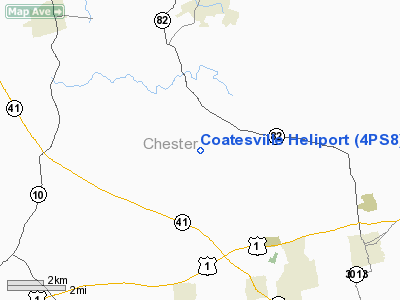
| From nearest city: | 3 nautical miles N of Coatesville, PA |
| Location: | Chester County, PA |
| Magnetic Variation: | () |
Owner & Manager
| Ownership: | Privately owned |
| Owner: | John J. Geewax |
| Address: | 129 Hicks Rd
West Grove, PA 11413 |
| Phone number: | 610-869-4750 |
| Manager: | John J. Geewax |
| Address: | 129 Hicks Rd
West Grove, PA 11413 |
| Phone number: | 610-869-4750 |
Airport Operations and Facilities
| Airport Use: | Private |
| Wind indicator: | Yes |
| Control Tower: | No |
| Sectional chart: | Washington |
| Region: | AEA - Eastern |
| Boundary ARTCC: | ZNY - New York |
| Tie-in FSS: | IPT - Williamsport |
| FSS Toll Free: | 1-800-WX-BRIEF |
Runway Information
Helipad H1
| Dimension: | 32 x 32 ft / 9.8 x 9.8 m |
| Surface: | CONC, |
| |
Runway H1 |
Runway |
| Traffic Pattern: | Left | Left |
|
Radio Navigation Aids
| ID |
Type |
Name |
Ch |
Freq |
Var |
Dist |
| APG | NDB | Aberdeen | | 349.00 | 11W | 25.3 nm |
| ING | NDB | Ambler | | 275.00 | 11W | 28.2 nm |
| NXX | NDB | Willow Grove | | 388.00 | 12W | 35.7 nm |
| UKT | NDB | Quakertown | | 208.00 | 12W | 39.9 nm |
| DYL | NDB | Doylestown | | 237.00 | 10W | 41.6 nm |
| RNB | NDB | Rainbow | | 363.00 | 11W | 42.6 nm |
| MTN | NDB | Martin | | 342.00 | 11W | 44.2 nm |
| BZJ | NDB | Bellgrove | | 328.00 | 10W | 46.9 nm |
| EUD | NDB | York | | 254.00 | 11W | 48.9 nm |
| NXX | TACAN | Willow Grove | 061X | | 10W | 35.8 nm |
| MTN | TACAN | Martin | 068X | | 11W | 43.6 nm |
| DOV | TACAN | Dover | 037X | | 09W | 48.6 nm |
| PNE | VOR | North Philadelphia | | 112.00 | 10W | 38.9 nm |
| PPM | VOR/DME | Phillips | 021X | 108.40 | 09W | 30.4 nm |
| CKZ | VOR/DME | Pennridge | 025Y | 108.85 | 12W | 38.6 nm |
| ETX | VOR/DME | East Texas | 039X | 110.20 | 09W | 41.8 nm |
| ARD | VOR/DME | Yardley | 019X | 108.20 | 10W | 47.1 nm |
| MXE | VORTAC | Modena | 079X | 113.20 | 09W | 7.0 nm |
| DQO | VORTAC | Dupont | 087X | 114.00 | 10W | 16.2 nm |
| PTW | VORTAC | Pottstown | 112X | 116.50 | 09W | 23.1 nm |
| LRP | VORTAC | Lancaster | 120X | 117.30 | 09W | 25.7 nm |
| OOD | VORTAC | Woodstown | 075X | 112.80 | 10W | 28.4 nm |
| ENO | VORTAC | Smyrna | 051X | 111.40 | 09W | 42.2 nm |
| VCN | VORTAC | Cedar Lake | 099X | 115.20 | 10W | 44.8 nm |
| PHL | VOT | Philadelphia Intl | | 109.80 | | 26.5 nm |
| MDT | VOT | Harrisburg International | | 110.00 | | 47.2 nm |
Remarks
- PRVDD VFR/PVT USE; TAKEOFF/LNDNG AREA MRKD; AND A WIND INDICATOR IS MAINTAINED.
Images and information placed above are from
http://www.airport-data.com/airport/4PS8/
We thank them for the data!
|
|


