 |
|
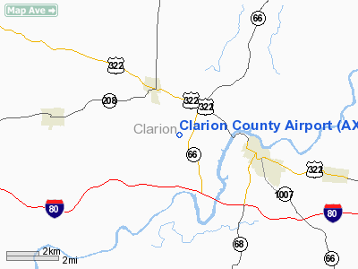
Location & QuickFacts
| FAA Information Effective: | 2008-09-25 |
| Airport Identifier: | AXQ |
| Airport Status: | Operational |
| Longitude/Latitude: | 079-26-31.8000W/41-13-29.8000N
-79.442167/41.224944 (Estimated) |
| Elevation: | 1458 ft / 444.40 m (Surveyed) |
| Land: | 219 acres |
| From nearest city: | 3 nautical miles NW of Clarion, PA |
| Location: | Clarion County, PA |
| Magnetic Variation: | 10W (2005) |
Owner & Manager
| Ownership: | Publicly owned |
| Owner: | Clarion County Arpt Auth |
| Address: | 395 Airport Rd
Shippenville, PA 16254 |
| Phone number: | 814-226-9993 |
| Manager: | Robert S. Sheffer |
| Address: | Box 37
Lamartine, PA 16375 |
| Phone number: | 412-951-0588 |
Airport Operations and Facilities
| Airport Use: | Open to public |
| Wind indicator: | Yes |
| Segmented Circle: | Yes |
| Control Tower: | No |
| Lighting Schedule: | DUSK-DAWN
ACTVT REIL & PAPI RYS 06 & 24 - CTAF. |
| Beacon Color: | Clear-Green (lighted land airport) |
| Landing fee charge: | No |
| Sectional chart: | Detroit |
| Region: | AEA - Eastern |
| Boundary ARTCC: | ZOB - Cleveland |
| Tie-in FSS: | AOO - Altoona |
| FSS on Airport: | No |
| FSS Toll Free: | 1-800-WX-BRIEF |
| NOTAMs Facility: | AOO (NOTAM-d service avaliable) |
| Federal Agreements: | NGVY |
Airport Communications
| CTAF: | 122.800 |
| Unicom: | 122.800 |
Airport Services
| Fuel available: | 100LLA |
| Bottled Oxygen: | NONE |
| Bulk Oxygen: | NONE |
Runway Information
Runway 06/24
| Dimension: | 5003 x 75 ft / 1524.9 x 22.9 m |
| Surface: | ASPH, Good Condition |
| Weight Limit: | Single wheel: 15000 lbs. |
| Edge Lights: | Medium |
| |
Runway 06 |
Runway 24 |
| Longitude: | 079-26-54.8100W | 079-26-08.7597W |
| Latitude: | 41-13-12.1874N | 41-13-47.3156N |
| Elevation: | 1433.00 ft | 1457.00 ft |
| Alignment: | 45 | 127 |
| Traffic Pattern: | Left | Left |
| Markings: | Non-precision instrument, Good Condition | Non-precision instrument, Good Condition |
| Crossing Height: | 40.00 ft | 40.00 ft |
| VASI: | 2-light PAPI on left side | 2-light PAPI on left side |
| Visual Glide Angle: | 3.00° | 3.00° |
| Runway End Identifier: | Yes | Yes |
| Obstruction: | 22 ft , 686.0 ft from runway, 151 ft right of centerline, 22:1 slope to clear | 56 ft trees, 1173.0 ft from runway, 165 ft left of centerline, 17:1 slope to clear |
|
Radio Navigation Aids
| ID |
Type |
Name |
Ch |
Freq |
Var |
Dist |
| INP | NDB | Indiana | | 242.00 | 08W | 39.5 nm |
| ORJ | NDB | Corry | | 258.00 | 09W | 42.4 nm |
| UCP | NDB | Castle | | 272.00 | 09W | 45.7 nm |
| HBD | NDB | Hubbard | | 408.00 | 08W | 49.5 nm |
| FKL | VOR | Franklin | | 109.60 | 06W | 22.7 nm |
| CIP | VOR/DME | Clarion | 076X | 112.90 | 06W | 4.8 nm |
| TDT | VORTAC | Tidioute | 123X | 117.60 | 09W | 29.4 nm |
| EWC | VORTAC | Ellwood City | 105X | 115.80 | 08W | 42.4 nm |
Remarks
- DEER AND BIRDS ON & INVOF ARPT.
Images and information placed above are from
http://www.airport-data.com/airport/AXQ/
We thank them for the data!
| General Info
|
| Country |
United States
|
| State |
PENNSYLVANIA
|
| FAA ID |
AXQ
|
| Latitude |
41-13-32.924N
|
| Longitude |
079-26-27.563W
|
| Elevation |
1458 feet
|
| Near City |
CLARION
|
We don't guarantee the information is fresh and accurate. The data may
be wrong or outdated.
For more up-to-date information please refer to other sources.
|
|


