 |
|
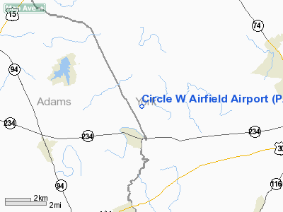
Circle W Airfield Airport |
Location & QuickFacts
| FAA Information Effective: | 2008-09-25 |
| Airport Identifier: | PA72 |
| Airport Status: | Operational |
| Longitude/Latitude: | 076-58-14.9180W/39-57-31.3470N
-76.970811/39.958708 (Estimated) |
| Elevation: | 460 ft / 140.21 m (Estimated) |
| Land: | 35 acres |
| From nearest city: | 1 nautical miles N of East Berlin, PA |
| Location: | York County, PA |
| Magnetic Variation: | 10W (1985) |
Owner & Manager
| Ownership: | Privately owned |
| Owner: | Kenneth W. Wolff |
| Address: | Rt 2 Box 211
East Berlin, PA 17316 |
| Phone number: | 717-259-8397 |
| Manager: | Kenneth W. Wolff |
| Address: | Rt 2 Box 211
East Berlin, PA 17316 |
| Phone number: | 717-259-8397 |
Airport Operations and Facilities
| Airport Use: | Private |
| Wind indicator: | Yes |
| Segmented Circle: | No |
| Control Tower: | No |
| Landing fee charge: | No |
| Sectional chart: | Washington |
| Region: | AEA - Eastern |
| Boundary ARTCC: | ZNY - New York |
| Tie-in FSS: | IPT - Williamsport |
| FSS on Airport: | No |
| FSS Toll Free: | 1-800-WX-BRIEF |
Airport Services
| Airframe Repair: | NONE |
| Power Plant Repair: | NONE |
Runway Information
Runway 15/33
| Dimension: | 2200 x 100 ft / 670.6 x 30.5 m |
| Surface: | TURF, |
| |
Runway 15 |
Runway 33 |
| Traffic Pattern: | Left | Left |
| Displaced threshold: | 130.00 ft | 500.00 ft |
| Obstruction: | 30 ft trees, 500.0 ft from runway | 30 ft trees, 400.0 ft from runway |
|
Radio Navigation Aids
| ID |
Type |
Name |
Ch |
Freq |
Var |
Dist |
| EUD | NDB | York | | 254.00 | 11W | 4.9 nm |
| BZJ | NDB | Bellgrove | | 328.00 | 10W | 34.5 nm |
| FND | NDB | Ellicott | | 371.00 | 11W | 41.3 nm |
| IUB | NDB | Institute | | 404.00 | 08W | 43.4 nm |
| APG | NDB | Aberdeen | | 349.00 | 11W | 47.4 nm |
| MTN | NDB | Martin | | 342.00 | 11W | 48.1 nm |
| GAI | NDB | Gaithersburg | | 385.00 | 09W | 48.3 nm |
| MTN | TACAN | Martin | 068X | | 11W | 45.8 nm |
| FDK | VOR | Frederick | | 109.00 | 08W | 37.8 nm |
| HGR | VOR | Hagerstown | | 109.80 | 07W | 43.8 nm |
| PPM | VOR/DME | Phillips | 021X | 108.40 | 09W | 47.4 nm |
| HAR | VORTAC | Harrisburg | 072X | 112.50 | 10W | 21.1 nm |
| EMI | VORTAC | Westminster | 126X | 117.90 | 08W | 27.9 nm |
| LRP | VORTAC | Lancaster | 120X | 117.30 | 09W | 32.7 nm |
| RAV | VORTAC | Ravine | 093X | 114.60 | 11W | 39.6 nm |
| THS | VORTAC | St Thomas | 097X | 115.00 | 07W | 45.2 nm |
| BAL | VORTAC | Baltimore | 098X | 115.10 | 11W | 49.5 nm |
| MDT | VOT | Harrisburg International | | 110.00 | | 17.2 nm |
Images and information placed above are from
http://www.airport-data.com/airport/PA72/
We thank them for the data!
| General Info
|
| Country |
United States
|
| State |
PENNSYLVANIA
|
| FAA ID |
PA72
|
| Latitude |
39-57-31.347N
|
| Longitude |
076-58-14.918W
|
| Elevation |
460 feet
|
| Near City |
EAST BERLIN
|
We don't guarantee the information is fresh and accurate. The data may
be wrong or outdated.
For more up-to-date information please refer to other sources.
|
|


