 |
|
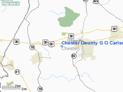
Chester County G O Carlson Airport |
| Chester County G. O. Carlson Airport |
| IATA: CTH – ICAO: KMQS – FAA LID: MQS |
| Summary |
| Airport type |
Public |
| Owner |
Chester County Area Airport Authority |
| Location |
Coatesville, Pennsylvania |
| Elevation AMSL |
660 ft / 201 m |
| Coordinates |
39°58′44″N 075°51′56″W / 39.97889°N 75.86556°W / 39.97889; -75.86556 |
| Website |
www.chestercountyairport.com |
| Runways |
| Direction |
Length |
Surface |
| ft |
m |
| 11/29 |
5,400 |
1,646 |
Asphalt |
| Statistics (2008) |
| Aircraft operations |
52,000 |
| Based aircraft |
96 |
| Source: Federal Aviation Administration |
Chester County G. O. Carlson Airport (IATA: CTH, ICAO: KMQS, FAA LID: MQS) is a public-use airport located two miles (3 km) west of the central business district of Coatesville, in Chester County, Pennsylvania, United States. It is owned by the Chester County Area Airport Authority.
Chester County's airport identifier was formerly 40N, but it has recently changed to MQS. The airport is adjacent to Keystone Heliport. JetDirect Aviation, a fixed base operator, and flight training offered by Chester County Aviation, are also located on field.
Although most U.S. airports use the same three-letter location identifier for the FAA and IATA, Chester County Airport is assigned MQS by the FAA and CTH by the IATA (which assigned MQS to Mustique Airport on Mustique island in Saint Vincent and the Grenadines). History
The airport first opened May 1, 1928 as Coatesville Airport and was owned and operated by the City of Coatesville. In 1959, Chester County purchased the airport and took over operations. At this time, the Chester County Area Airport Authority was formed and the airport was renamed to the Chester County Airport. After only three years, in 1962, the airport was renamed to its current name in honor of the first Authority chairman, G. O. Carlson.
Facilities and aircraft
Chester County G. O. Carlson Airport covers an area of 250 acres (101 ha) which contains one asphalt paved runway designated 11/29 and measuring 5,400 x 100 ft (1,646 x 30 m). For the 12-month period ending November 17, 2006, the airport had 52,000 aircraft operations, an average of 142 per day: 94% general aviation, 6% air taxi and <1% military. There are 96 aircraft based at this airport: 62% single-engine, 17% multi-engine, 20% jet, and 1% helicopter.
Expansion
As part of the 12-year-plan for the airport, many construction projects are planned for the airport. A new apron, is planned south of the current runway. New hangars will be built to accommodate corporate jets. The biggest project planned is that of building a brand new 6,000-foot (1,800 m) long runway that will be more aligned with the usual winds at the airport. This runway will not replace the current runway, but simply add a new option for arriving and departing traffic. A control tower is also being discussed for the future, if traffic increases.
The above content comes from Wikipedia and is published under free licenses – click here to read more.
Location & QuickFacts
| FAA Information Effective: | 2008-09-25 |
| Airport Identifier: | MQS |
| Airport Status: | Operational |
| Longitude/Latitude: | 075-51-55.7000W/39-58-44.3000N
-75.865472/39.978972 (Estimated) |
| Elevation: | 660 ft / 201.17 m (Surveyed) |
| Land: | 250 acres |
| From nearest city: | 2 nautical miles W of Coatesville, PA |
| Location: | Chester County, PA |
| Magnetic Variation: | 11W (1990) |
Owner & Manager
| Ownership: | Publicly owned |
| Owner: | Chester Co Arpt Auth |
| Address: | 1 Earhart Dr Suite 2
Coatesville, PA 19320 |
| Phone number: | 610-383-6057 |
| Manager: | Gary L. Hudson |
| Address: | 1 Earhart Dr Suite 2
Coatesville, PA 19320 |
| Phone number: | 610-383-6057
CELL 484-880-2959 |
Airport Operations and Facilities
| Airport Use: | Open to public |
| Wind indicator: | Yes |
| Segmented Circle: | No |
| Control Tower: | No |
| Lighting Schedule: | DUSK-DAWN
ACTVT MIRL RY 11/29 AND REIL RY 11/29 - CTAF. |
| Beacon Color: | Clear-Green (lighted land airport) |
| Landing fee charge: | No |
| Sectional chart: | Washington |
| Region: | AEA - Eastern |
| Boundary ARTCC: | ZNY - New York |
| Tie-in FSS: | IPT - Williamsport |
| FSS on Airport: | No |
| FSS Toll Free: | 1-800-WX-BRIEF |
| NOTAMs Facility: | IPT (NOTAM-d service avaliable) |
| Federal Agreements: | NGY |
Airport Communications
| CTAF: | 122.700 |
| Unicom: | 122.700 |
Airport Services
| Fuel available: | 100LLA |
| Airframe Repair: | MAJOR |
| Power Plant Repair: | MAJOR |
| Bottled Oxygen: | HIGH/LOW |
| Bulk Oxygen: | HIGH/LOW |
Runway Information
Runway 11/29
| Dimension: | 5400 x 100 ft / 1645.9 x 30.5 m |
| Surface: | ASPH, Good Condition |
| Surface Treatment: | Saw-cut or plastic Grooved |
| Weight Limit: | Single wheel: 30000 lbs.
Dual wheel: 48000 lbs. |
| Edge Lights: | Medium |
| |
Runway 11 |
Runway 29 |
| Longitude: | 075-52-29.6528W | 075-51-21.7209W |
| Latitude: | 39-58-49.6437N | 39-58-38.8782N |
| Elevation: | 638.00 ft | 660.00 ft |
| Alignment: | 102 | 127 |
| ILS Type: | | ILS |
| Traffic Pattern: | Left | Left |
| Markings: | Non-precision instrument, Good Condition | Precision instrument, Good Condition |
| Crossing Height: | 51.00 ft | 57.00 ft |
| VASI: | 4-box on right side | 4-light PAPI on left side |
| Visual Glide Angle: | 3.00° | 3.00° |
| Runway End Identifier: | Yes | Yes |
| Obstruction: | 52 ft trees, 1179.0 ft from runway, 425 ft left of centerline, 18:1 slope to clear | 21 ft trees, 381.0 ft from runway, 415 ft right of centerline, 8:1 slope to clear
+31' TREES 173' OUT, 485' LEFT. |
|
Radio Navigation Aids
| ID |
Type |
Name |
Ch |
Freq |
Var |
Dist |
| ING | NDB | Ambler | | 275.00 | 11W | 28.1 nm |
| APG | NDB | Aberdeen | | 349.00 | 11W | 28.9 nm |
| NXX | NDB | Willow Grove | | 388.00 | 12W | 35.4 nm |
| UKT | NDB | Quakertown | | 208.00 | 12W | 37.4 nm |
| DYL | NDB | Doylestown | | 237.00 | 10W | 40.3 nm |
| BZJ | NDB | Bellgrove | | 328.00 | 10W | 41.8 nm |
| EUD | NDB | York | | 254.00 | 11W | 46.8 nm |
| MTN | NDB | Martin | | 342.00 | 11W | 47.3 nm |
| RNB | NDB | Rainbow | | 363.00 | 11W | 47.7 nm |
| NXX | TACAN | Willow Grove | 061X | | 10W | 35.5 nm |
| MTN | TACAN | Martin | 068X | | 11W | 46.4 nm |
| PNE | VOR | North Philadelphia | | 112.00 | 10W | 39.9 nm |
| PPM | VOR/DME | Phillips | 021X | 108.40 | 09W | 33.9 nm |
| CKZ | VOR/DME | Pennridge | 025Y | 108.85 | 12W | 36.3 nm |
| ETX | VOR/DME | East Texas | 039X | 110.20 | 09W | 37.1 nm |
| ARD | VOR/DME | Yardley | 019X | 108.20 | 10W | 47.0 nm |
| MXE | VORTAC | Modena | 079X | 113.20 | 09W | 9.7 nm |
| PTW | VORTAC | Pottstown | 112X | 116.50 | 09W | 20.3 nm |
| LRP | VORTAC | Lancaster | 120X | 117.30 | 09W | 21.3 nm |
| DQO | VORTAC | Dupont | 087X | 114.00 | 10W | 21.7 nm |
| OOD | VORTAC | Woodstown | 075X | 112.80 | 10W | 33.2 nm |
| ENO | VORTAC | Smyrna | 051X | 111.40 | 09W | 47.7 nm |
| RAV | VORTAC | Ravine | 093X | 114.60 | 11W | 48.2 nm |
| FJC | VORTAC | Allentown | 122X | 117.50 | 10W | 48.7 nm |
| VCN | VORTAC | Cedar Lake | 099X | 115.20 | 10W | 49.3 nm |
| PHL | VOT | Philadelphia Intl | | 109.80 | | 29.3 nm |
| MDT | VOT | Harrisburg International | | 110.00 | | 43.3 nm |
Remarks
- MIGRATORY BIRDS ON & INVOF ARPT.
- NOISE ABATEMENT PROCEDURES IN EFFECT, CTC FBO 610-384-9000.
- +164 FT WATER TWR 1343 FT FM RY 11 THR 1842 FT R MKD WITH STROBE LGT DALGT HRS; STD OBSTN LGT NGT HRS.
- HELICOPTER OPS INVOF ARPT SOUTH AND SOUTHWEST OF KEYSTONE HELIPAD.
- DEER ON THE RY AT NIGHT.
- HELICOPTER TRAFFIC REQUESTED TO LAND AND TKOF FM RY ONLY.
Images and information placed above are from
http://www.airport-data.com/airport/MQS/
We thank them for the data!
|
|


