 |
|
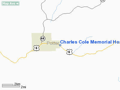
Charles Cole Memorial Hospital Heliport |
Location & QuickFacts
| FAA Information Effective: | 2008-09-25 |
| Airport Identifier: | PN09 |
| Airport Status: | Operational |
| Longitude/Latitude: | 077-58-47.0000W/41-46-18.0000N
-77.979722/41.771667 (Estimated) |
| Elevation: | 1753 ft / 534.31 m (Surveyed) |
| Land: | 600 acres |
| From nearest city: | 2 nautical miles E of Coudersport, PA |
| Location: | Potter County, PA |
| Magnetic Variation: | 12W (1995) |
Owner & Manager
| Ownership: | Privately owned |
| Owner: | Charles Cole Memorial Hospital |
| Address: | 1001 East Second St
Coudersport, PA 16915 |
| Phone number: | 814-274-9300 |
| Manager: | Fred Hershey |
| Address: | 1001 East Second St
Coudersport, PA 16915 |
| Phone number: | 814-260-5281 |
Airport Operations and Facilities
| Airport Use: | Private
MEDICAL USE. |
| Wind indicator: | Yes |
| Segmented Circle: | No |
| Control Tower: | No |
| Lighting Schedule: | PHONE REQ |
| Sectional chart: | Detroit |
| Region: | AEA - Eastern |
| Boundary ARTCC: | ZOB - Cleveland |
| Tie-in FSS: | AOO - Altoona |
| FSS Toll Free: | 1-800-WX-BRIEF |
Runway Information
Helipad H1
| Dimension: | 80 x 80 ft / 24.4 x 24.4 m |
| Surface: | ASPH-CONC, |
| |
Runway H1 |
Runway |
| Traffic Pattern: | Left | Left |
|
Radio Navigation Aids
| ID |
Type |
Name |
Ch |
Freq |
Var |
Dist |
| EL | NDB | Halos | | 269.00 | 09W | 20.5 nm |
| LYS | NDB | Olean | | 360.00 | 09W | 34.6 nm |
| SFK | VOR/DME | Stonyfork | 023X | 108.60 | 08W | 25.5 nm |
| BFD | VOR/DME | Bradford | 113X | 116.60 | 07W | 28.7 nm |
| ULW | VOR/DME | Elmira | 033Y | 109.65 | 12W | 46.9 nm |
| SLT | VORTAC | Slate Run | 086X | 113.90 | 08W | 15.6 nm |
| ELZ | VORTAC | Wellsville | 051X | 111.40 | 09W | 19.1 nm |
| ETG | VORTAC | Keating | 107X | 116.00 | 10W | 34.3 nm |
Remarks
- PRVDD CLEAR 8:1 INGRESS/EGRESS, APPROPRIATE INGRESS/EGRESS MKGS, LGTD WINDSOCK, VEHICULAR TFC AROUND SITE CONTROLLED, VFR ONLY.
Images and information placed above are from
http://www.airport-data.com/airport/PN09/
We thank them for the data!
| General Info
|
| Country |
United States
|
| State |
PENNSYLVANIA
|
| FAA ID |
PN09
|
| Latitude |
41-46-18.000N
|
| Longitude |
075-59-08.000W
|
| Elevation |
1751 feet
|
| Near City |
COUDERSPORT
|
We don't guarantee the information is fresh and accurate. The data may
be wrong or outdated.
For more up-to-date information please refer to other sources.
|
|


