 |
|
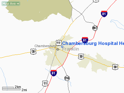
Chambersburg Hospital Heliport |
Location & QuickFacts
| FAA Information Effective: | 2008-09-25 |
| Airport Identifier: | PA60 |
| Airport Status: | Operational |
| Longitude/Latitude: | 077-38-52.9660W/39-56-22.3270N
-77.648046/39.939535 (Estimated) |
| Elevation: | 640 ft / 195.07 m (Estimated) |
| Land: | 0 acres |
| From nearest city: | 0 nautical miles S of Chambersburg, PA |
| Location: | Franklin County, PA |
| Magnetic Variation: | 09W (1985) |
Owner & Manager
| Ownership: | Privately owned |
| Owner: | Chambersburg Hospital |
| Address: | 112 N 7th St
Chambersburg, PA 17201 |
| Phone number: | 717-267-7397 |
| Manager: | James R. Hosking
DIRECTOR OF OPERATIONS. |
| Address: | 112 N 7th St
Chambersburg, PA 17201 |
| Phone number: | 717267-7141 |
Airport Operations and Facilities
| Airport Use: | Private
MEDICAL USE. |
| Wind indicator: | Yes |
| Segmented Circle: | Yes |
| Control Tower: | No |
| Landing fee charge: | No |
| Sectional chart: | Washington |
| Region: | AEA - Eastern |
| Boundary ARTCC: | ZNY - New York |
| Tie-in FSS: | IPT - Williamsport |
| FSS on Airport: | No |
| FSS Toll Free: | 1-800-WX-BRIEF |
Airport Services
| Airframe Repair: | NONE |
| Power Plant Repair: | NONE |
Runway Information
Helipad H1
| Dimension: | 60 x 60 ft / 18.3 x 18.3 m |
| Surface: | ASPH, |
| |
Runway H1 |
Runway |
| Traffic Pattern: | Left | Left |
|
Radio Navigation Aids
| ID |
Type |
Name |
Ch |
Freq |
Var |
Dist |
| EUD | NDB | York | | 254.00 | 11W | 35.5 nm |
| RV | NDB | Stroh | | 407.00 | 10W | 40.7 nm |
| HGR | VOR | Hagerstown | | 109.80 | 07W | 17.4 nm |
| FDK | VOR | Frederick | | 109.00 | 08W | 34.1 nm |
| AOO | VOR | Altoona | | 108.80 | 07W | 38.0 nm |
| THS | VORTAC | St Thomas | 097X | 115.00 | 07W | 14.0 nm |
| HAR | VORTAC | Harrisburg | 072X | 112.50 | 10W | 34.4 nm |
| MRB | VORTAC | Martinsburg | 058X | 112.10 | 07W | 34.6 nm |
| EMI | VORTAC | Westminster | 126X | 117.90 | 08W | 40.9 nm |
| MDT | VOT | Harrisburg International | | 110.00 | | 43.6 nm |
Images and information placed above are from
http://www.airport-data.com/airport/PA60/
We thank them for the data!
| General Info
|
| Country |
United States
|
| State |
PENNSYLVANIA
|
| FAA ID |
PA60
|
| Latitude |
39-56-22.327N
|
| Longitude |
077-38-52.966W
|
| Elevation |
640 feet
|
| Near City |
CHAMBERSBURG
|
We don't guarantee the information is fresh and accurate. The data may
be wrong or outdated.
For more up-to-date information please refer to other sources.
|
|


