 |
|
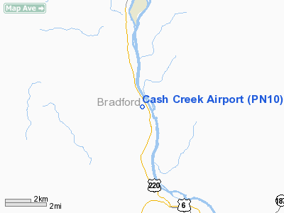
Location & QuickFacts
| FAA Information Effective: | 2008-09-25 |
| Airport Identifier: | PN10 |
| Airport Status: | Operational |
| Longitude/Latitude: | 076-30-35.7970W/41-51-54.2690N
-76.509944/41.865075 (Estimated) |
| Elevation: | 1250 ft / 381.00 m (Estimated) |
| Land: | 5 acres |
| From nearest city: | 1 nautical miles E of Ulster, PA |
| Location: | Bradford County, PA |
| Magnetic Variation: | 11W (1990) |
Owner & Manager
| Ownership: | Privately owned |
| Owner: | Virginia E Geromi |
| Address: | P O Box 390
Picture Rocks, PA 17762 |
| Phone number: | 717-584-4750 |
| Manager: | Virginia E Geromi |
| Address: | P O Box 390
Picture Rocks, PA 17762 |
| Phone number: | 717-584-4750 |
Airport Operations and Facilities
| Airport Use: | Private |
| Wind indicator: | Yes |
| Segmented Circle: | No |
| Control Tower: | No |
| Sectional chart: | New York |
| Region: | AEA - Eastern |
| Boundary ARTCC: | ZNY - New York |
| Tie-in FSS: | IPT - Williamsport |
| FSS on Airport: | No |
| FSS Toll Free: | 1-800-WX-BRIEF |
Runway Information
Runway 18/36
| Dimension: | 2000 x 200 ft / 609.6 x 61.0 m |
| Surface: | TURF, Good Condition |
| |
Runway 18 |
Runway 36 |
| Traffic Pattern: | Left | Left |
| Obstruction: | 40 ft plines, 2100.0 ft from runway | |
|
Radio Navigation Aids
| ID |
Type |
Name |
Ch |
Freq |
Var |
Dist |
| ALP | NDB | Alpine | | 245.00 | 12W | 25.2 nm |
| PIX | NDB | Picture Rocks | | 344.00 | 09W | 36.5 nm |
| CYE | NDB | Crystal Lake | | 410.00 | 11W | 49.8 nm |
| ULW | VOR/DME | Elmira | 033Y | 109.65 | 12W | 26.8 nm |
| FQM | VOR/DME | Williamsport | 091X | 114.40 | 09W | 33.8 nm |
| ITH | VOR/DME | Ithaca | 055X | 111.80 | 10W | 37.9 nm |
| SFK | VOR/DME | Stonyfork | 023X | 108.60 | 08W | 42.0 nm |
| CFB | VORTAC | Binghamton | 059X | 112.20 | 10W | 24.2 nm |
Images and information placed above are from
http://www.airport-data.com/airport/PN10/
We thank them for the data!
| General Info
|
| Country |
United States
|
| State |
PENNSYLVANIA
|
| FAA ID |
PN10
|
| Latitude |
41-51-54.269N
|
| Longitude |
076-30-35.797W
|
| Elevation |
1250 feet
|
| Near City |
ULSTER
|
We don't guarantee the information is fresh and accurate. The data may
be wrong or outdated.
For more up-to-date information please refer to other sources.
|
|


