 |
|
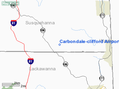
Carbondale-clifford Airport |
Location & QuickFacts
| FAA Information Effective: | 2008-09-25 |
| Airport Identifier: | 9PA1 |
| Airport Status: | Operational |
| Longitude/Latitude: | 075-34-43.6700W/41-39-15.2910N
-75.578797/41.654247 (Estimated) |
| Elevation: | 1400 ft / 426.72 m (Estimated) |
| Land: | 60 acres |
| From nearest city: | 6 nautical miles NW of Carbondale, PA |
| Location: | Susquehanna County, PA |
| Magnetic Variation: | 12W (1985) |
Owner & Manager
| Ownership: | Privately owned |
| Owner: | Johnson Family |
| Address: | 1055 Sr 29n
Tunkhannock, PA 18657 |
| Phone number: | 570-836-2380 |
| Manager: | Donald D. Johnson |
| Address: | 1055 Sr 29n
Tunkhannock, PA 18657 |
| Phone number: | 570-836-2380 |
Airport Operations and Facilities
| Airport Use: | Private |
| Wind indicator: | Yes |
| Segmented Circle: | No |
| Control Tower: | No |
| Lighting Schedule: | PHONE REQ |
| Landing fee charge: | No |
| Sectional chart: | New York |
| Region: | AEA - Eastern |
| Boundary ARTCC: | ZNY - New York |
| Tie-in FSS: | IPT - Williamsport |
| FSS on Airport: | No |
| FSS Toll Free: | 1-800-WX-BRIEF |
Airport Services
| Bottled Oxygen: | NONE |
| Bulk Oxygen: | NONE |
Runway Information
Runway 12/30
| Dimension: | 2630 x 100 ft / 801.6 x 30.5 m |
| Surface: | TURF, |
| Edge Lights: | Low
LGTS NON STD. |
| |
Runway 12 |
Runway 30 |
| Traffic Pattern: | Left | Left |
| Displaced threshold: | 483.00 ft | 1257.00 ft |
| Runway End Identifier: | No | No |
| Centerline Lights: | No | No |
| Touchdown Lights: | No | No |
| Obstruction: | 96 ft trees, 1442.0 ft from runway | 128 ft trees, 1301.0 ft from runway |
|
Radio Navigation Aids
| ID |
Type |
Name |
Ch |
Freq |
Var |
Dist |
| CYE | NDB | Crystal Lake | | 410.00 | 11W | 29.0 nm |
| MS | NDB | Monga | | 359.00 | 12W | 32.9 nm |
| HXM | NDB | Humbolt | | 366.00 | 10W | 44.2 nm |
| HZL | VOR | Hazleton | | 109.40 | 09W | 47.7 nm |
| HNK | VOR/DME | Hancock | 115X | 116.80 | 11W | 27.2 nm |
| DNY | VOR/DME | De Lancey | 058X | 112.10 | 11W | 42.0 nm |
| HUO | VOR/DME | Huguenot | 108X | 116.10 | 11W | 46.8 nm |
| LHY | VORTAC | Lake Henry | 045X | 110.80 | 10W | 11.6 nm |
| LVZ | VORTAC | Wilkes-barre | 053X | 111.60 | 10W | 23.5 nm |
| CFB | VORTAC | Binghamton | 059X | 112.20 | 10W | 39.2 nm |
Remarks
Images and information placed above are from
http://www.airport-data.com/airport/9PA1/
We thank them for the data!
| General Info
|
| Country |
United States
|
| State |
PENNSYLVANIA
|
| FAA ID |
9PA1
|
| Latitude |
41-39-15.291N
|
| Longitude |
075-34-43.670W
|
| Elevation |
1400 feet
|
| Near City |
CARBONDALE
|
We don't guarantee the information is fresh and accurate. The data may
be wrong or outdated.
For more up-to-date information please refer to other sources.
|
|


