|
|
- For other airports with this name, see Capital City Airport.
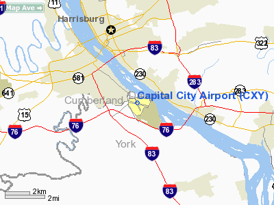
Capital City Airport (IATA: HAR, ICAO: KCXY, FAA LID: CXY) is a public airport located in Fairview Township, York County, Pennsylvania, three miles (5 km) southeast of the central business district of Harrisburg, the capital city of Pennsylvania. The airport serves the counties of Cumberland, Dauphin and York. It is also the home airport for the Pennsylvania Bureau of Aviation and the Pennsylvania State Police.
Although most U.S. airports use the same three-letter location identifier for the FAA and IATA, Capital City Airport is assigned CXY by the FAA and HAR by the IATA (which assigned CXY to Cat Cay, Bimini Islands, Bahamas). History
Originally called Capital Landing Field, the facility opened in mid-1930 and was Harrisburg's original commercial service airport. In 1934, the Commonwealth of Pennsylvania purchased the facility and renamed it Harrisburg-York State Airport. The airport provided air service to the capital region and was an intermediate stop on longer air routes, principally the route between Pittsburgh and Philadelphia. During those years, scheduled commercial air service was provided by Transcontinental and Western Airlines, TWA's predecessor.
During the 1940s, the airport continued in its role as the third largest airport in Pennsylvania and served an important role in the movement of war materials for the adjacent New Cumberland Army Depot, and as the site of the former Naval Photographic Reconnaissance Training School. During the 1950s and 1960's, both air carrier service and the number of FBO's increased steadily until 1968 when Olmsted Air Force Base, located just across the river in Middletown was closed and all scheduled commercial air service was transferred to newly named Harrisburg International Airport. It was at that time, that Capital City Airport received its current name and became the region's main general aviation airport.
Capital City Airport is located adjacent to the Defense Distribution Center, one of the largest military distribution centers for the warehousing of supplies and equipment for the U.S. Armed Forces. A parachutte rigger detachment from the 82nd Airborne Division also operates out of Capital City Airport.
Since 1999, Capital City Airport has been owned and operated by the Susquehanna Area Regional Airport Authority (SARAA).
Facilities and aircraft
Capital City Airport covers an area of 320 acres (129 ha) which contains two asphalt paved runways: 8/26 meauring 5,001 x 150 ft (1,524 x 46 m) and 12/30 measuring 3,925 x 100 ft (1,196 x 30 m).
For the 12-month period ending October 13, 2006, the airport had 57,668 aircraft operations, an average of 157 per day: 95% general aviation, 3% military and 2% air taxi. There are 145 aircraft based at this airport: 81% single-engine, 13% multi-engine, 3% helicopter and 2% jet.
The above content comes from Wikipedia and is published under free licenses – click here to read more.
 |
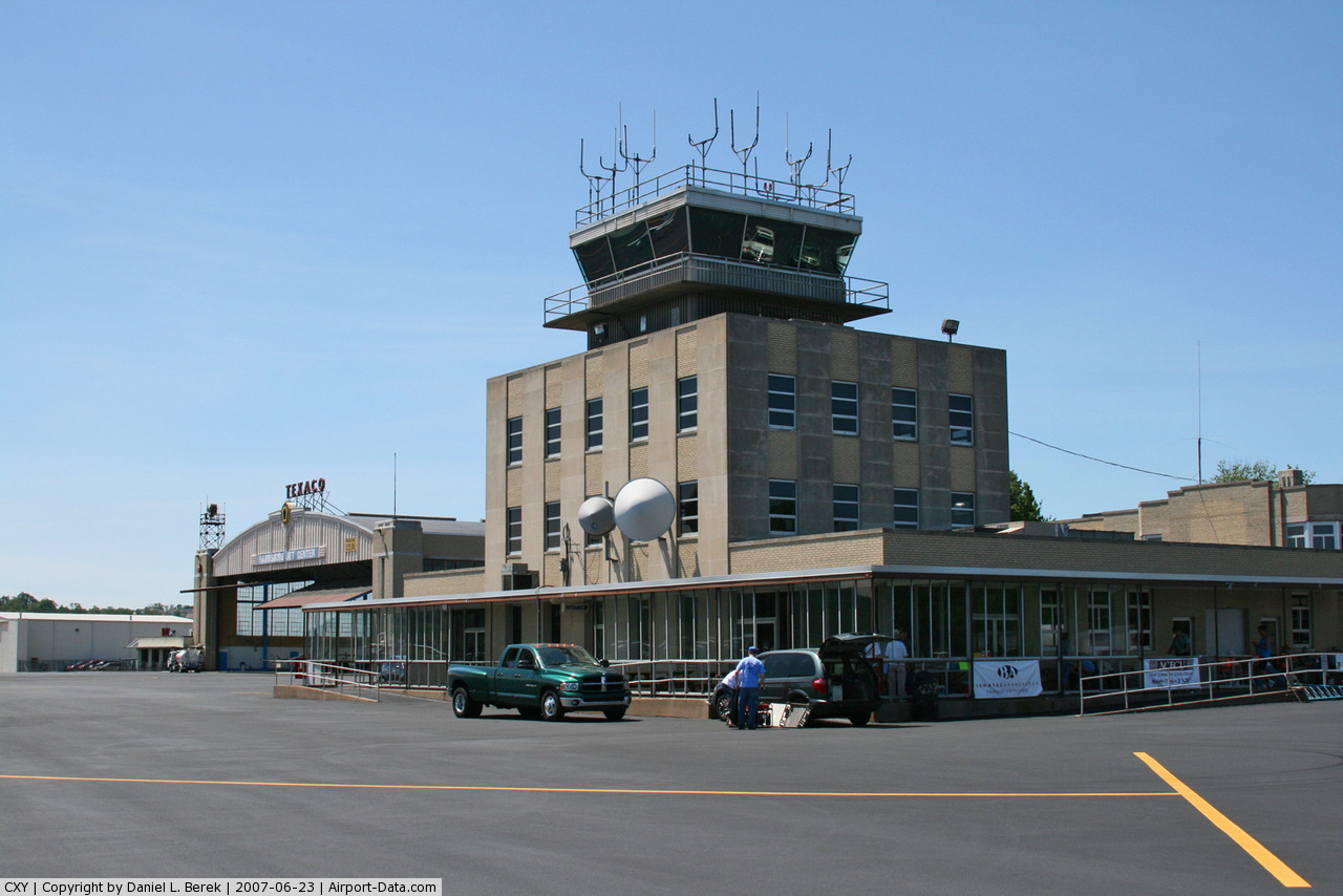
(Click on the photo to enlarge) |
Location & QuickFacts
| FAA Information Effective: | 2008-09-25 |
| Airport Identifier: | CXY |
| Airport Status: | Operational |
| Longitude/Latitude: | 076-51-05.3000W/40-13-01.7000N
-76.851472/40.217139 (Estimated) |
| Elevation: | 347 ft / 105.77 m (Surveyed) |
| Land: | 320 acres |
| From nearest city: | 3 nautical miles SE of Harrisburg, PA |
| Location: | York County, PA |
| Magnetic Variation: | 11W (1995) |
Owner & Manager
| Ownership: | Publicly owned |
| Owner: | Susquehanna Reg Arpt Auth |
| Address: | One Terminal Drive, Suite 30
Middletown, PA 17057 |
| Phone number: | 717-774-8335 |
| Manager: | Tim Edwards |
| Address: | One Terminal Drive, Suite 30
Middletown, PA 17057 |
| Phone number: | 717-948-3900 |
Airport Operations and Facilities
| Airport Use: | Open to public |
| Wind indicator: | Yes |
| Segmented Circle: | Yes |
| Control Tower: | Yes |
| Lighting Schedule: | DUSK-DAWN
WHEN ATCT CLSD HIRL RY 08/26 OPR LOW INTST. TO ACTVT HIGHER INTST-CTAF. ACTVT MIRL RY 12/30, MALSR RY 08 & TWY LGTS-CTAF. |
| Beacon Color: | Clear-Green (lighted land airport) |
| Landing fee charge: | No |
| Sectional chart: | New York |
| Region: | AEA - Eastern |
| Traffic Pattern Alt: | 1153 ft |
| Boundary ARTCC: | ZNY - New York |
| Tie-in FSS: | IPT - Williamsport |
| FSS on Airport: | No |
| FSS Toll Free: | 1-800-WX-BRIEF |
| NOTAMs Facility: | CXY (NOTAM-d service avaliable) |
| Federal Agreements: | NGY |
Airport Communications
| CTAF: | 119.500 |
| Unicom: | 122.950 |
Airport Services
| Fuel available: | 100LLA |
| Airframe Repair: | MAJOR |
| Power Plant Repair: | MAJOR |
| Bottled Oxygen: | HIGH/LOW |
| Bulk Oxygen: | HIGH/LOW |
Runway Information
Runway 08/26
| Dimension: | 5001 x 150 ft / 1524.3 x 45.7 m |
| Surface: | ASPH, Good Condition |
| Surface Treatment: | Saw-cut or plastic Grooved |
| Weight Limit: | Single wheel: 65000 lbs.
Dual wheel: 105000 lbs.
Dual tandem wheel: 185000 lbs.
& RWY 12/30, PPR FOR LOADS OVER 100,000 LBS. |
| Edge Lights: | High |
| |
Runway 08 |
Runway 26 |
| Longitude: | 076-51-30.7434W | 076-50-29.7257W |
| Latitude: | 40-12-56.1287N | 40-13-12.0624N |
| Elevation: | 335.00 ft | 346.00 ft |
| Alignment: | 71 | 127 |
| ILS Type: | ILS
| |
| Traffic Pattern: | Left | Right |
| Markings: | Precision instrument, Good Condition | Precision instrument, Good Condition |
| Crossing Height: | 0.00 ft | 56.00 ft |
| VASI: | | 4-box on left side |
| Visual Glide Angle: | 0.00° | 3.10° |
| Approach lights: | MALSR | |
| Obstruction: | 15 ft tree, 444.0 ft from runway, 161 ft right of centerline, 16:1 slope to clear
+10 FT PRIVATE ROAD OFF THLD. | 19 ft pole, 717.0 ft from runway, 63 ft left of centerline, 27:1 slope to clear
RWY 26 +7 FT ROAD;GOLF COURSE, +6 FT VINYL FENCE. |
|
Runway 12/30
| Dimension: | 3925 x 100 ft / 1196.3 x 30.5 m |
| Surface: | ASPH, Good Condition |
| Weight Limit: | Single wheel: 40000 lbs.
Dual wheel: 65000 lbs.
Dual tandem wheel: 115000 lbs.
& RWY 12/30, PPR FOR LOADS OVER 100,000 LBS. |
| Edge Lights: | Medium |
| |
Runway 12 |
Runway 30 |
| Longitude: | 076-51-34.3767W | 076-50-49.1007W |
| Latitude: | 40-13-07.3776N | 40-12-50.0686N |
| Elevation: | 334.00 ft | 344.00 ft |
| Alignment: | 117 | 127 |
| Traffic Pattern: | Right | Left |
| Markings: | Non-precision instrument, Good Condition | Non-precision instrument, Good Condition |
| Crossing Height: | 62.00 ft | 62.00 ft |
| Displaced threshold: | 147.00 ft | 0.00 ft |
| VASI: | 4-box on left side | 4-box on left side |
| Visual Glide Angle: | 3.90° | 4.00° |
| Runway End Identifier: | Yes | Yes |
| Obstruction: | 17 ft pole, 415.0 ft from runway, 278 ft right of centerline, 12:1 slope to clear
+3 FT ROAD 198 FT L/R. | 72 ft tree, 932.0 ft from runway, 313 ft right of centerline, 10:1 slope to clear |
|
Radio Navigation Aids
| ID |
Type |
Name |
Ch |
Freq |
Var |
Dist |
| EUD | NDB | York | | 254.00 | 11W | 17.9 nm |
| BZJ | NDB | Bellgrove | | 328.00 | 10W | 19.0 nm |
| RV | NDB | Stroh | | 407.00 | 10W | 46.3 nm |
| HAR | VORTAC | Harrisburg | 072X | 112.50 | 10W | 11.2 nm |
| RAV | VORTAC | Ravine | 093X | 114.60 | 11W | 23.3 nm |
| LRP | VORTAC | Lancaster | 120X | 117.30 | 09W | 26.4 nm |
| SEG | VORTAC | Selinsgrove | 041X | 110.40 | 08W | 34.5 nm |
| EMI | VORTAC | Westminster | 126X | 117.90 | 08W | 43.8 nm |
| MIP | VORTAC | Milton | 029X | 109.20 | 09W | 49.2 nm |
| MDT | VOT | Harrisburg International | | 110.00 | | 4.2 nm |
Remarks
- PPR FOR HAZARDOUS CARGO.
- ARPT CLSD TO FAR PART 121 ACFT.
- BIRD FLOCKS ON & INVOF ARPT.
Images and information placed above are from
http://www.airport-data.com/airport/CXY/
We thank them for the data!
| General Info
|
| Country |
United States
|
| State |
PENNSYLVANIA
|
| FAA ID |
CXY
|
| Latitude |
40-13-01.700N
|
| Longitude |
076-51-05.300W
|
| Elevation |
347 feet
|
| Near City |
HARRISBURG
|
We don't guarantee the information is fresh and accurate. The data may
be wrong or outdated.
For more up-to-date information please refer to other sources.
|
|