 |
|
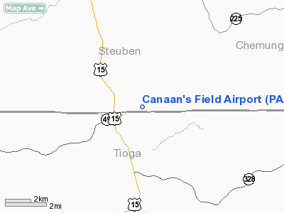
Location & QuickFacts
| FAA Information Effective: | 2008-09-25 |
| Airport Identifier: | PA17 |
| Airport Status: | Operational |
| Longitude/Latitude: | 077-06-00.0000W/42-00-13.2660N
-77.100000/42.003685 (Estimated) |
| Elevation: | 1600 ft / 487.68 m (Estimated) |
| Land: | 10 acres |
| From nearest city: | 1 nautical miles NE of Lawrenceville, PA |
| Location: | Tioga County, PA |
| Magnetic Variation: | 11W (1985) |
Owner & Manager
| Ownership: | Privately owned |
| Owner: | Carl P. Warner |
| Address: | P.o. Box 1282
Skippack, PA 19474 |
| Phone number: | 607-524-6648 |
| Manager: | Carl P. Warner |
| Address: | P.o. Box 1282 Skippack, Pa 19474
Skippack, PA 19474 |
| Phone number: | 607-524-6648 |
Airport Operations and Facilities
| Airport Use: | Private |
| Wind indicator: | Yes |
| Segmented Circle: | No |
| Control Tower: | No |
| Sectional chart: | Detroit |
| Region: | AEA - Eastern |
| Boundary ARTCC: | ZNY - New York |
| Tie-in FSS: | IPT - Williamsport |
| FSS Toll Free: | 1-800-WX-BRIEF |
Runway Information
Runway 10/28
| Dimension: | 1600 x 50 ft / 487.7 x 15.2 m |
| Surface: | TURF, |
| |
Runway 10 |
Runway 28 |
| Traffic Pattern: | Left | Left |
| Displaced threshold: | 0.00 ft | 200.00 ft |
| Obstruction: | | 50 ft trees, 500.0 ft from runway |
|
Radio Navigation Aids
| ID |
Type |
Name |
Ch |
Freq |
Var |
Dist |
| ALP | NDB | Alpine | | 245.00 | 12W | 20.6 nm |
| EL | NDB | Halos | | 269.00 | 09W | 36.9 nm |
| PYA | NDB | Penn Yan | | 260.00 | 12W | 38.5 nm |
| PIX | NDB | Picture Rocks | | 344.00 | 09W | 47.1 nm |
| ULW | VOR/DME | Elmira | 033Y | 109.65 | 12W | 6.4 nm |
| SFK | VOR/DME | Stonyfork | 023X | 108.60 | 08W | 23.4 nm |
| ITH | VOR/DME | Ithaca | 055X | 111.80 | 10W | 41.0 nm |
| FQM | VOR/DME | Williamsport | 091X | 114.40 | 09W | 42.6 nm |
| ELZ | VORTAC | Wellsville | 051X | 111.40 | 09W | 40.5 nm |
| CFB | VORTAC | Binghamton | 059X | 112.20 | 10W | 44.0 nm |
| SLT | VORTAC | Slate Run | 086X | 113.90 | 08W | 48.9 nm |
Remarks
Images and information placed above are from
http://www.airport-data.com/airport/PA17/
We thank them for the data!
| General Info
|
| Country |
United States
|
| State |
PENNSYLVANIA
|
| FAA ID |
PA17
|
| Latitude |
42-00-13.266N
|
| Longitude |
077-06-00.000W
|
| Elevation |
1600 feet
|
| Near City |
LAWRENCEVILLE
|
We don't guarantee the information is fresh and accurate. The data may
be wrong or outdated.
For more up-to-date information please refer to other sources.
|
|


