 |
|
Location & QuickFacts
| FAA Information Effective: | 2008-09-25 |
| Airport Identifier: | PS57 |
| Airport Status: | Operational |
| Longitude/Latitude: | 077-50-36.0040W/40-49-08.2210N
-77.843334/40.818950 (Estimated) |
| Elevation: | 1105 ft / 336.80 m (Estimated) |
| Land: | 1 acres |
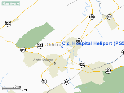
| From nearest city: | 2 nautical miles NE of State College, PA |
| Location: | Centre County, PA |
| Magnetic Variation: | 10W (1985) |
Owner & Manager
| Ownership: | Privately owned |
| Owner: | Centre Community Hospital |
| Address: | 1800 E. Park Avenue
State College, PA 16803 |
| Phone number: | 814-234-6161 |
| Manager: | Donald J. Spackman, P.e. |
| Address: | 1800 E. Park Avenue
State College, PA 16803 |
| Phone number: | 814-234-6161 |
Airport Operations and Facilities
| Airport Use: | Private
MEDICAL USE. |
| Wind indicator: | Yes |
| Segmented Circle: | No |
| Control Tower: | No |
| Lighting Schedule: | PHONE REQ
FOR PERIMETER LGTS CALL 814-234-6110. |
| Landing fee charge: | No |
| Sectional chart: | Detroit |
| Region: | AEA - Eastern |
| Boundary ARTCC: | ZNY - New York |
| Tie-in FSS: | AOO - Altoona |
| FSS on Airport: | No |
| FSS Toll Free: | 1-800-WX-BRIEF |
Runway Information
Helipad H1
| Dimension: | 25 x 25 ft / 7.6 x 7.6 m |
| Surface: | CONC, |
| |
Runway H1 |
Runway |
| Traffic Pattern: | Left | Left |
|
Radio Navigation Aids
| ID |
Type |
Name |
Ch |
Freq |
Var |
Dist |
| RV | NDB | Stroh | | 407.00 | 10W | 13.5 nm |
| AOO | VOR | Altoona | | 108.80 | 07W | 36.4 nm |
| REC | VOR/DME | Revloc | 043X | 110.60 | 09W | 44.3 nm |
| PSB | VORTAC | Philipsburg | 102X | 115.50 | 10W | 9.0 nm |
| TON | VORTAC | Tyrone | 096X | 114.90 | 07W | 22.8 nm |
| ETG | VORTAC | Keating | 107X | 116.00 | 10W | 27.4 nm |
| SLT | VORTAC | Slate Run | 086X | 113.90 | 08W | 42.1 nm |
| SEG | VORTAC | Selinsgrove | 041X | 110.40 | 08W | 43.7 nm |
| HAR | VORTAC | Harrisburg | 072X | 112.50 | 10W | 47.0 nm |
Images and information placed above are from
http://www.airport-data.com/airport/PS57/
We thank them for the data!
| General Info
|
| Country |
United States
|
| State |
PENNSYLVANIA
|
| FAA ID |
PS57
|
| Latitude |
40-49-08.221N
|
| Longitude |
077-50-36.004W
|
| Elevation |
1105 feet
|
| Near City |
STATE COLLEGE
|
We don't guarantee the information is fresh and accurate. The data may
be wrong or outdated.
For more up-to-date information please refer to other sources.
|
|


