 |
|
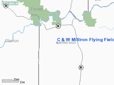
C & W Milliron Flying Field Airport |
Location & QuickFacts
| FAA Information Effective: | 2008-09-25 |
| Airport Identifier: | PN13 |
| Airport Status: | Operational |
| Longitude/Latitude: | 079-09-59.1430W/41-17-14.2280N
-79.166429/41.287286 (Estimated) |
| Elevation: | 1700 ft / 518.16 m (Estimated) |
| Land: | 75 acres |
| From nearest city: | 3 nautical miles NW of Sigel, PA |
| Location: | Jefferson County, PA |
| Magnetic Variation: | 09W (1990) |
Owner & Manager
| Ownership: | Privately owned |
| Owner: | Chester R Milliron |
| Address: | Rr 1 Box 245b
Sigel, PA 15860 |
| Phone number: | 814-752-2550 |
| Manager: | Chester R Milliron |
| Address: | Rr 1 Box 245b
Sigel, PA 15860 |
| Phone number: | 814-752-2550 |
Airport Operations and Facilities
| Airport Use: | Private |
| Wind indicator: | Yes |
| Segmented Circle: | No |
| Control Tower: | No |
| Sectional chart: | Detroit |
| Region: | AEA - Eastern |
| Boundary ARTCC: | ZOB - Cleveland |
| Tie-in FSS: | AOO - Altoona |
| FSS on Airport: | No |
| FSS Toll Free: | 1-800-WX-BRIEF |
Runway Information
Runway 09/27
| Dimension: | 2000 x 100 ft / 609.6 x 30.5 m |
| Surface: | TURF, |
| |
Runway 09 |
Runway 27 |
| Traffic Pattern: | Left | Left |
|
Runway 12/30
| Dimension: | 1550 x 100 ft / 472.4 x 30.5 m |
| Surface: | TURF, |
| |
Runway 12 |
Runway 30 |
| Traffic Pattern: | Left | Left |
|
Radio Navigation Aids
| ID |
Type |
Name |
Ch |
Freq |
Var |
Dist |
| INP | NDB | Indiana | | 242.00 | 08W | 39.7 nm |
| ORJ | NDB | Corry | | 258.00 | 09W | 43.4 nm |
| FKL | VOR | Franklin | | 109.60 | 06W | 32.4 nm |
| CIP | VOR/DME | Clarion | 076X | 112.90 | 06W | 15.7 nm |
| BFD | VOR/DME | Bradford | 113X | 116.60 | 07W | 38.8 nm |
| REC | VOR/DME | Revloc | 043X | 110.60 | 09W | 48.4 nm |
| TDT | VORTAC | Tidioute | 123X | 117.60 | 09W | 28.0 nm |
| ETG | VORTAC | Keating | 107X | 116.00 | 10W | 46.5 nm |
Images and information placed above are from
http://www.airport-data.com/airport/PN13/
We thank them for the data!
| General Info
|
| Country |
United States
|
| State |
PENNSYLVANIA
|
| FAA ID |
PN13
|
| Latitude |
41-17-14.228N
|
| Longitude |
079-09-59.143W
|
| Elevation |
1700 feet
|
| Near City |
SIGEL
|
We don't guarantee the information is fresh and accurate. The data may
be wrong or outdated.
For more up-to-date information please refer to other sources.
|
|


