|
|
Butler County/k W Scholter Field Airport |
Butler County Airport
K. W. Scholter Field |
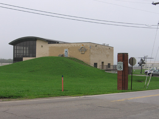 |
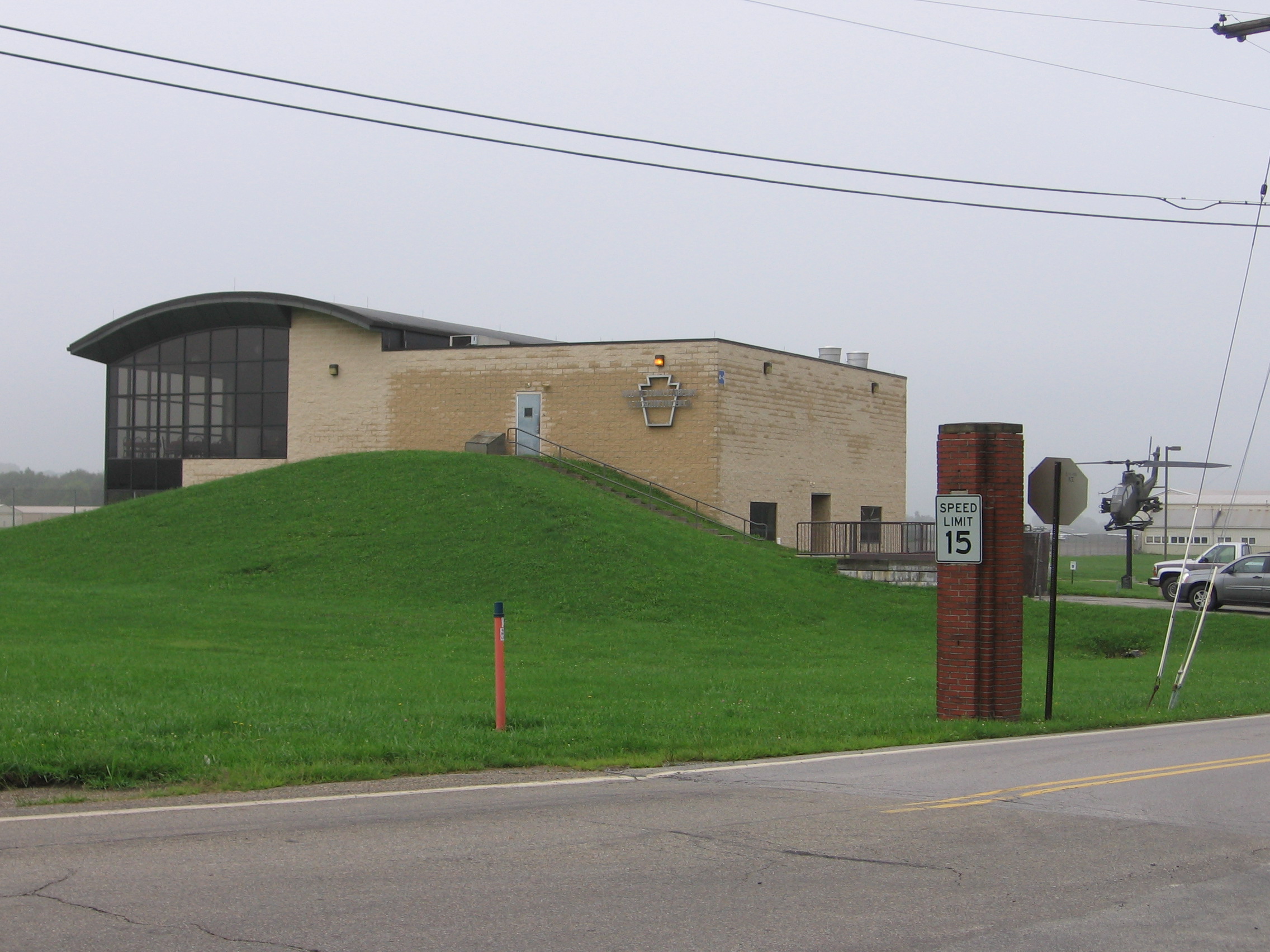
| Terminal Building |
| IATA: BTP – ICAO: KBTP – FAA LID: BTP |
| Summary |
| Airport type |
Public |
| Owner |
Butler County Airport Authority |
| Serves |
Butler, Pennsylvania |
| Location |
Penn Township, Pennsylvania |
| Elevation AMSL |
1,248 ft / 380 m |
| Coordinates |
40°46′37″N 079°56′59″W / 40.77694°N 79.94972°W / 40.77694; -79.94972 |
| Website |
Butler County Airport |
| Runways |
| Direction |
Length |
Surface |
| ft |
m |
| 8/26 |
4,801 |
1,463 |
Asphalt |
| Statistics (2007) |
| Aircraft operations |
62,685 |
| Based aircraft |
132 |
| Source: Federal Aviation Administration |
For the similarly-named airport in Ohio, see Butler County Regional Airport.
Butler County Airport (IATA: BTP, ICAO: KBTP, FAA LID: BTP), also known as K. W. Scholter Field, is a public airport located five miles (8 km) southwest of the central business district of Butler, a city in Butler County, Pennsylvania, United States. It is owned by the Butler County Airport Authority.
History
Butler County Airport opened as the Pittsburgh-Butler Airporton September 27th and 28th, 1929 with much fanfare and aircraft demonstrations. It was later named the Butler-Graham Airport. For more than twenty years the Butler airfield was one of the primary airports servicing the city of Pittsburgh until Pittsburgh International Airport was completed in the early 1950s. During its early years, the airport served as an important training area for potential pilots. One notable trainee was Amelia Earhart who received her instrument flight certificate there while practicing for her solo flight over the Atlantic Ocean in 1932. It was also at the airport that Earhart had the long-range fuel tanks installed on her Lockheed Vega. Another notable aviator was C.G. Taylor, who in 1935 moved his Taylorcraft Aircraft company to Butler. His new planes were tested at the airport. During World War II the airport served as a training ground for fighter pilots. By the late 1990s, the airport was getting too small to handle the amount of aircraft coming in so plans were made to extend the runway by 800 feet. The extension of the single runway was completed in 2004.
Facilities and aircraft
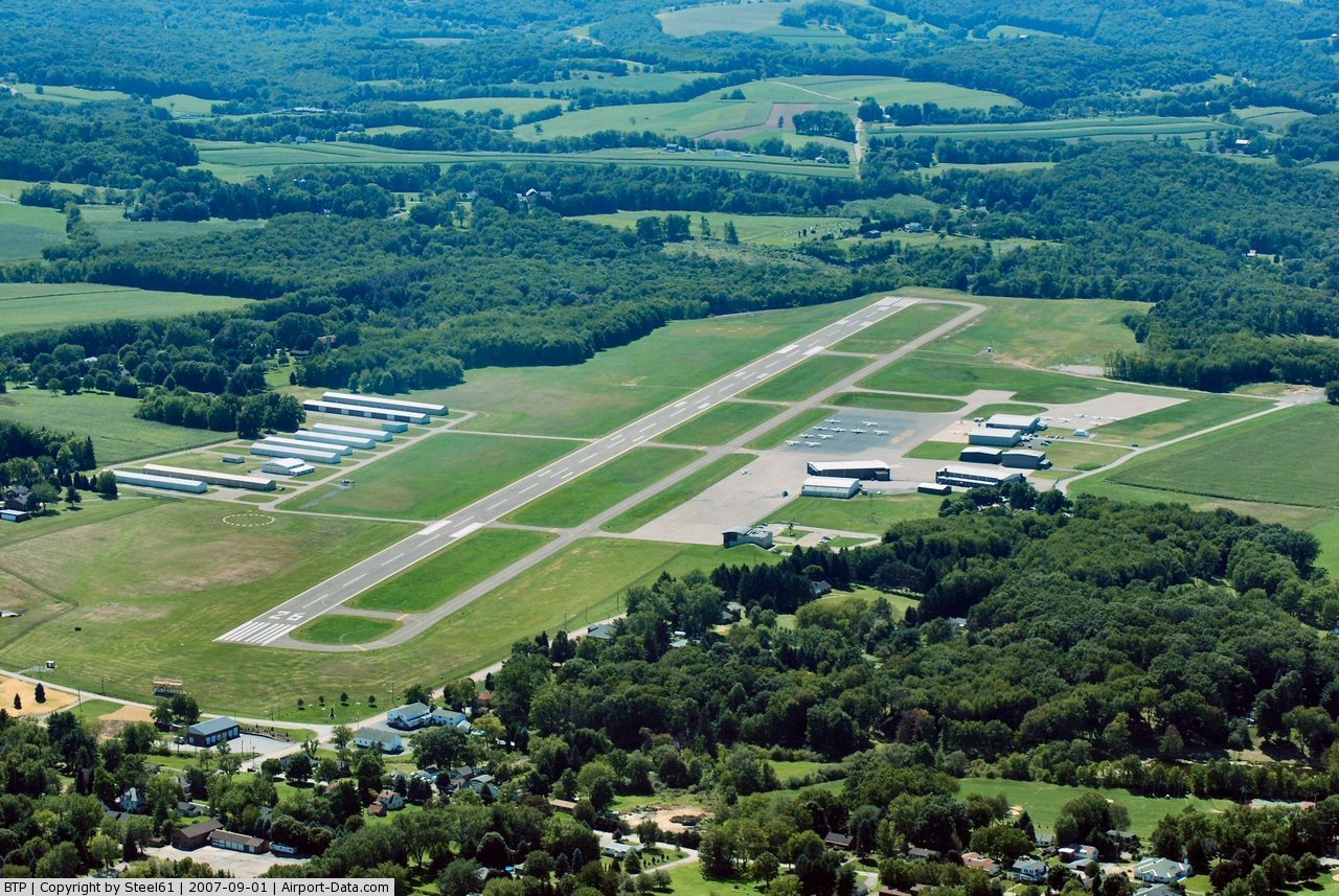
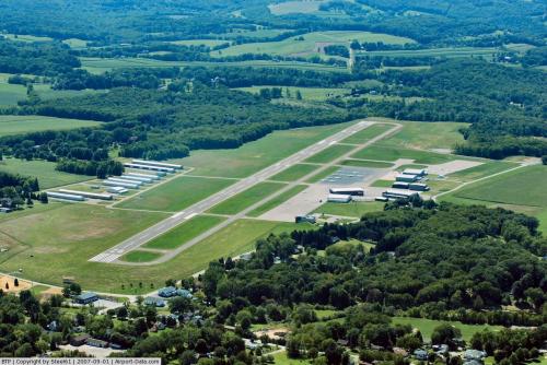
Butler County Airport covers an area of 230 acres (93 ha) and contains one asphalt paved runway designated 8/26 which measures 4,801 x 100 ft (1,463 x 30 m). For the 12-month period ending February 27, 2007, the airport had 62,685 aircraft operations, an average of 171 per day: 98% general aviation, 2% air taxi and <1% military. There are 132 aircraft based at this airport: 72% single-engine, 23% multi-engine, 3% jet and 2% helicopter.
The above content comes from Wikipedia and is published under free licenses – click here to read more.

 |
(Click on the photo to enlarge) |
 |
(Click on the photo to enlarge) |
Location & QuickFacts
| FAA Information Effective: | 2008-09-25 |
| Airport Identifier: | BTP |
| Airport Status: | Operational |
| Longitude/Latitude: | 079-56-58.9650W/40-46-36.9600N
-79.949713/40.776933 (Estimated) |
| Elevation: | 1248 ft / 380.39 m (Surveyed) |
| Land: | 323 acres |
| From nearest city: | 5 nautical miles SW of Butler, PA |
| Location: | Butler County, PA |
| Magnetic Variation: | 08W (1985) |
Owner & Manager
| Ownership: | Publicly owned |
| Owner: | Butler Co Arpt Auth |
| Address: | 475 Airport Rd
Butler, PA 16002 |
| Phone number: | 724-586-6665 |
| Manager: | Don Bailey |
| Address: | 475 Airport Rd
Butler, PA 16002 |
| Phone number: | 724-586-6665 |
Airport Operations and Facilities
| Airport Use: | Open to public |
| Wind indicator: | Yes |
| Segmented Circle: | Yes |
| Control Tower: | No |
| Lighting Schedule: | DUSK-DAWN
ACTVT HIRL RY 08/26, MALSF RY 08, PAPI RY 08 & PAPI RY 26 - CTAF. |
| Beacon Color: | Clear-Green (lighted land airport) |
| Sectional chart: | Detroit |
| Region: | AEA - Eastern |
| Boundary ARTCC: | ZOB - Cleveland |
| Tie-in FSS: | AOO - Altoona |
| FSS on Airport: | No |
| FSS Toll Free: | 1-800-WX-BRIEF |
| NOTAMs Facility: | BTP (NOTAM-d service avaliable) |
| Federal Agreements: | NGY |
Airport Communications
| CTAF: | 122.800 |
| Unicom: | 122.800 |
Airport Services
| Fuel available: | 100LLA |
| Airframe Repair: | MAJOR |
| Power Plant Repair: | MAJOR |
| Bottled Oxygen: | NONE |
| Bulk Oxygen: | HIGH/LOW |
Runway Information
Runway 08/26
| Dimension: | 4801 x 100 ft / 1463.3 x 30.5 m |
| Surface: | ASPH, Good Condition |
| Surface Treatment: | Saw-cut or plastic Grooved |
| Weight Limit: | Single wheel: 37000 lbs.
Dual wheel: 50000 lbs. |
| Edge Lights: | High |
| |
Runway 08 |
Runway 26 |
| Longitude: | 079-57-33.5810W | 079-56-34.2600W |
| Latitude: | 40-46-28.3840N | 40-46-43.0800N |
| Elevation: | 1228.00 ft | 1244.00 ft |
| Alignment: | 72 | 127 |
| ILS Type: | ILS
| |
| Traffic Pattern: | Left | Left |
| Markings: | Precision instrument, Good Condition | Non-precision instrument, Good Condition |
| Crossing Height: | 53.00 ft | 60.00 ft |
| VASI: | 4-light PAPI on left side | 4-light PAPI on left side |
| Visual Glide Angle: | 3.00° | 3.50° |
| Approach lights: | MALSF | |
| Runway End Identifier: | | Yes |
| Obstruction: | 86 ft , 3059.0 ft from runway, 59 ft right of centerline, 33:1 slope to clear | 39 ft trees, 798.0 ft from runway, 10 ft left of centerline, 15:1 slope to clear
RY 26 PUBLIC RD AT THLD 455 FT RGT. |
|
Radio Navigation Aids
| ID |
Type |
Name |
Ch |
Freq |
Var |
Dist |
| UCP | NDB | Castle | | 272.00 | 09W | 25.8 nm |
| MKP | NDB | Mc Keesport | | 287.00 | 07W | 26.5 nm |
| HBD | NDB | Hubbard | | 408.00 | 08W | 34.8 nm |
| PNU | NDB | Washington County | | 255.00 | 08W | 39.2 nm |
| BHU | NDB | Benje | | 382.00 | 07W | 39.2 nm |
| INP | NDB | Indiana | | 242.00 | 08W | 41.2 nm |
| FKL | VOR | Franklin | | 109.60 | 06W | 40.0 nm |
| AGC | VOR/DME | Allegheny | 037X | 110.00 | 09W | 30.2 nm |
| CIP | VOR/DME | Clarion | 076X | 112.90 | 06W | 31.5 nm |
| HLG | VOR/DME | Wheeling | 059X | 112.20 | 07W | 42.0 nm |
| EWC | VORTAC | Ellwood City | 105X | 115.80 | 08W | 12.3 nm |
| MMJ | VORTAC | Montour | 057X | 112.00 | 08W | 20.6 nm |
| YNG | VORTAC | Youngstown | 027X | 109.00 | 05W | 46.8 nm |
Remarks
- NOISE ABATEMENT PROCEDURES IN EFFECT; CTC AMGR 724-586-6665.
- IN OPERN PRIOR TO 1959.
Images and information placed above are from
http://www.airport-data.com/airport/BTP/
We thank them for the data!
| General Info
|
| Country |
United States
|
| State |
PENNSYLVANIA
|
| FAA ID |
BTP
|
| Latitude |
40-46-36.934N
|
| Longitude |
079-56-59.007W
|
| Elevation |
1248 feet
|
| Near City |
BUTLER
|
We don't guarantee the information is fresh and accurate. The data may
be wrong or outdated.
For more up-to-date information please refer to other sources.
|
|