 |
|
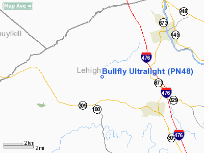
Bullfly Ultralight Airport |
Location & QuickFacts
| FAA Information Effective: | 2008-09-25 |
| Airport Identifier: | PN48 |
| Airport Status: | Operational |
| Longitude/Latitude: | 075-41-10.0000W/40-42-30.0000N
-75.686111/40.708333 (Estimated) |
| Elevation: | 812 ft / 247.50 m (Estimated) |
| Land: | 9 acres |
| From nearest city: | 1 nautical miles NE of Germansville, PA |
| Location: | Lehigh County, PA |
| Magnetic Variation: | 12W (2000) |
Owner & Manager
| Ownership: | Privately owned |
| Owner: | Robert R. Gorry |
| Address: | 5568 Bullhead Rd
Germansville, PA 18053 |
| Phone number: | 610-7676-1111 |
| Manager: | Robert R. Gorry |
| Address: | 5568 Bullhead Rd
Germansville, PA 18053 |
| Phone number: | 610-7676-1111 |
Airport Operations and Facilities
| Airport Use: | Private |
| Wind indicator: | Yes |
| Segmented Circle: | No |
| Control Tower: | No |
| Sectional chart: | New York |
| Region: | AEA - Eastern |
| Boundary ARTCC: | ZNY - New York |
| Tie-in FSS: | IPT - Williamsport |
| FSS Toll Free: | 1-800-WX-BRIEF |
Runway Information
Runway 04/22
| Dimension: | 1200 x 110 ft / 365.8 x 33.5 m |
| Surface: | TURF, |
| |
Runway 04 |
Runway 22 |
| Traffic Pattern: | Left | Left |
| Displaced threshold: | 225.00 ft | 100.00 ft |
| Obstruction: | 15 ft road | 30 ft trees |
|
Radio Navigation Aids
| ID |
Type |
Name |
Ch |
Freq |
Var |
Dist |
| LQX | NDB | Carbon | | 339.00 | 12W | 7.1 nm |
| HXM | NDB | Humbolt | | 366.00 | 10W | 22.0 nm |
| UKT | NDB | Quakertown | | 208.00 | 12W | 24.6 nm |
| CYE | NDB | Crystal Lake | | 410.00 | 11W | 30.9 nm |
| DYL | NDB | Doylestown | | 237.00 | 10W | 34.1 nm |
| ING | NDB | Ambler | | 275.00 | 11W | 39.5 nm |
| NXX | NDB | Willow Grove | | 388.00 | 12W | 39.8 nm |
| BZJ | NDB | Bellgrove | | 328.00 | 10W | 42.8 nm |
| NXX | TACAN | Willow Grove | 061X | | 10W | 39.5 nm |
| HZL | VOR | Hazleton | | 109.40 | 09W | 25.6 nm |
| PNE | VOR | North Philadelphia | | 112.00 | 10W | 48.7 nm |
| ETX | VOR/DME | East Texas | 039X | 110.20 | 09W | 7.7 nm |
| CKZ | VOR/DME | Pennridge | 025Y | 108.85 | 12W | 26.3 nm |
| BWZ | VOR/DME | Broadway | 089X | 114.20 | 11W | 39.7 nm |
| STW | VOR/DME | Stillwater | 033X | 109.60 | 11W | 41.0 nm |
| SBJ | VOR/DME | Solberg | 076X | 112.90 | 10W | 43.7 nm |
| ARD | VOR/DME | Yardley | 019X | 108.20 | 10W | 44.9 nm |
| FJC | VORTAC | Allentown | 122X | 117.50 | 10W | 10.6 nm |
| PTW | VORTAC | Pottstown | 112X | 116.50 | 09W | 29.8 nm |
| LVZ | VORTAC | Wilkes-barre | 053X | 111.60 | 10W | 33.9 nm |
| RAV | VORTAC | Ravine | 093X | 114.60 | 11W | 42.7 nm |
| LRP | VORTAC | Lancaster | 120X | 117.30 | 09W | 44.9 nm |
| LHY | VORTAC | Lake Henry | 045X | 110.80 | 10W | 47.0 nm |
| MXE | VORTAC | Modena | 079X | 113.20 | 09W | 47.5 nm |
| MIP | VORTAC | Milton | 029X | 109.20 | 09W | 48.4 nm |
Remarks
- PRVDD VFR ONLY, CLEAR 20:1 APCH/DEP PATH, TREES AT RY END REMOVED, STOP SIGN PLACED AT END OF DIRT ROAD TO CTL INTERFERENCE W/APCH/DEP.
Images and information placed above are from
http://www.airport-data.com/airport/PN48/
We thank them for the data!
| General Info
|
| Country |
United States
|
| State |
PENNSYLVANIA
|
| FAA ID |
PN48
|
| Latitude |
40-43-00.340N
|
| Longitude |
075-43-48.680W
|
| Elevation |
800 feet
|
| Near City |
GERMANSVILLE
|
We don't guarantee the information is fresh and accurate. The data may
be wrong or outdated.
For more up-to-date information please refer to other sources.
|
|


