 |
|
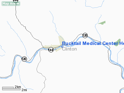
Bucktail Medical Center Heliport |
Location & QuickFacts
| FAA Information Effective: | 2008-09-25 |
| Airport Identifier: | 7PS8 |
| Airport Status: | Operational |
| Longitude/Latitude: | 077-44-08.9510W/41-19-40.2410N
-77.735820/41.327845 (Estimated) |
| Elevation: | 665 ft / 202.69 m (Estimated) |
| Land: | 0 acres |
| From nearest city: | 1 nautical miles NE of South Renovo, PA |
| Location: | Clinton County, PA |
| Magnetic Variation: | 10W (1985) |
Owner & Manager
| Ownership: | Privately owned |
| Owner: | Bucktail Medical Center |
| Address: | 1001 Pine St.
Renovo, PA 17764 |
| Phone number: | 717-923-1000 |
| Manager: | Thomas R. Chesney |
| Address: | 1001 Pine St.
Renovo, PA 17764 |
| Phone number: | 717-923-1000 |
Airport Operations and Facilities
| Airport Use: | Private
MEDICAL USE. |
| Wind indicator: | Yes |
| Segmented Circle: | No |
| Control Tower: | No |
| Lighting Schedule: | DUSK-DAWN |
| Landing fee charge: | No |
| Sectional chart: | Detroit |
| Region: | AEA - Eastern |
| Boundary ARTCC: | ZNY - New York |
| Tie-in FSS: | IPT - Williamsport |
| FSS Toll Free: | 1-800-WX-BRIEF |
Runway Information
Helipad H1
| Dimension: | 65 x 65 ft / 19.8 x 19.8 m |
| Surface: | ASPH, Good Condition |
| |
Runway H1 |
Runway |
| Traffic Pattern: | Left | Left |
|
Radio Navigation Aids
| ID |
Type |
Name |
Ch |
Freq |
Var |
Dist |
| RV | NDB | Stroh | | 407.00 | 10W | 42.9 nm |
| PIX | NDB | Picture Rocks | | 344.00 | 09W | 46.4 nm |
| EL | NDB | Halos | | 269.00 | 09W | 47.7 nm |
| SFK | VOR/DME | Stonyfork | 023X | 108.60 | 08W | 26.3 nm |
| FQM | VOR/DME | Williamsport | 091X | 114.40 | 09W | 43.4 nm |
| BFD | VOR/DME | Bradford | 113X | 116.60 | 07W | 48.4 nm |
| SLT | VORTAC | Slate Run | 086X | 113.90 | 08W | 15.3 nm |
| ETG | VORTAC | Keating | 107X | 116.00 | 10W | 19.6 nm |
| PSB | VORTAC | Philipsburg | 102X | 115.50 | 10W | 27.3 nm |
| TON | VORTAC | Tyrone | 096X | 114.90 | 07W | 44.7 nm |
| ELZ | VORTAC | Wellsville | 051X | 111.40 | 09W | 47.3 nm |
Remarks
- PROVIDED 8:1 APPROACH SURFACE IS PROVIDED.
Images and information placed above are from
http://www.airport-data.com/airport/7PS8/
We thank them for the data!
| General Info
|
| Country |
United States
|
| State |
PENNSYLVANIA
|
| FAA ID |
7PS8
|
| Latitude |
41-19-40.241N
|
| Longitude |
077-44-08.951W
|
| Elevation |
665 feet
|
| Near City |
SOUTH RENOVO
|
We don't guarantee the information is fresh and accurate. The data may
be wrong or outdated.
For more up-to-date information please refer to other sources.
|
|


