 |
|
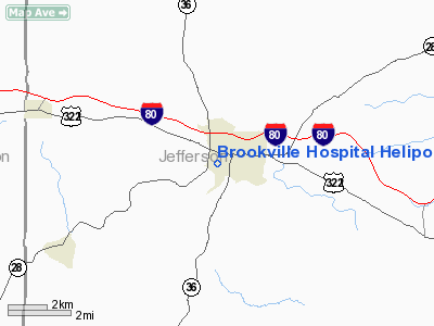
Brookville Hospital Heliport |
Location & QuickFacts
| FAA Information Effective: | 2008-09-25 |
| Airport Identifier: | PA04 |
| Airport Status: | Operational |
| Longitude/Latitude: | 079-05-35.1330W/41-09-23.2290N
-79.093092/41.156453 (Estimated) |
| Elevation: | 1516 ft / 462.08 m (Surveyed) |
| Land: | 0 acres |
| From nearest city: | 1 nautical miles SW of Brookville, PA |
| Location: | Jefferson County, PA |
| Magnetic Variation: | 10W (2000) |
Owner & Manager
| Ownership: | Privately owned |
| Owner: | Brookville Hospital |
| Address: | 100 Hospital Rd
Brookville, PA 15825 |
| Phone number: | 814-849-2312 |
| Manager: | Warren J Bassett |
| Address: | 100 Hospital Rd
Brookville, PA 15825 |
| Phone number: | 814-849-2312 |
Airport Operations and Facilities
| Airport Use: | Private
MEDICAL USE. |
| Wind indicator: | Yes |
| Segmented Circle: | No |
| Control Tower: | No |
| Lighting Schedule: | PHONE REQ
FOR PERIMETER LGTS CALL 814-849-2312. |
| Sectional chart: | Detroit |
| Region: | AEA - Eastern |
| Boundary ARTCC: | ZOB - Cleveland |
| Tie-in FSS: | AOO - Altoona |
| FSS Toll Free: | 1-800-WX-BRIEF |
Runway Information
Helipad H1
| Dimension: | 65 x 65 ft / 19.8 x 19.8 m |
| Surface: | ASPH, |
| |
Runway H1 |
Runway |
| Traffic Pattern: | Left | Left |
|
Radio Navigation Aids
| ID |
Type |
Name |
Ch |
Freq |
Var |
Dist |
| INP | NDB | Indiana | | 242.00 | 08W | 31.6 nm |
| BHU | NDB | Benje | | 382.00 | 07W | 47.6 nm |
| FKL | VOR | Franklin | | 109.60 | 06W | 38.4 nm |
| CIP | VOR/DME | Clarion | 076X | 112.90 | 06W | 16.5 nm |
| REC | VOR/DME | Revloc | 043X | 110.60 | 09W | 39.9 nm |
| BFD | VOR/DME | Bradford | 113X | 116.60 | 07W | 43.5 nm |
| TDT | VORTAC | Tidioute | 123X | 117.60 | 09W | 36.5 nm |
| TON | VORTAC | Tyrone | 096X | 114.90 | 07W | 42.9 nm |
| ETG | VORTAC | Keating | 107X | 116.00 | 10W | 43.1 nm |
Remarks
- PRVDD INGRESS IS 260 & 170 DEGREES ; EGRESS IS 80 & 350 DEGREES.
Images and information placed above are from
http://www.airport-data.com/airport/PA04/
We thank them for the data!
| General Info
|
| Country |
United States
|
| State |
PENNSYLVANIA
|
| FAA ID |
PA04
|
| Latitude |
41-09-23.229N
|
| Longitude |
079-05-35.133W
|
| Elevation |
1516 feet
|
| Near City |
BROOKVILLE
|
We don't guarantee the information is fresh and accurate. The data may
be wrong or outdated.
For more up-to-date information please refer to other sources.
|
|


