 |
|
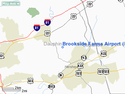
Location & QuickFacts
| FAA Information Effective: | 2008-09-25 |
| Airport Identifier: | 59PN |
| Airport Status: | Operational |
| Longitude/Latitude: | 076-41-08.8880W/40-18-57.3230N
-76.685802/40.315923 (Estimated) |
| Elevation: | 489 ft / 149.05 m (Estimated) |
| Land: | 6 acres |
| From nearest city: | 3 nautical miles NW of Hershey, PA |
| Location: | Dauphin County, PA |
| Magnetic Variation: | 10W (1985) |
Owner & Manager
| Ownership: | Privately owned |
| Owner: | R E Cassel |
| Address: | 25 Shetland Drive
Hummelstown, PA 17036 |
| Manager: | Re Cassel |
| Address: | 25 Shetland Drive
Hummelstown, PA 17036 |
Airport Operations and Facilities
| Airport Use: | Private |
| Wind indicator: | No |
| Segmented Circle: | No |
| Control Tower: | No |
| Landing fee charge: | No |
| Sectional chart: | New York |
| Region: | AEA - Eastern |
| Boundary ARTCC: | ZNY - New York |
| Tie-in FSS: | IPT - Williamsport |
| FSS on Airport: | No |
| FSS Toll Free: | 1-800-WX-BRIEF |
Airport Services
| Airframe Repair: | NONE |
| Power Plant Repair: | NONE |
Runway Information
Runway 09/27
| Dimension: | 2320 x 100 ft / 707.1 x 30.5 m |
| Surface: | TURF, |
| |
Runway 09 |
Runway 27 |
| Traffic Pattern: | Left | Left |
| Runway End Identifier: | No | No |
| Centerline Lights: | No | No |
| Touchdown Lights: | No | No |
|
Radio Navigation Aids
| ID |
Type |
Name |
Ch |
Freq |
Var |
Dist |
| BZJ | NDB | Bellgrove | | 328.00 | 10W | 9.4 nm |
| EUD | NDB | York | | 254.00 | 11W | 25.4 nm |
| HZL | VOR | Hazleton | | 109.40 | 09W | 47.1 nm |
| ETX | VOR/DME | East Texas | 039X | 110.20 | 09W | 48.5 nm |
| RAV | VORTAC | Ravine | 093X | 114.60 | 11W | 14.8 nm |
| HAR | VORTAC | Harrisburg | 072X | 112.50 | 10W | 17.6 nm |
| LRP | VORTAC | Lancaster | 120X | 117.30 | 09W | 21.6 nm |
| SEG | VORTAC | Selinsgrove | 041X | 110.40 | 08W | 29.9 nm |
| MIP | VORTAC | Milton | 029X | 109.20 | 09W | 42.5 nm |
| MDT | VOT | Harrisburg International | | 110.00 | | 8.0 nm |
Remarks
Images and information placed above are from
http://www.airport-data.com/airport/59PN/
We thank them for the data!
| General Info
|
| Country |
United States
|
| State |
PENNSYLVANIA
|
| FAA ID |
59PN
|
| Latitude |
40-18-57.323N
|
| Longitude |
076-41-08.888W
|
| Elevation |
489 feet
|
| Near City |
HERSHEY
|
We don't guarantee the information is fresh and accurate. The data may
be wrong or outdated.
For more up-to-date information please refer to other sources.
|
|


