 |
|
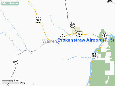
Location & QuickFacts
| FAA Information Effective: | 2008-09-25 |
| Airport Identifier: | P15 |
| Airport Status: | Operational |
| Longitude/Latitude: | 079-21-41.5940W/41-49-57.3690N
-79.361554/41.832603 (Estimated) |
| Elevation: | 1230 ft / 374.90 m (Estimated) |
| Land: | 240 acres |
| From nearest city: | 1 nautical miles E of Pittsfield, PA |
| Location: | Warren County, PA |
| Magnetic Variation: | 09W (1985) |
Owner & Manager
| Ownership: | Privately owned |
| Owner: | Bill Holder |
| Address: | Po Box 134
Pittsfield, PA 16340 |
| Phone number: | 814-563-4949 |
| Manager: | Bill Holder |
| Address: | Po Box 134
Warren, PA 16340 |
| Phone number: | 814-563-3166 |
Airport Operations and Facilities
| Airport Use: | Open to public |
| Wind indicator: | Yes |
| Segmented Circle: | Yes |
| Control Tower: | No |
| Lighting Schedule: | PHONE REQ
FOR ROTG BCN CALL 814-563-3166 OR 4549 OR 4949. |
| Beacon Color: | Clear-Green (lighted land airport) |
| Landing fee charge: | No |
| Sectional chart: | Detroit |
| Region: | AEA - Eastern |
| Boundary ARTCC: | ZOB - Cleveland |
| Tie-in FSS: | AOO - Altoona |
| FSS on Airport: | No |
| FSS Toll Free: | 1-800-WX-BRIEF |
| NOTAMs Facility: | AOO (NOTAM-d service avaliable) |
Airport Communications
Airport Services
| Fuel available: | 100LL |
| Airframe Repair: | MINOR |
| Power Plant Repair: | MINOR |
| Bottled Oxygen: | NONE |
| Bulk Oxygen: | NONE |
Runway Information
Runway 09/27
| Dimension: | 2660 x 100 ft / 810.8 x 30.5 m |
| Surface: | TURF, Good Condition |
| Edge Lights: | Low |
| |
Runway 09 |
Runway 27 |
| Longitude: | 079-21-58.4600W | 079-21-24.7270W |
| Latitude: | 41-49-53.6900N | 41-50-01.0700N |
| Elevation: | 1230.00 ft | 1225.00 ft |
| Traffic Pattern: | Left | Right |
| Displaced threshold: | 210.00 ft | 0.00 ft |
| Obstruction: | 10 ft road
RWY 09 APCH SLOPE 20:1 FM DSPLCD THR. | 82 ft trees, 1766.0 ft from runway, 277 ft left of centerline, 21:1 slope to clear |
|
Radio Navigation Aids
| ID |
Type |
Name |
Ch |
Freq |
Var |
Dist |
| ORJ | NDB | Corry | | 258.00 | 09W | 13.7 nm |
| CQD | NDB | Cascade | | 372.00 | 08W | 37.4 nm |
| FKL | VOR | Franklin | | 109.60 | 06W | 32.5 nm |
| JHW | VOR/DME | Jamestown | 094X | 114.70 | 07W | 23.9 nm |
| BFD | VOR/DME | Bradford | 113X | 116.60 | 07W | 33.4 nm |
| CIP | VOR/DME | Clarion | 076X | 112.90 | 06W | 41.5 nm |
| TDT | VORTAC | Tidioute | 123X | 117.60 | 09W | 7.6 nm |
| DKK | VORTAC | Dunkirk | 109X | 116.20 | 07W | 39.7 nm |
| ERI | VORTAC | Erie | 031X | 109.40 | 06W | 43.1 nm |
Remarks
- +42 FT PLINE PARALLELING RY APPRX 215 FT S OF RY CNTRLN; PLINE MARKED WITH ORANGE SPHERES.
- RWY SOFT DURING SPRING THAW.
- 850 FT SAFETY AREA EAST END RY 09/27.
- DEER; WOODCHUCKS & GEESE ON & INVOF RY.
- EXTENSIVE GLIDER OPNS WEEKENDS.
- SEE AIRSPACE LETTER DATED 12/03/92.
Images and information placed above are from
http://www.airport-data.com/airport/P15/
We thank them for the data!
| General Info
|
| Country |
United States
|
| State |
PENNSYLVANIA
|
| FAA ID |
P15
|
| Latitude |
41-49-57.211N
|
| Longitude |
079-21-40.175W
|
| Elevation |
1230 feet
|
| Near City |
PITTSFIELD
|
We don't guarantee the information is fresh and accurate. The data may
be wrong or outdated.
For more up-to-date information please refer to other sources.
|
|


