 |
|
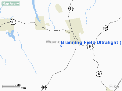
Branning Field Ultralight Airport |
Location & QuickFacts
| FAA Information Effective: | 2008-09-25 |
| Airport Identifier: | PN33 |
| Airport Status: | Operational |
| Longitude/Latitude: | 075-16-55.6360W/41-33-10.3160N
-75.282121/41.552866 (Estimated) |
| Elevation: | 1420 ft / 432.82 m (Estimated) |
| Land: | 0 acres |
| From nearest city: | 2 nautical miles NE of Honesdale, PA |
| Location: | Wayne County, PA |
| Magnetic Variation: | 12W (1990) |
Owner & Manager
| Ownership: | Privately owned |
| Owner: | O Jay Branning |
| Address: | Rd 5 Box 1015
Honesdale, PA 18431 |
| Phone number: | 717-253-5258 |
| Manager: | O Jay Branning |
| Address: | Rd 5 Box 1015
Honesdale, PA 18431 |
| Phone number: | 717-253-5258 |
Airport Operations and Facilities
| Airport Use: | Private |
| Segmented Circle: | No |
| Control Tower: | No |
| Sectional chart: | New York |
| Region: | AEA - Eastern |
| Boundary ARTCC: | ZNY - New York |
| Tie-in FSS: | IPT - Williamsport |
| FSS on Airport: | No |
| FSS Toll Free: | 1-800-WX-BRIEF |
Runway Information
Runway 05/32
| Dimension: | 1100 x 50 ft / 335.3 x 15.2 m |
| Surface: | TURF, |
| |
Runway 05 |
Runway 32 |
| Traffic Pattern: | Left | Left |
|
Radio Navigation Aids
| ID |
Type |
Name |
Ch |
Freq |
Var |
Dist |
| MS | NDB | Monga | | 359.00 | 12W | 22.9 nm |
| CYE | NDB | Crystal Lake | | 410.00 | 11W | 32.2 nm |
| HXM | NDB | Humbolt | | 366.00 | 10W | 46.8 nm |
| SW | NDB | Neely | | 335.00 | 14W | 47.6 nm |
| LQX | NDB | Carbon | | 339.00 | 12W | 49.5 nm |
| HNK | VOR/DME | Hancock | 115X | 116.80 | 11W | 30.7 nm |
| HUO | VOR/DME | Huguenot | 108X | 116.10 | 11W | 32.3 nm |
| STW | VOR/DME | Stillwater | 033X | 109.60 | 11W | 38.3 nm |
| DNY | VOR/DME | De Lancey | 058X | 112.10 | 11W | 40.3 nm |
| BWZ | VOR/DME | Broadway | 089X | 114.20 | 11W | 49.9 nm |
| LHY | VORTAC | Lake Henry | 045X | 110.80 | 10W | 10.1 nm |
| LVZ | VORTAC | Wilkes-barre | 053X | 111.60 | 10W | 24.9 nm |
| SAX | VORTAC | Sparta | 104X | 115.70 | 11W | 44.5 nm |
Remarks
Images and information placed above are from
http://www.airport-data.com/airport/PN33/
We thank them for the data!
| General Info
|
| Country |
United States
|
| State |
PENNSYLVANIA
|
| FAA ID |
PN33
|
| Latitude |
41-33-10.316N
|
| Longitude |
075-16-55.636W
|
| Elevation |
1420 feet
|
| Near City |
HONESDALE
|
We don't guarantee the information is fresh and accurate. The data may
be wrong or outdated.
For more up-to-date information please refer to other sources.
|
|


