|
|
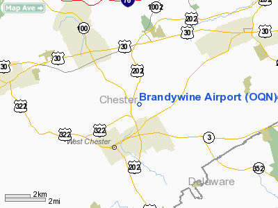
| Brandywine Airport |
| IATA: OQN – ICAO: KOQN – FAA LID: OQN |
| Summary |
| Airport type |
Public |
| Owner |
New Brandywine Airport Club, Inc. |
| Serves |
West Goshen Township, Pennsylvania |
| Elevation AMSL |
466 ft / 142 m |
| Coordinates |
39°59′24″N 075°34′55″W / 39.99°N 75.58194°W / 39.99; -75.58194 |
| Website |
n99.com |
| Runways |
| Direction |
Length |
Surface |
| ft |
m |
| 9/27 |
3,347 |
1,020 |
Asphalt |
| Statistics (2009) |
| Aircraft operations |
60,065 |
| Based aircraft |
113 |
| Source: Federal Aviation Administration |
Brandywine Airport (IATA: OQN, ICAO: KOQN, FAA LID: OQN) is a public use airport located in West Goshen Township, Pennsylvania, three nautical miles (6 km) northeast of the central business district of West Chester. It is privately owned by the New Brandywine Airport Club Inc.
Facilities and aircraft
Brandywine Airport covers an area of 44 acres (18 ha) at an elevation of 466 feet (142 m) above mean sea level. It has one runway designated 9/27 with an asphalt surface measuring 3,347 by 50 feet (1,020 x 15 m).
For the 12-month period ending July 28, 2009, the airport had 60,065 aircraft operations, an average of 164 per day: 98% general aviation and 2% air taxi. At that time there were 113 aircraft based at this airport: 86% single-engine, 8% multi-engine, 1% jet and 5% helicopter.
The above content comes from Wikipedia and is published under free licenses – click here to read more.
 |
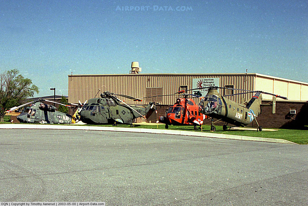
(Click on the photo to enlarge) |
Location & QuickFacts
| FAA Information Effective: | 2008-09-25 |
| Airport Identifier: | OQN |
| Airport Status: | Operational |
| Longitude/Latitude: | 075-34-54.8650W/39-59-24.4240N
-75.581907/39.990118 (Estimated) |
| Elevation: | 466 ft / 142.04 m (Surveyed) |
| Land: | 44 acres |
| From nearest city: | 3 nautical miles NE of West Chester, PA |
| Location: | Chester County, PA |
| Magnetic Variation: | 12W (2000) |
Owner & Manager
| Ownership: | Privately owned |
| Owner: | New Brandywine Arpt Club Inc |
| Address: | 1205 Ward Ave
West Chester, PA 19380 |
| Phone number: | 610-692-6100 |
| Manager: | John Taylor |
| Address: | 1205 Ward Ave
West Chester, PA 19380 |
| Phone number: | 610-692-6100 |
Airport Operations and Facilities
| Airport Use: | Open to public |
| Wind indicator: | Yes |
| Segmented Circle: | No |
| Control Tower: | No |
| Lighting Schedule: | RDO-CTL
ACTIVATE - ROTG BCN - CTAF. |
| Beacon Color: | Clear-Green (lighted land airport) |
| Landing fee charge: | Yes
LANDING FEE COML OPNS ONLY. |
| Sectional chart: | Washington |
| Region: | AEA - Eastern |
| Traffic Pattern Alt: | 1035 ft |
| Boundary ARTCC: | ZNY - New York |
| Tie-in FSS: | IPT - Williamsport |
| FSS on Airport: | No |
| FSS Toll Free: | 1-800-WX-BRIEF |
| NOTAMs Facility: | IPT (NOTAM-d service avaliable) |
| Federal Agreements: | NMY |
Airport Communications
| CTAF: | 123.075 |
| Unicom: | 123.075 |
Airport Services
| Fuel available: | 100LLA |
| Airframe Repair: | MINOR |
| Power Plant Repair: | MAJOR |
| Bottled Oxygen: | NONE |
| Bulk Oxygen: | NONE |
Runway Information
Runway 09/27
| Dimension: | 3347 x 50 ft / 1020.2 x 15.2 m |
| Surface: | ASPH, Good Condition |
| Weight Limit: | Single wheel: 10000 lbs. |
| Edge Lights: | Low |
| |
Runway 09 |
Runway 27 |
| Longitude: | 075-35-15.7750W | 075-34-33.9550W |
| Latitude: | 39-59-20.5800N | 39-59-28.2680N |
| Elevation: | 460.00 ft | 462.00 ft |
| Alignment: | 77 | 127 |
| Traffic Pattern: | Right | Left |
| Markings: | Non-precision instrument, Good Condition | Non-precision instrument, Good Condition |
| Displaced threshold: | 125.00 ft | 250.00 ft |
| Obstruction: | 11 ft trees, 300.0 ft from runway, 97 ft right of centerline, 9:1 slope to clear
RY 09 APCH RATIO 38:1 TO DSPLCD THLD.
RY 09 HAS 5 FT TREE, 187 FT FM RY END, 36 FT L. | 14 ft trees, 222.0 ft from runway, 250 ft right of centerline, 1:1 slope to clear
RY 27 APCH RATIO 33:1 TO DSPLCD THLD.
ROAD TRAVERSING THE 200 FT PRIMARY SFC AREA BYD EOR; ROAD RISES TO +13 FT AT A POINT 14 FT FROM EOR 265 FT R. |
|
Radio Navigation Aids
| ID |
Type |
Name |
Ch |
Freq |
Var |
Dist |
| ING | NDB | Ambler | | 275.00 | 11W | 15.9 nm |
| NXX | NDB | Willow Grove | | 388.00 | 12W | 23.4 nm |
| UKT | NDB | Quakertown | | 208.00 | 12W | 29.2 nm |
| DYL | NDB | Doylestown | | 237.00 | 10W | 29.6 nm |
| APG | NDB | Aberdeen | | 349.00 | 11W | 36.5 nm |
| RNB | NDB | Rainbow | | 363.00 | 11W | 40.1 nm |
| NXX | TACAN | Willow Grove | 061X | | 10W | 23.5 nm |
| PNE | VOR | North Philadelphia | | 112.00 | 10W | 26.9 nm |
| CKZ | VOR/DME | Pennridge | 025Y | 108.85 | 12W | 27.6 nm |
| ARD | VOR/DME | Yardley | 019X | 108.20 | 10W | 34.8 nm |
| ETX | VOR/DME | East Texas | 039X | 110.20 | 09W | 35.8 nm |
| PPM | VOR/DME | Phillips | 021X | 108.40 | 09W | 41.6 nm |
| MXE | VORTAC | Modena | 079X | 113.20 | 09W | 6.0 nm |
| PTW | VORTAC | Pottstown | 112X | 116.50 | 09W | 14.0 nm |
| DQO | VORTAC | Dupont | 087X | 114.00 | 10W | 18.8 nm |
| OOD | VORTAC | Woodstown | 075X | 112.80 | 10W | 24.9 nm |
| LRP | VORTAC | Lancaster | 120X | 117.30 | 09W | 33.6 nm |
| VCN | VORTAC | Cedar Lake | 099X | 115.20 | 10W | 39.3 nm |
| FJC | VORTAC | Allentown | 122X | 117.50 | 10W | 44.7 nm |
| GXU | VORTAC | Mc Guire | 043X | 110.60 | 11W | 45.4 nm |
| ENO | VORTAC | Smyrna | 051X | 111.40 | 09W | 45.7 nm |
| PHL | VOT | Philadelphia Intl | | 109.80 | | 17.1 nm |
Remarks
- TFC DEPARTING RY 27 TURN RIGHT 10 DEG UNTIL REACHING 1200 FT MSL TO AVIOD MANSION LEFT & HOMES RIGHT.
- BIRDS ON & INVOF ARPT.
- FOR SVC AFT HRS CTC 484-832-3476.
Images and information placed above are from
http://www.airport-data.com/airport/OQN/
We thank them for the data!
|
|