 |
|
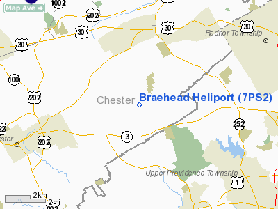
Location & QuickFacts
| FAA Information Effective: | 2008-09-25 |
| Airport Identifier: | 7PS2 |
| Airport Status: | Operational |
| Longitude/Latitude: | 075-29-27.7280W/39-59-16.3920N
-75.491036/39.987887 (Estimated) |
| Elevation: | 500 ft / 152.40 m (Estimated) |
| Land: | 0 acres |
| From nearest city: | 4 nautical miles W of Willistown, PA |
| Location: | Chester County, PA |
| Magnetic Variation: | 11W (1985) |
Owner & Manager
| Ownership: | Privately owned |
| Owner: | Robert Mc Clements, Jr. |
| Address: | 773 Sugartown Road
Malvern, PA 19355 |
| Phone number: | 215-296-3560 |
| Address: |
|
Airport Operations and Facilities
| Airport Use: | Private |
| Segmented Circle: | No |
| Control Tower: | No |
| Sectional chart: | Washington |
| Region: | AEA - Eastern |
| Boundary ARTCC: | ZNY - New York |
| Responsible ARTCC: | ZDC - Washington |
| Tie-in FSS: | IPT - Williamsport |
| FSS Toll Free: | 1-800-WX-BRIEF |
Runway Information
Helipad H1
| Dimension: | 85 x 85 ft / 25.9 x 25.9 m |
| Surface: | TURF, |
| |
Runway H1 |
Runway |
| Traffic Pattern: | Left | Left |
|
Radio Navigation Aids
| ID |
Type |
Name |
Ch |
Freq |
Var |
Dist |
| ING | NDB | Ambler | | 275.00 | 11W | 12.6 nm |
| NXX | NDB | Willow Grove | | 388.00 | 12W | 20.0 nm |
| DYL | NDB | Doylestown | | 237.00 | 10W | 26.9 nm |
| UKT | NDB | Quakertown | | 208.00 | 12W | 27.7 nm |
| RNB | NDB | Rainbow | | 363.00 | 11W | 38.0 nm |
| APG | NDB | Aberdeen | | 349.00 | 11W | 39.4 nm |
| NXX | TACAN | Willow Grove | 061X | | 10W | 20.1 nm |
| PNE | VOR | North Philadelphia | | 112.00 | 10W | 22.9 nm |
| CKZ | VOR/DME | Pennridge | 025Y | 108.85 | 12W | 25.9 nm |
| ARD | VOR/DME | Yardley | 019X | 108.20 | 10W | 31.2 nm |
| ETX | VOR/DME | East Texas | 039X | 110.20 | 09W | 36.7 nm |
| PPM | VOR/DME | Phillips | 021X | 108.40 | 09W | 44.4 nm |
| SBJ | VOR/DME | Solberg | 076X | 112.90 | 10W | 49.6 nm |
| MXE | VORTAC | Modena | 079X | 113.20 | 09W | 9.3 nm |
| PTW | VORTAC | Pottstown | 112X | 116.50 | 09W | 14.4 nm |
| DQO | VORTAC | Dupont | 087X | 114.00 | 10W | 19.4 nm |
| OOD | VORTAC | Woodstown | 075X | 112.80 | 10W | 22.9 nm |
| VCN | VORTAC | Cedar Lake | 099X | 115.20 | 10W | 36.3 nm |
| LRP | VORTAC | Lancaster | 120X | 117.30 | 09W | 37.7 nm |
| GXU | VORTAC | Mc Guire | 043X | 110.60 | 11W | 41.2 nm |
| FJC | VORTAC | Allentown | 122X | 117.50 | 10W | 44.4 nm |
| ENO | VORTAC | Smyrna | 051X | 111.40 | 09W | 45.5 nm |
| RBV | VORTAC | Robbinsville | 085X | 113.80 | 10W | 47.6 nm |
| CYN | VORTAC | Coyle | 081X | 113.40 | 10W | 49.9 nm |
| PHL | VOT | Philadelphia Intl | | 109.80 | | 13.4 nm |
Remarks
Images and information placed above are from
http://www.airport-data.com/airport/7PS2/
We thank them for the data!
| General Info
|
| Country |
United States
|
| State |
PENNSYLVANIA
|
| FAA ID |
7PS2
|
| Latitude |
39-59-16.392N
|
| Longitude |
075-29-27.728W
|
| Elevation |
500 feet
|
| Near City |
WILLISTOWN
|
We don't guarantee the information is fresh and accurate. The data may
be wrong or outdated.
For more up-to-date information please refer to other sources.
|
|


