|
|
 |
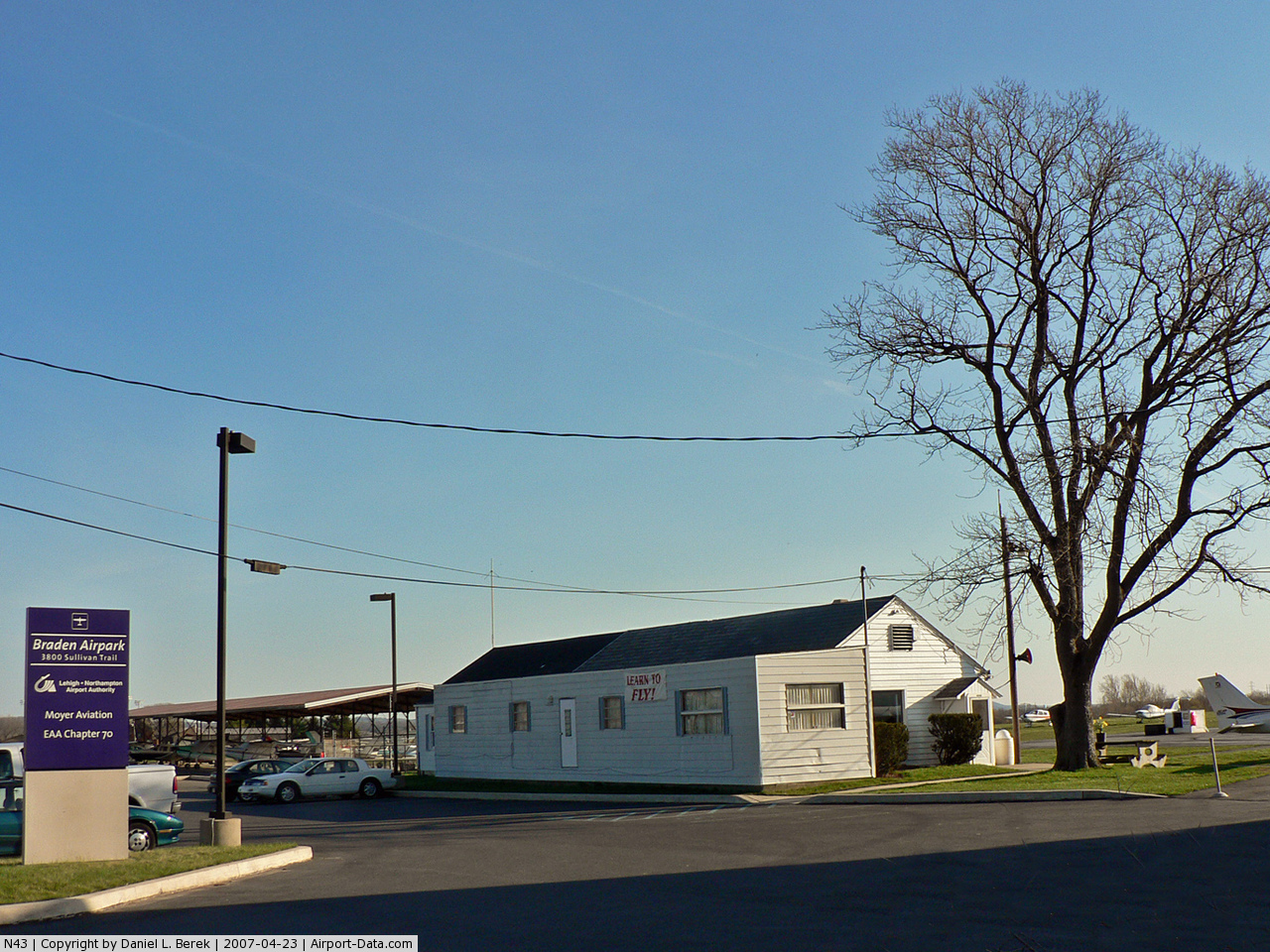
(Click on the photo to enlarge) |
Location & QuickFacts
| FAA Information Effective: | 2008-09-25 |
| Airport Identifier: | N43 |
| Airport Status: | Operational |
| Longitude/Latitude: | 075-14-34.6000W/40-44-31.8000N
-75.242944/40.742167 (Estimated) |
| Elevation: | 399 ft / 121.62 m (Surveyed) |
| Land: | 80 acres |
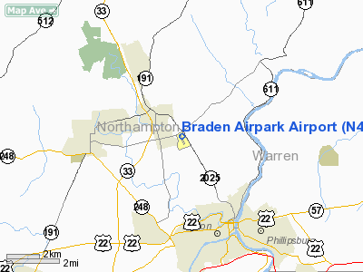
| From nearest city: | 3 nautical miles N of Easton, PA |
| Location: | Northampton County, PA |
| Magnetic Variation: | 13W (2000) |
Owner & Manager
| Ownership: | Publicly owned |
| Owner: | Lehigh-northampton Arpt Authority |
| Address: | Lehigh Valley Intl Arpt, 3311 Airport Road
Allentown, PA 18109-3040 |
| Phone number: | 610-266-6001 |
| Manager: | Verne Moyer |
| Address: | Braden Airpark, 3800 Sullivan Trail
Easton, PA 18040 |
| Phone number: | 610-258-0473 |
Airport Operations and Facilities
| Airport Use: | Open to public |
| Wind indicator: | Yes |
| Segmented Circle: | No |
| Control Tower: | No |
| Lighting Schedule: | DUSK-DAWN |
| Beacon Color: | Clear-Green (lighted land airport) |
| Landing fee charge: | No |
| Sectional chart: | New York |
| Region: | AEA - Eastern |
| Boundary ARTCC: | ZNY - New York |
| Tie-in FSS: | IPT - Williamsport |
| FSS on Airport: | No |
| FSS Toll Free: | 1-800-WX-BRIEF |
| NOTAMs Facility: | IPT (NOTAM-d service avaliable) |
Airport Communications
| CTAF: | 123.000 |
| Unicom: | 123.000 |
Airport Services
| Fuel available: | 100LL |
| Airframe Repair: | MAJOR |
| Power Plant Repair: | MAJOR |
| Bottled Oxygen: | NONE |
| Bulk Oxygen: | NONE |
Runway Information
Runway 18/36
| Dimension: | 1956 x 165 ft / 596.2 x 50.3 m
RY 18/36 1956 FT BY 50 FT ASPH ALIGNED IN CNTR OF 165 FT TURF STRIP. |
| Surface: | ASPH-TURF, Good Condition |
| Edge Lights: | Non-standard lighting system
RY 18/36 NSTD LIRL; NO RY END OR THLD LTS. |
| |
Runway 18 |
Runway 36 |
| Longitude: | 075-14-37.6716W | 075-14-31.5138W |
| Latitude: | 40-44-41.1427N | 40-44-22.3899N |
| Elevation: | 395.00 ft | 384.00 ft |
| Alignment: | 127 | 127 |
| Traffic Pattern: | Left | Left |
| Markings: | Basic, Good Condition | Basic, Good Condition |
| Displaced threshold: | 192.00 ft | 0.00 ft |
| Obstruction: | 8 ft bldg, 180.0 ft from runway, 95 ft left of centerline, 21:1 slope to clear
APCH RATIO 48:1 TO DSPLCD THLD.
BRUSH 8 FT FM RY END & ACROSS APCH, 8 FT HIGH. | 7 ft fence, 33.0 ft from runway, 47 ft right of centerline, 4:1 slope to clear
TREE 145 FT FM RY END & 72 FT RIGHT, 8 FT HIGH. |
|
Radio Navigation Aids
| ID |
Type |
Name |
Ch |
Freq |
Var |
Dist |
| EWR | FAN MARKER | Maryann | | | 11W | 48.1 nm |
| UKT | NDB | Quakertown | | 208.00 | 12W | 19.2 nm |
| LQX | NDB | Carbon | | 339.00 | 12W | 23.9 nm |
| DYL | NDB | Doylestown | | 237.00 | 10W | 25.0 nm |
| NXX | NDB | Willow Grove | | 388.00 | 12W | 33.5 nm |
| CAT | NDB | Chatham | | 254.00 | 11W | 37.0 nm |
| ING | NDB | Ambler | | 275.00 | 11W | 37.1 nm |
| HXM | NDB | Humbolt | | 366.00 | 10W | 37.3 nm |
| CYE | NDB | Crystal Lake | | 410.00 | 11W | 38.8 nm |
| NXX | TACAN | Willow Grove | 061X | | 10W | 33.2 nm |
| PNE | VOR | North Philadelphia | | 112.00 | 10W | 41.1 nm |
| HZL | VOR | Hazleton | | 109.40 | 09W | 42.5 nm |
| BWZ | VOR/DME | Broadway | 089X | 114.20 | 11W | 19.5 nm |
| CKZ | VOR/DME | Pennridge | 025Y | 108.85 | 12W | 21.2 nm |
| ETX | VOR/DME | East Texas | 039X | 110.20 | 09W | 22.3 nm |
| STW | VOR/DME | Stillwater | 033X | 109.60 | 11W | 22.8 nm |
| SBJ | VOR/DME | Solberg | 076X | 112.90 | 10W | 24.8 nm |
| ARD | VOR/DME | Yardley | 019X | 108.20 | 10W | 33.1 nm |
| HUO | VOR/DME | Huguenot | 108X | 116.10 | 11W | 49.8 nm |
| FJC | VORTAC | Allentown | 122X | 117.50 | 10W | 9.7 nm |
| PTW | VORTAC | Pottstown | 112X | 116.50 | 09W | 34.5 nm |
| SAX | VORTAC | Sparta | 104X | 115.70 | 11W | 37.5 nm |
| LVZ | VORTAC | Wilkes-barre | 053X | 111.60 | 10W | 37.8 nm |
| LHY | VORTAC | Lake Henry | 045X | 110.80 | 10W | 45.4 nm |
| RBV | VORTAC | Robbinsville | 085X | 113.80 | 10W | 47.1 nm |
Remarks
- ACFT MAY NOT BE VISIBLE ON ALL PARTS OF FIELD.
- EST PRIOR TO 1959.
Images and information placed above are from
http://www.airport-data.com/airport/N43/
We thank them for the data!
| General Info
|
| Country |
United States
|
| State |
PENNSYLVANIA
|
| FAA ID |
N43
|
| Latitude |
40-44-31.390N
|
| Longitude |
075-14-35.950W
|
| Elevation |
399 feet
|
| Near City |
EASTON
|
We don't guarantee the information is fresh and accurate. The data may
be wrong or outdated.
For more up-to-date information please refer to other sources.
|
|