 |
|
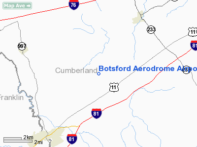
Botsford Aerodrome Airport |
Location & QuickFacts
| FAA Information Effective: | 2008-09-25 |
| Airport Identifier: | 6PA5 |
| Airport Status: | Operational |
| Longitude/Latitude: | 077-27-14.9480W/40-06-48.3190N
-77.454152/40.113422 (Estimated) |
| Elevation: | 615 ft / 187.45 m (Estimated) |
| Land: | 6 acres |
| From nearest city: | 5 nautical miles NE of Shippensburg, PA |
| Location: | Cumberland County, PA |
| Magnetic Variation: | 10W (1990) |
Owner & Manager
| Ownership: | Privately owned |
| Owner: | Thomas Trez |
| Address: | 797 Newville Rd.
Shippensburg, PA 17257-9510 |
| Phone number: | 717-776-3679 |
| Manager: | Thomas Trez |
| Address: | 797 Newville Rd.
Shippensburg, PA 17257-9510 |
| Phone number: | 717-776-3679 |
Airport Operations and Facilities
| Airport Use: | Private
PERSONAL USE. |
| Wind indicator: | Yes |
| Segmented Circle: | No |
| Control Tower: | No |
| Sectional chart: | Detroit |
| Region: | AEA - Eastern |
| Boundary ARTCC: | ZNY - New York |
| Tie-in FSS: | IPT - Williamsport |
| FSS on Airport: | No |
| FSS Toll Free: | 1-800-WX-BRIEF |
Runway Information
Runway 04/22
| Dimension: | 2400 x 30 ft / 731.5 x 9.1 m |
| Surface: | ASPH, |
| |
Runway 04 |
Runway 22 |
| Traffic Pattern: | Left | Left |
| Displaced threshold: | 200.00 ft | 200.00 ft |
|
Radio Navigation Aids
| ID |
Type |
Name |
Ch |
Freq |
Var |
Dist |
| EUD | NDB | York | | 254.00 | 11W | 29.0 nm |
| RV | NDB | Stroh | | 407.00 | 10W | 32.5 nm |
| BZJ | NDB | Bellgrove | | 328.00 | 10W | 45.6 nm |
| HGR | VOR | Hagerstown | | 109.80 | 07W | 31.1 nm |
| AOO | VOR | Altoona | | 108.80 | 07W | 41.0 nm |
| FDK | VOR | Frederick | | 109.00 | 08W | 42.3 nm |
| HAR | VORTAC | Harrisburg | 072X | 112.50 | 10W | 21.0 nm |
| THS | VORTAC | St Thomas | 097X | 115.00 | 07W | 25.3 nm |
| EMI | VORTAC | Westminster | 126X | 117.90 | 08W | 43.2 nm |
| RAV | VORTAC | Ravine | 093X | 114.60 | 11W | 47.3 nm |
| MRB | VORTAC | Martinsburg | 058X | 112.10 | 07W | 47.4 nm |
| SEG | VORTAC | Selinsgrove | 041X | 110.40 | 08W | 48.4 nm |
| MDT | VOT | Harrisburg International | | 110.00 | | 32.1 nm |
Remarks
- PRVDD ARPT USED FOR DALGT VFR OPNS ONLY; TREES AT BOTH ENDS OF RY REMOVED OR LOWERED; IF TREES ARE NOT REMOVED OR LOWERED THEN THRS SHALL BE DSPLCD TO ENSURE A 20:1 OBSTACLE CLNC PLANE; MKRS SHOULD BE PLACED TO IDENTIFY DSPLCD THRS, MKRS SHOULD BE DISCERNABLE FM BOTH THE AIR & GROUND.
Images and information placed above are from
http://www.airport-data.com/airport/6PA5/
We thank them for the data!
| General Info
|
| Country |
United States
|
| State |
PENNSYLVANIA
|
| FAA ID |
6PA5
|
| Latitude |
40-06-48.319N
|
| Longitude |
077-27-14.948W
|
| Elevation |
615 feet
|
| Near City |
SHIPPENSBURG
|
We don't guarantee the information is fresh and accurate. The data may
be wrong or outdated.
For more up-to-date information please refer to other sources.
|
|


