 |
|
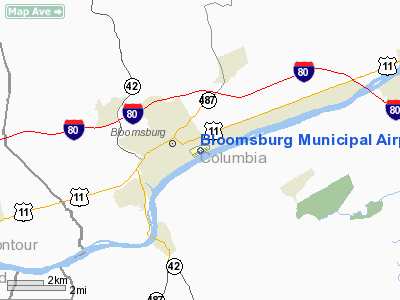
| Bloomsburg Municipal Airport |
| IATA: none – ICAO: none – FAA LID: N13 |
| Summary |
| Airport type |
Public |
| Owner |
Town Of Bloomsburg |
| Location |
Bloomsburg, Pennsylvania |
| Elevation AMSL |
481 ft / 147 m |
| Coordinates |
40°59′52″N 76°26′10″W / 40.9977°N 76.4360°W / 40.9977; -76.4360Coordinates: 40°59′52″N 76°26′10″W / 40.9977°N 76.4360°W / 40.9977; -76.4360 |
| Runways |
| Direction |
Length |
Surface |
| ft |
m |
| 08/26 |
2,800 |
853 |
Asphalt |
Bloomsburg Municipal Airport (FAA LID: N13) is a public non-towered general aviation airport along the Susquehanna River within town limits on the south east corner of Bloomsburg. Services
- Columbia Aircraft Services, Inc.
Fuel
Clubs
Training
The above content comes from Wikipedia and is published under free licenses – click here to read more.
Location & QuickFacts
| FAA Information Effective: | 2008-09-25 |
| Airport Identifier: | N13 |
| Airport Status: | Operational |
| Longitude/Latitude: | 076-26-09.8010W/40-59-52.0120N
-76.436056/40.997781 (Estimated) |
| Elevation: | 481 ft / 146.61 m (Surveyed) |
| Land: | 69 acres |
| From nearest city: | 0 nautical miles E of Bloomsburg, PA |
| Location: | Columbia County, PA |
| Magnetic Variation: | 09W (1965) |
Owner & Manager
| Ownership: | Publicly owned |
| Owner: | Town Of Bloomsburg |
| Address: | Bloomsburg Town Hall
Bloomsburg, PA 17815-9588 |
| Phone number: | 570-784-7703
FOR TOLL FREE CALL TO ARPT ONLY IN PENNSYLVANIA CALL 800-222-1522. |
| Manager: | Scott Smith |
| Address: | 301 Airport Road, 301 East Second Street
Bloomsburg, PA 17815-9588 |
| Phone number: | 570-784-3070
OR 570-683-5604 |
Airport Operations and Facilities
| Airport Use: | Open to public |
| Wind indicator: | Yes |
| Segmented Circle: | No |
| Control Tower: | No |
| Lighting Schedule: | DUSK-DAWN |
| Beacon Color: | Clear-Green (lighted land airport) |
| Landing fee charge: | No
OVERNIGHT FEE. |
| Sectional chart: | New York |
| Region: | AEA - Eastern |
| Traffic Pattern Alt: | 1100 ft |
| Boundary ARTCC: | ZNY - New York |
| Tie-in FSS: | IPT - Williamsport |
| FSS on Airport: | No |
| FSS Toll Free: | 1-800-WX-BRIEF |
| NOTAMs Facility: | IPT (NOTAM-d service avaliable) |
| Federal Agreements: | NGY |
Airport Communications
| CTAF: | 122.800 |
| Unicom: | 122.800 |
Airport Services
| Fuel available: | 100LL |
| Airframe Repair: | MAJOR |
| Power Plant Repair: | MAJOR |
| Bottled Oxygen: | NONE |
| Bulk Oxygen: | NONE |
Runway Information
Runway 08/26
| Dimension: | 2800 x 50 ft / 853.4 x 15.2 m |
| Surface: | ASPH, Good Condition |
| Weight Limit: | Single wheel: 12500 lbs. |
| Edge Lights: | Low |
| |
Runway 08 |
Runway 26 |
| Longitude: | 076-26-27.1950W | 076-25-52.3340W |
| Latitude: | 40-59-47.9190N | 40-59-56.1220N |
| Elevation: | 481.00 ft | 477.00 ft |
| Alignment: | 73 | 127 |
| Traffic Pattern: | Left | Left |
| Markings: | Basic, Good Condition | Basic, Good Condition |
| Obstruction: | 17 ft road, 389.0 ft from runway, 18 ft right of centerline, 11:1 slope to clear | 92 ft trees, 1541.0 ft from runway, 241 ft left of centerline, 14:1 slope to clear |
|
Radio Navigation Aids
| ID |
Type |
Name |
Ch |
Freq |
Var |
Dist |
| HXM | NDB | Humbolt | | 366.00 | 10W | 19.9 nm |
| PIX | NDB | Picture Rocks | | 344.00 | 09W | 20.9 nm |
| CYE | NDB | Crystal Lake | | 410.00 | 11W | 30.2 nm |
| LQX | NDB | Carbon | | 339.00 | 12W | 32.7 nm |
| BZJ | NDB | Bellgrove | | 328.00 | 10W | 34.2 nm |
| HZL | VOR | Hazleton | | 109.40 | 09W | 14.1 nm |
| FQM | VOR/DME | Williamsport | 091X | 114.40 | 09W | 25.6 nm |
| ETX | VOR/DME | East Texas | 039X | 110.20 | 09W | 42.4 nm |
| MIP | VORTAC | Milton | 029X | 109.20 | 09W | 10.5 nm |
| SEG | VORTAC | Selinsgrove | 041X | 110.40 | 08W | 23.9 nm |
| RAV | VORTAC | Ravine | 093X | 114.60 | 11W | 27.7 nm |
| LVZ | VORTAC | Wilkes-barre | 053X | 111.60 | 10W | 37.6 nm |
| FJC | VORTAC | Allentown | 122X | 117.50 | 10W | 47.5 nm |
Remarks
- FACTORY PARKING LOT IN PRIMARY SFC 08/26.
- SPB ASP: EXISTED PRIOR TO 1959.
Images and information placed above are from
http://www.airport-data.com/airport/N13/
We thank them for the data!
| General Info
|
| Country |
United States
|
| State |
PENNSYLVANIA
|
| FAA ID |
N13
|
| Latitude |
40-59-52.012N
|
| Longitude |
076-26-09.801W
|
| Elevation |
481 feet
|
| Near City |
BLOOMSBURG
|
We don't guarantee the information is fresh and accurate. The data may
be wrong or outdated.
For more up-to-date information please refer to other sources.
|
|


