 |
|
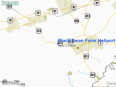
Location & QuickFacts
| FAA Information Effective: | 2008-09-25 |
| Airport Identifier: | 5PA4 |
| Airport Status: | Operational |
| Longitude/Latitude: | 075-38-58.7700W/39-58-00.3890N
-75.649658/39.966775 (Estimated) |
| Elevation: | 273 ft / 83.21 m (Estimated) |
| Land: | 62 acres |
| From nearest city: | 2 nautical miles NW of West Chester, PA |
| Location: | Chester County, PA |
| Magnetic Variation: | 11W (1985) |
Owner & Manager
| Ownership: | Privately owned |
| Owner: | Steven B. Siepser |
| Address: | 866 Downingtown Pike
West Chester, PA 19380 |
| Phone number: | 215-296-3333 |
| Manager: | Steven B. Siepser |
| Address: | 866 Downingtown Pike
West Chester, PA 19380 |
| Phone number: | 215-296-3333 |
Airport Operations and Facilities
| Airport Use: | Private |
| Wind indicator: | Yes |
| Segmented Circle: | Yes |
| Control Tower: | No |
| Sectional chart: | Washington |
| Region: | AEA - Eastern |
| Boundary ARTCC: | ZNY - New York |
| Tie-in FSS: | IPT - Williamsport |
| FSS on Airport: | No |
| FSS Toll Free: | 1-800-WX-BRIEF |
Runway Information
Helipad H1
| Dimension: | 60 x 60 ft / 18.3 x 18.3 m |
| Surface: | TURF, |
| |
Runway H1 |
Runway |
| Traffic Pattern: | Left | Left |
|
Radio Navigation Aids
| ID |
Type |
Name |
Ch |
Freq |
Var |
Dist |
| ING | NDB | Ambler | | 275.00 | 11W | 19.3 nm |
| NXX | NDB | Willow Grove | | 388.00 | 12W | 26.8 nm |
| UKT | NDB | Quakertown | | 208.00 | 12W | 31.9 nm |
| DYL | NDB | Doylestown | | 237.00 | 10W | 32.8 nm |
| APG | NDB | Aberdeen | | 349.00 | 11W | 33.4 nm |
| RNB | NDB | Rainbow | | 363.00 | 11W | 40.7 nm |
| NXX | TACAN | Willow Grove | 061X | | 10W | 26.9 nm |
| PNE | VOR | North Philadelphia | | 112.00 | 10W | 30.3 nm |
| CKZ | VOR/DME | Pennridge | 025Y | 108.85 | 12W | 30.4 nm |
| ETX | VOR/DME | East Texas | 039X | 110.20 | 09W | 37.0 nm |
| ARD | VOR/DME | Yardley | 019X | 108.20 | 10W | 38.2 nm |
| PPM | VOR/DME | Phillips | 021X | 108.40 | 09W | 38.5 nm |
| MXE | VORTAC | Modena | 079X | 113.20 | 09W | 3.1 nm |
| PTW | VORTAC | Pottstown | 112X | 116.50 | 09W | 15.9 nm |
| DQO | VORTAC | Dupont | 087X | 114.00 | 10W | 17.5 nm |
| OOD | VORTAC | Woodstown | 075X | 112.80 | 10W | 25.5 nm |
| LRP | VORTAC | Lancaster | 120X | 117.30 | 09W | 30.9 nm |
| VCN | VORTAC | Cedar Lake | 099X | 115.20 | 10W | 40.7 nm |
| ENO | VORTAC | Smyrna | 051X | 111.40 | 09W | 44.6 nm |
| FJC | VORTAC | Allentown | 122X | 117.50 | 10W | 46.5 nm |
| GXU | VORTAC | Mc Guire | 043X | 110.60 | 11W | 48.6 nm |
| PHL | VOT | Philadelphia Intl | | 109.80 | | 19.5 nm |
Remarks
- (E111-1) WIND SOCK (CONE) SHOULD BE INSTALLED; IF NIGHT OPNS ARE CONDUCTED, ALL MARKING & LIGHTING SHOULD BE ACCOMPLISHED; INGRESS IS FM E, EGRESS IS TO THE W; CTC PHILADELPHIA TCA FOR BRIEFING; LARGEST CLASS OF ACFT IS THE SK-76.
- PRVDD SIGNS ARE POSTED ATHELIPORT TO ALERT PEOPLE UNFAMILIAR WITH HELIPORT OPNS TAKING PLACE; REMOVE EVERGREEN TREE APRXLY 60 FT NW, TREE APRXLY 41 FT NW, SMALL TREE APRXLY 38 FT S OF LNDG AREA BECAUSE OF BEING CONSIDERED OBSTNS.
Images and information placed above are from
http://www.airport-data.com/airport/5PA4/
We thank them for the data!
| General Info
|
| Country |
United States
|
| State |
PENNSYLVANIA
|
| FAA ID |
5PA4
|
| Latitude |
39-58-00.389N
|
| Longitude |
075-38-58.770W
|
| Elevation |
273 feet
|
| Near City |
WEST CHESTER
|
We don't guarantee the information is fresh and accurate. The data may
be wrong or outdated.
For more up-to-date information please refer to other sources.
|
|


