 |
|
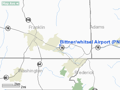
Location & QuickFacts
| FAA Information Effective: | 2008-09-25 |
| Airport Identifier: | PN58 |
| Airport Status: | Operational |
| Longitude/Latitude: | 077-31-36.6000W/39-44-33.6000N
-77.526833/39.742667 (Estimated) |
| Elevation: | 760 ft / 231.65 m () |
| Land: | 0 acres |
| From nearest city: | 1 nautical miles SE of Waynesboro, PA |
| Location: | Franklin County, PA |
| Magnetic Variation: | 11W (2000) |
Owner & Manager
| Ownership: | Privately owned |
| Owner: | Anthony Bittner |
| Address: | 11689 Buchanan Trail East
Waynesboro, PA 17268 |
| Phone number: | 717-762-7940 |
| Manager: | Anthony Bittner |
| Address: | 11689 Buchanan Trail East
Waynesboro, PA 17268 |
| Phone number: | 717-762-7940 |
Airport Operations and Facilities
| Airport Use: | Private |
| Segmented Circle: | No |
| Control Tower: | No |
| Sectional chart: | Washington |
| Region: | AEA - Eastern |
| Boundary ARTCC: | ZDC - Washington |
| Tie-in FSS: | IPT - Williamsport |
| FSS Toll Free: | 1-800-WX-BRIEF |
Runway Information
Runway 03/21
| Dimension: | 1400 x 100 ft / 426.7 x 30.5 m |
| Surface: | TURF, |
| |
Runway 03 |
Runway 21 |
| Traffic Pattern: | Left | Right |
| Obstruction: | 30 ft fence, 400.0 ft from runway | 5 ft fence, 200.0 ft from runway |
|
Radio Navigation Aids
| ID |
Type |
Name |
Ch |
Freq |
Var |
Dist |
| EUD | NDB | York | | 254.00 | 11W | 31.8 nm |
| GAI | NDB | Gaithersburg | | 385.00 | 09W | 38.3 nm |
| FND | NDB | Ellicott | | 371.00 | 11W | 44.2 nm |
| TZ | NDB | Cogan | | 364.00 | 10W | 46.8 nm |
| GDX | NDB | Goodwin Lake | | 227.00 | 08W | 49.5 nm |
| IUB | NDB | Institute | | 404.00 | 08W | 50.0 nm |
| HGR | VOR | Hagerstown | | 109.80 | 07W | 15.4 nm |
| FDK | VOR | Frederick | | 109.00 | 08W | 21.1 nm |
| THS | VORTAC | St Thomas | 097X | 115.00 | 07W | 22.7 nm |
| MRB | VORTAC | Martinsburg | 058X | 112.10 | 07W | 26.1 nm |
| EMI | VORTAC | Westminster | 126X | 117.90 | 08W | 29.4 nm |
| HAR | VORTAC | Harrisburg | 072X | 112.50 | 10W | 39.7 nm |
| AML | VORTAC | Armel | 082X | 113.50 | 08W | 48.7 nm |
| MDT | VOT | Harrisburg International | | 110.00 | | 44.6 nm |
Remarks
- PRVDD VFR ONLY, CLEAR 20; APCH PATH, CONSIDERATION BE GIVEN TO TREES WHEN LDG TO THE NE.
Images and information placed above are from
http://www.airport-data.com/airport/PN58/
We thank them for the data!
| General Info
|
| Country |
United States
|
| State |
PENNSYLVANIA
|
| FAA ID |
PN58
|
| Latitude |
39-44-33.600N
|
| Longitude |
077-31-36.600W
|
| Elevation |
760 feet
|
| Near City |
WAYNESBORO
|
We don't guarantee the information is fresh and accurate. The data may
be wrong or outdated.
For more up-to-date information please refer to other sources.
|
|


