 |
|
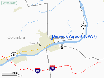
Location & QuickFacts
| FAA Information Effective: | 2008-09-25 |
| Airport Identifier: | 6PA7 |
| Airport Status: | Closed Indefinitely |
| Longitude/Latitude: | 076-12-58.7600W/41-04-10.3040N
-76.216322/41.069529 (Estimated) |
| Elevation: | 610 ft / 185.93 m (Estimated) |
| Land: | 103 acres |
| From nearest city: | 2 nautical miles E of Berwick, PA |
| Location: | Luzerne County, PA |
| Magnetic Variation: | 11W (1985) |
Owner & Manager
| Ownership: | Privately owned |
| Owner: | Joseph H. Bower |
| Address: | Rd 1,
Berwick,, PA 18603 |
| Address: |
|
Airport Operations and Facilities
| Airport Use: | Private |
| Segmented Circle: | No |
| Control Tower: | No |
| Landing fee charge: | No |
| Sectional chart: | New York |
| Region: | AEA - Eastern |
| Boundary ARTCC: | ZNY - New York |
| Tie-in FSS: | IPT - Williamsport |
| FSS on Airport: | No |
| FSS Toll Free: | 1-800-WX-BRIEF |
Airport Services
| Airframe Repair: | NONE |
| Power Plant Repair: | NONE |
| Bottled Oxygen: | NONE |
| Bulk Oxygen: | NONE |
Runway Information
Runway 09/27
| Dimension: | 2144 x 185 ft / 653.5 x 56.4 m |
| Surface: | TURF, |
| |
Runway 09 |
Runway 27 |
| Traffic Pattern: | Left | Left |
| Markings: | None, | None, |
| Displaced threshold: | 0.00 ft | 250.00 ft |
| Runway End Identifier: | No | No |
| Centerline Lights: | No | No |
| Touchdown Lights: | No | No |
|
Radio Navigation Aids
| ID |
Type |
Name |
Ch |
Freq |
Var |
Dist |
| HXM | NDB | Humbolt | | 366.00 | 10W | 11.1 nm |
| CYE | NDB | Crystal Lake | | 410.00 | 11W | 19.4 nm |
| PIX | NDB | Picture Rocks | | 344.00 | 09W | 25.6 nm |
| LQX | NDB | Carbon | | 339.00 | 12W | 25.9 nm |
| BZJ | NDB | Bellgrove | | 328.00 | 10W | 41.1 nm |
| HZL | VOR | Hazleton | | 109.40 | 09W | 7.0 nm |
| FQM | VOR/DME | Williamsport | 091X | 114.40 | 09W | 30.0 nm |
| ETX | VOR/DME | East Texas | 039X | 110.20 | 09W | 38.1 nm |
| MIP | VORTAC | Milton | 029X | 109.20 | 09W | 20.5 nm |
| LVZ | VORTAC | Wilkes-barre | 053X | 111.60 | 10W | 26.8 nm |
| SEG | VORTAC | Selinsgrove | 041X | 110.40 | 08W | 34.6 nm |
| RAV | VORTAC | Ravine | 093X | 114.60 | 11W | 35.6 nm |
| FJC | VORTAC | Allentown | 122X | 117.50 | 10W | 40.3 nm |
| LHY | VORTAC | Lake Henry | 045X | 110.80 | 10W | 41.2 nm |
Remarks
- (ARPT STATUS) ARPT CLSD INDEFLY.
Images and information placed above are from
http://www.airport-data.com/airport/6PA7/
We thank them for the data!
| General Info
|
| Country |
United States
|
| State |
PENNSYLVANIA
|
| FAA ID |
6PA7
|
| Latitude |
41-04-10.304N
|
| Longitude |
076-12-58.760W
|
| Elevation |
610 feet
|
| Near City |
BERWICK
|
We don't guarantee the information is fresh and accurate. The data may
be wrong or outdated.
For more up-to-date information please refer to other sources.
|
|


