 |
|
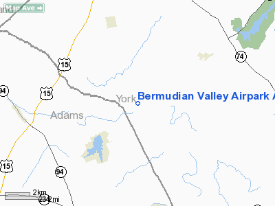
Bermudian Valley Airpark Airport |
Location & QuickFacts
| FAA Information Effective: | 2008-09-25 |
| Airport Identifier: | 07N |
| Airport Status: | Operational |
| Longitude/Latitude: | 077-00-13.9200W/40-01-00.3420N
-77.003867/40.016762 (Estimated) |
| Elevation: | 470 ft / 143.26 m (Surveyed) |
| Land: | 24 acres |
| From nearest city: | 2 nautical miles W of Kralltown, PA |
| Location: | York County, PA |
| Magnetic Variation: | 10W (1985) |
Owner & Manager
| Ownership: | Privately owned |
| Owner: | Good Air, Inc. |
| Address: | 23 Milford Green Rd
East Berlin, PA 17316 |
| Phone number: | 717-292-0188 |
| Manager: | Robert J. Donato |
| Address: | 23 Milford Green Rd
East Berlin, PA 17316 |
| Phone number: | 717-292-0188
PHONE IN OPERATION 717-292-9905. |
Airport Operations and Facilities
| Airport Use: | Open to public |
| Wind indicator: | Yes |
| Segmented Circle: | Yes |
| Control Tower: | No |
| Landing fee charge: | No |
| Sectional chart: | Detroit |
| Region: | AEA - Eastern |
| Boundary ARTCC: | ZNY - New York |
| Tie-in FSS: | IPT - Williamsport |
| FSS on Airport: | No |
| FSS Toll Free: | 1-800-WX-BRIEF |
| NOTAMs Facility: | IPT (NOTAM-d service avaliable) |
Airport Communications
| CTAF: | 122.800 |
| Unicom: | 122.800 |
Airport Services
| Airframe Repair: | MAJOR |
| Power Plant Repair: | MAJOR |
Runway Information
Runway 16/34
| Dimension: | 2200 x 100 ft / 670.6 x 30.5 m |
| Surface: | TURF, Fair Condition |
| |
Runway 16 |
Runway 34 |
| Traffic Pattern: | Left | Left |
| Displaced threshold: | 370.00 ft
RWY 16 & 34 DSPLCD THLDS MARKED WITH ORANGE CONES EACH SIDE OF RY AND 2 WHITE TIRES EAST SIDE OF RY. | 100.00 ft |
| Obstruction: | 62 ft trees, 797.0 ft from runway, 32 ft right of centerline, 12:1 slope to clear
APCH SLOPE 18:1 TO DSPLCD THLD. | 88 ft trees, 1678.0 ft from runway, 72 ft right of centerline, 19:1 slope to clear
RY 34 APCH SLOPE 20:1 TO DSPLCD THLD. |
|
Radio Navigation Aids
| ID |
Type |
Name |
Ch |
Freq |
Var |
Dist |
| EUD | NDB | York | | 254.00 | 11W | 8.2 nm |
| BZJ | NDB | Bellgrove | | 328.00 | 10W | 32.6 nm |
| FND | NDB | Ellicott | | 371.00 | 11W | 45.1 nm |
| IUB | NDB | Institute | | 404.00 | 08W | 47.2 nm |
| RV | NDB | Stroh | | 407.00 | 10W | 48.6 nm |
| MTN | TACAN | Martin | 068X | | 11W | 49.5 nm |
| FDK | VOR | Frederick | | 109.00 | 08W | 40.2 nm |
| HGR | VOR | Hagerstown | | 109.80 | 07W | 43.7 nm |
| HAR | VORTAC | Harrisburg | 072X | 112.50 | 10W | 17.4 nm |
| EMI | VORTAC | Westminster | 126X | 117.90 | 08W | 31.4 nm |
| LRP | VORTAC | Lancaster | 120X | 117.30 | 09W | 33.4 nm |
| RAV | VORTAC | Ravine | 093X | 114.60 | 11W | 37.2 nm |
| THS | VORTAC | St Thomas | 097X | 115.00 | 07W | 43.9 nm |
| SEG | VORTAC | Selinsgrove | 041X | 110.40 | 08W | 46.9 nm |
| MDT | VOT | Harrisburg International | | 110.00 | | 15.5 nm |
Remarks
- ULTRALIGHT & GLIDER ACTIVITY ON & INVOF ARPT.
- FIELD SOFT AFTER PROLONGED RAIN.
Images and information placed above are from
http://www.airport-data.com/airport/07N/
We thank them for the data!
| General Info
|
| Country |
United States
|
| State |
PENNSYLVANIA
|
| FAA ID |
07N
|
| Latitude |
40-01-00.342N
|
| Longitude |
077-00-13.920W
|
| Elevation |
470 feet
|
| Near City |
KRALLTOWN
|
We don't guarantee the information is fresh and accurate. The data may
be wrong or outdated.
For more up-to-date information please refer to other sources.
|
|


