 |
|
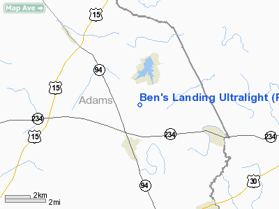
Ben's Landing Ultralight Airport |
Location & QuickFacts
| FAA Information Effective: | 2008-09-25 |
| Airport Identifier: | PA89 |
| Airport Status: | Operational |
| Longitude/Latitude: | 077-02-58.9260W/39-57-32.3440N
-77.049702/39.958984 (Estimated) |
| Elevation: | 550 ft / 167.64 m (Estimated) |
| Land: | 6 acres |
| From nearest city: | 2 nautical miles S of East Berlin, PA |
| Location: | Adams County, PA |
| Magnetic Variation: | 11W (1995) |
Owner & Manager
| Ownership: | Privately owned |
| Owner: | Bennett L. Lens |
| Address: | 614 Hoover School Rd
East Berlin, PA 17316 |
| Phone number: | 717-259-0330 |
| Manager: | Bennett L. Lens |
| Address: | 614 Hoover School Rd
East Berlin, PA 17316 |
| Phone number: | 717-259-0330 |
Airport Operations and Facilities
| Airport Use: | Private |
| Wind indicator: | Yes |
| Segmented Circle: | No |
| Control Tower: | No |
| Sectional chart: | Washington |
| Region: | AEA - Eastern |
| Boundary ARTCC: | ZNY - New York |
| Tie-in FSS: | IPT - Williamsport |
| FSS Toll Free: | 1-800-WX-BRIEF |
Airport Communications
Runway Information
Runway 15/33
| Dimension: | 1095 x 100 ft / 333.8 x 30.5 m |
| Surface: | TURF, |
| |
Runway 15 |
Runway 33 |
| Traffic Pattern: | Left | Left |
| Displaced threshold: | 532.00 ft | 0.00 ft |
| Obstruction: | 50 ft trees, 300.0 ft from runway | |
|
Radio Navigation Aids
| ID |
Type |
Name |
Ch |
Freq |
Var |
Dist |
| EUD | NDB | York | | 254.00 | 11W | 8.3 nm |
| BZJ | NDB | Bellgrove | | 328.00 | 10W | 36.6 nm |
| FND | NDB | Ellicott | | 371.00 | 11W | 42.3 nm |
| IUB | NDB | Institute | | 404.00 | 08W | 44.9 nm |
| GAI | NDB | Gaithersburg | | 385.00 | 09W | 47.7 nm |
| RV | NDB | Stroh | | 407.00 | 10W | 49.9 nm |
| MTN | TACAN | Martin | 068X | | 11W | 47.9 nm |
| FDK | VOR | Frederick | | 109.00 | 08W | 36.1 nm |
| HGR | VOR | Hagerstown | | 109.80 | 07W | 40.4 nm |
| HAR | VORTAC | Harrisburg | 072X | 112.50 | 10W | 20.7 nm |
| EMI | VORTAC | Westminster | 126X | 117.90 | 08W | 28.1 nm |
| LRP | VORTAC | Lancaster | 120X | 117.30 | 09W | 36.2 nm |
| RAV | VORTAC | Ravine | 093X | 114.60 | 11W | 41.3 nm |
| THS | VORTAC | St Thomas | 097X | 115.00 | 07W | 41.6 nm |
| MDT | VOT | Harrisburg International | | 110.00 | | 19.5 nm |
Remarks
- PRVDD DALGT OPNS ONLY; ACTIVITY AT FACILITY LIMITED TO ULTRALGTS ONLY; IFR OPNS NOT OCNDUCTED; & CLEAR 20:1 APCH.
Images and information placed above are from
http://www.airport-data.com/airport/PA89/
We thank them for the data!
| General Info
|
| Country |
United States
|
| State |
PENNSYLVANIA
|
| FAA ID |
PA89
|
| Latitude |
39-57-32.344N
|
| Longitude |
077-02-58.926W
|
| Elevation |
550 feet
|
| Near City |
EAST BERLIN
|
We don't guarantee the information is fresh and accurate. The data may
be wrong or outdated.
For more up-to-date information please refer to other sources.
|
|


