 |
|
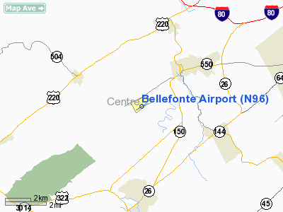
Location & QuickFacts
| FAA Information Effective: | 2008-09-25 |
| Airport Identifier: | N96 |
| Airport Status: | Operational |
| Longitude/Latitude: | 077-48-58.7000W/40-53-07.7000N
-77.816306/40.885472 (Estimated) |
| Elevation: | 1071 ft / 326.44 m (Surveyed) |
| Land: | 42 acres |
| From nearest city: | 3 nautical miles SW of Bellefonte, PA |
| Location: | Centre County, PA |
| Magnetic Variation: | 10W (1990) |
Owner & Manager
| Ownership: | Privately owned |
| Owner: | John & Marina Elnitski |
| Address: | 225 Snowbird La
Bellefonte, PA 16823 |
| Phone number: | 814-355-7407 |
| Manager: | John Elnitski |
| Address: | 225 Snowbird La
Bellefonte, PA 16823 |
| Phone number: | 814-355-7407 |
Airport Operations and Facilities
| Airport Use: | Open to public |
| Wind indicator: | Yes |
| Segmented Circle: | Yes |
| Control Tower: | No |
| Lighting Schedule: | RDO-CTL
ACTVT ROTG BCN & LIRL RY 07/25 - 122.7. |
| Beacon Color: | Clear-Green (lighted land airport) |
| Sectional chart: | Detroit |
| Region: | AEA - Eastern |
| Traffic Pattern Alt: | 1029 ft |
| Boundary ARTCC: | ZNY - New York |
| Tie-in FSS: | AOO - Altoona |
| FSS on Airport: | No |
| FSS Toll Free: | 1-800-WX-BRIEF |
| NOTAMs Facility: | AOO (NOTAM-d service avaliable) |
Airport Communications
| CTAF: | 122.800 |
| Unicom: | 122.800 |
Airport Services
| Fuel available: | 100LLA |
| Airframe Repair: | MAJOR |
| Power Plant Repair: | MAJOR |
| Bottled Oxygen: | NONE |
| Bulk Oxygen: | NONE |
Runway Information
Runway 07/25
| Dimension: | 3585 x 40 ft / 1092.7 x 12.2 m |
| Surface: | ASPH, Fair Condition |
| Edge Lights: | Non-standard lighting system
NSTD LIRL; EDGE LGTS MORE THAN 10 FT OUTWARD FROM PAVEMENT EDGE; STD THR LGTS. FIRST 30 FT ON RY END 25 NOT LGTD. |
| |
Runway 07 |
Runway 25 |
| Longitude: | 077-49-18.1277W | 077-48-39.2596W |
| Latitude: | 40-52-57.8891N | 40-53-17.4968N |
| Elevation: | 1069.00 ft | 1058.00 ft |
| Alignment: | 56 | 127 |
| Traffic Pattern: | Left | Right |
| Markings: | Basic, Fair Condition | Basic, Fair Condition |
| Crossing Height: | 0.00 ft | 40.00 ft |
| Displaced threshold: | 238.00 ft
RY 07 DSPLCD THLD UNLGTD. | 0.00 ft |
| VASI: | | 2-light PAPI on left side |
| Visual Glide Angle: | 0.00° | 3.50° |
| Obstruction: | 24 ft tree, 317.0 ft from runway, 134 ft right of centerline, 4:1 slope to clear
APCH SLOPE 23:1 TO DSPLCD THLD.
+3 FT BRUSH, 25 FT FM RY END, 30 FT L. | , 50:1 slope to clear |
|
Radio Navigation Aids
| ID |
Type |
Name |
Ch |
Freq |
Var |
Dist |
| RV | NDB | Stroh | | 407.00 | 10W | 16.9 nm |
| AOO | VOR | Altoona | | 108.80 | 07W | 40.3 nm |
| REC | VOR/DME | Revloc | 043X | 110.60 | 09W | 47.0 nm |
| PSB | VORTAC | Philipsburg | 102X | 115.50 | 10W | 8.2 nm |
| ETG | VORTAC | Keating | 107X | 116.00 | 10W | 24.7 nm |
| TON | VORTAC | Tyrone | 096X | 114.90 | 07W | 25.1 nm |
| SLT | VORTAC | Slate Run | 086X | 113.90 | 08W | 38.3 nm |
| SEG | VORTAC | Selinsgrove | 041X | 110.40 | 08W | 42.8 nm |
| HAR | VORTAC | Harrisburg | 072X | 112.50 | 10W | 48.9 nm |
Remarks
- ULTRALIGHTS ON & INVOF ARPT.
- RY 25 HAS 35 FT PAVED RY SAFETY AREA.
- EXTENSIVE STUDENT TRAININT ON ARPT.
- ALL HELICOPTERS REQUIRED TO USE FIXED WING TRAFFIC PATTERN.
- HEAVY GLIDER ACTIVITY DURG DALGT HRS, ALL ALTS WITHIN 10 NM AREA, ALL DIRECTIONS, ESPECIALLY ALONG RIDGE 1 NM WEST & NORTH OF ARPT.
Images and information placed above are from
http://www.airport-data.com/airport/N96/
We thank them for the data!
| General Info
|
| Country |
United States
|
| State |
PENNSYLVANIA
|
| FAA ID |
N96
|
| Latitude |
40-53-07.700N
|
| Longitude |
077-48-58.700W
|
| Elevation |
1071 feet
|
| Near City |
BELLEFONTE
|
We don't guarantee the information is fresh and accurate. The data may
be wrong or outdated.
For more up-to-date information please refer to other sources.
|
|


