 |
|
Location & QuickFacts
| FAA Information Effective: | 2008-09-25 |
| Airport Identifier: | PN73 |
| Airport Status: | Operational |
| Longitude/Latitude: | 077-55-13.9940W/40-13-48.2910N
-77.920554/40.230081 (Estimated) |
| Elevation: | 630 ft / 192.02 m (Estimated) |
| Land: | 0 acres |
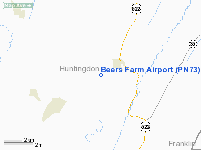
| From nearest city: | 1 nautical miles SW of Orbisona/rockhill, PA |
| Location: | Huntingdon County, PA |
| Magnetic Variation: | 09W (1985) |
Owner & Manager
| Ownership: | Privately owned |
| Owner: | Ward J. Beers |
| Address: | Rockhill Furnace
Rockhill, PA 17249 |
| Phone number: | 814-447-3577 |
| Address: |
|
Airport Operations and Facilities
| Airport Use: | Private |
| Wind indicator: | Yes |
| Segmented Circle: | No |
| Control Tower: | No |
| Landing fee charge: | No |
| Sectional chart: | Detroit |
| Region: | AEA - Eastern |
| Boundary ARTCC: | ZOB - Cleveland |
| Tie-in FSS: | AOO - Altoona |
| FSS on Airport: | No |
| FSS Toll Free: | 1-800-WX-BRIEF |
Airport Services
| Airframe Repair: | NONE |
| Power Plant Repair: | NONE |
Runway Information
Runway 08/26
| Dimension: | 2000 x 100 ft / 609.6 x 30.5 m
TOTAL FLD LENGTH IS 2600'THRESHOLD MARKINGS FOR THE 2000' LNDG AREA. |
| Surface: | TURF, |
| |
Runway 08 |
Runway 26 |
| Traffic Pattern: | Right | Right |
|
Radio Navigation Aids
| ID |
Type |
Name |
Ch |
Freq |
Var |
Dist |
| RV | NDB | Stroh | | 407.00 | 10W | 24.9 nm |
| SYS | NDB | Stoystown | | 209.00 | 08W | 46.6 nm |
| AOO | VOR | Altoona | | 108.80 | 07W | 18.5 nm |
| HGR | VOR | Hagerstown | | 109.80 | 07W | 32.1 nm |
| REC | VOR/DME | Revloc | 043X | 110.60 | 09W | 42.3 nm |
| THS | VORTAC | St Thomas | 097X | 115.00 | 07W | 17.9 nm |
| TON | VORTAC | Tyrone | 096X | 114.90 | 07W | 35.7 nm |
| HAR | VORTAC | Harrisburg | 072X | 112.50 | 10W | 39.3 nm |
| PSB | VORTAC | Philipsburg | 102X | 115.50 | 10W | 41.4 nm |
| JST | VORTAC | Johnstown | 077X | 113.00 | 06W | 42.2 nm |
Images and information placed above are from
http://www.airport-data.com/airport/PN73/
We thank them for the data!
| General Info
|
| Country |
United States
|
| State |
PENNSYLVANIA
|
| FAA ID |
PN73
|
| Latitude |
40-13-48.291N
|
| Longitude |
077-55-13.994W
|
| Elevation |
630 feet
|
| Near City |
ORBISONA/ROCKHILL
|
We don't guarantee the information is fresh and accurate. The data may
be wrong or outdated.
For more up-to-date information please refer to other sources.
|
|


