 |
|
Location & QuickFacts
| FAA Information Effective: | 2008-09-25 |
| Airport Identifier: | 0PS8 |
| Airport Status: | Operational |
| Longitude/Latitude: | 080-05-10.2130W/42-07-57.2070N
-80.086170/42.132557 (Estimated) |
| Elevation: | 1130 ft / 344.42 m (Estimated) |
| Land: | 0 acres |
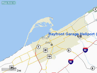
| From nearest city: | 0 nautical miles N of Erie, PA |
| Location: | Erie County, PA |
| Magnetic Variation: | 08W (1980) |
Owner & Manager
| Ownership: | Privately owned |
| Owner: | Hamot Medical Center |
| Address: | 201 State
Erie, PA 16550 |
| Phone number: | 814-870-6000 |
| Manager: | Michael J. Olenik |
| Address: | 201 State
Erie, PA 16550 |
| Phone number: | 814-870-6000 |
Airport Operations and Facilities
| Airport Use: | Private |
| Wind indicator: | Yes |
| Segmented Circle: | No |
| Control Tower: | No |
| Landing fee charge: | No |
| Sectional chart: | Detroit |
| Region: | AEA - Eastern |
| Boundary ARTCC: | ZOB - Cleveland |
| Tie-in FSS: | AOO - Altoona |
| FSS on Airport: | No |
| FSS Toll Free: | 1-800-WX-BRIEF |
Runway Information
Helipad H1
| Dimension: | 65 x 60 ft / 19.8 x 18.3 m |
| Surface: | CONC,
ROOFTOP. |
| |
Runway H1 |
Runway |
| Traffic Pattern: | Left | Left |
|
Radio Navigation Aids
| ID |
Type |
Name |
Ch |
Freq |
Var |
Dist |
| CQD | NDB | Cascade | | 372.00 | 08W | 1.1 nm |
| ORJ | NDB | Corry | | 258.00 | 09W | 23.6 nm |
| FKL | VOR | Franklin | | 109.60 | 06W | 43.0 nm |
| JFN | VOR/DME | Jefferson | 099X | 115.20 | 05W | 37.1 nm |
| JHW | VOR/DME | Jamestown | 094X | 114.70 | 07W | 43.1 nm |
| YQO | VOR/DME | Aylmer | 089X | 114.20 | 08W | 49.6 nm |
| ERI | VORTAC | Erie | 031X | 109.40 | 06W | 11.5 nm |
| TDT | VORTAC | Tidioute | 123X | 117.60 | 09W | 39.1 nm |
| DKK | VORTAC | Dunkirk | 109X | 116.20 | 07W | 42.0 nm |
Images and information placed above are from
http://www.airport-data.com/airport/0PS8/
We thank them for the data!
| General Info
|
| Country |
United States
|
| State |
PENNSYLVANIA
|
| FAA ID |
0PS8
|
| Latitude |
42-07-57.207N
|
| Longitude |
080-05-10.213W
|
| Elevation |
1130 feet
|
| Near City |
ERIE
|
We don't guarantee the information is fresh and accurate. The data may
be wrong or outdated.
For more up-to-date information please refer to other sources.
|
|


