 |
|
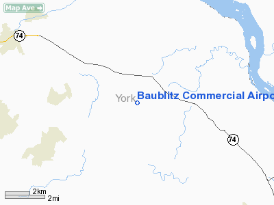
Baublitz Commercial Airport |
Location & QuickFacts
| FAA Information Effective: | 2008-09-25 |
| Airport Identifier: | 9W8 |
| Airport Status: | Operational |
| Longitude/Latitude: | 076-29-10.8720W/39-51-08.3650N
-76.486353/39.852324 (Estimated) |
| Elevation: | 750 ft / 228.60 m (Estimated) |
| Land: | 12 acres |
| From nearest city: | 1 nautical miles S of Brogue, PA |
| Location: | York County, PA |
| Magnetic Variation: | 10W (1985) |
Owner & Manager
| Ownership: | Privately owned |
| Owner: | Chanceford Aviation |
| Address: | 3354 Warner Rd
Brogue, PA 17309 |
| Phone number: | 717-870-4076 |
| Manager: | Bruce Eveler |
| Address: | 3354 Warner Rd
Brogue, PA 17309 |
| Phone number: | 717-244-9115
ALTERNATE NUMBER 717-927-6760 |
Airport Operations and Facilities
| Airport Use: | Open to public |
| Wind indicator: | No |
| Segmented Circle: | No |
| Control Tower: | No |
| Lighting Schedule: | NONE |
| Landing fee charge: | No |
| Sectional chart: | Washington |
| Region: | AEA - Eastern |
| Boundary ARTCC: | ZNY - New York |
| Responsible ARTCC: | ZDC - Washington |
| Tie-in FSS: | IPT - Williamsport |
| FSS on Airport: | No |
| FSS Toll Free: | 1-800-WX-BRIEF |
| NOTAMs Facility: | IPT (NOTAM-d service avaliable) |
Airport Communications
| CTAF: | 122.800 |
| Unicom: | 122.800 |
Airport Services
| Fuel available: | 100LL |
| Airframe Repair: | MINOR |
| Power Plant Repair: | MINOR |
| Bottled Oxygen: | NONE |
| Bulk Oxygen: | NONE |
Runway Information
Runway 10/28
| Dimension: | 2493 x 100 ft / 759.9 x 30.5 m
RY 10/28 393 FT OVERRUN WEST END. |
| Surface: | TURF, Good Condition |
| |
Runway 10 |
Runway 28 |
| Traffic Pattern: | Left | Left |
| Markings: | Basic, Fair Condition
RY 10/28 EDGES & RY ENDS MARKED BY YELLOW FLUSH PAINTED MARKERS. | Basic, Fair Condition |
| Displaced threshold: | 476.00 ft
RY 10 DSPLCD THLD MKD BY 2 YELLOW FLUSH MARKERS EACH SIDE OF RY. | 200.00 ft
RY 28 DSPLCD THLD MKD BY 2 YELLOW FLUSH MARKERS EACH SIDE OF RY. 26:1 APCH SLOPE TO DSPLCD THLD. |
| Obstruction: | 43 ft pole, 33.0 ft from runway, 127 ft left of centerline
RY 10 APCH RATIO 20:1 TO DSPLCD THLD; DSPLCD THLD GRADE HIGHER THAN RY END DUE TO RY SLOPE. | 10 ft road, 43.0 ft from runway, 4:1 slope to clear
APCH RATIO 24:1 TO DSPLCD THLD. |
|
Radio Navigation Aids
| ID |
Type |
Name |
Ch |
Freq |
Var |
Dist |
| EUD | NDB | York | | 254.00 | 11W | 18.5 nm |
| APG | NDB | Aberdeen | | 349.00 | 11W | 25.9 nm |
| MTN | NDB | Martin | | 342.00 | 11W | 33.6 nm |
| IUB | NDB | Institute | | 404.00 | 08W | 34.6 nm |
| BZJ | NDB | Bellgrove | | 328.00 | 10W | 35.2 nm |
| FND | NDB | Ellicott | | 371.00 | 11W | 36.5 nm |
| BUH | NDB | Anne Arundel | | 260.00 | 10W | 47.9 nm |
| MTN | TACAN | Martin | 068X | | 11W | 31.5 nm |
| FDK | VOR | Frederick | | 109.00 | 08W | 48.9 nm |
| PPM | VOR/DME | Phillips | 021X | 108.40 | 09W | 27.4 nm |
| LRP | VORTAC | Lancaster | 120X | 117.30 | 09W | 18.4 nm |
| EMI | VORTAC | Westminster | 126X | 117.90 | 08W | 31.3 nm |
| MXE | VORTAC | Modena | 079X | 113.20 | 09W | 37.8 nm |
| HAR | VORTAC | Harrisburg | 072X | 112.50 | 10W | 38.1 nm |
| BAL | VORTAC | Baltimore | 098X | 115.10 | 11W | 41.7 nm |
| DQO | VORTAC | Dupont | 087X | 114.00 | 10W | 42.0 nm |
| RAV | VORTAC | Ravine | 093X | 114.60 | 11W | 42.5 nm |
| PTW | VORTAC | Pottstown | 112X | 116.50 | 09W | 48.1 nm |
| MDT | VOT | Harrisburg International | | 110.00 | | 24.4 nm |
Remarks
- FOR PICKUP CLNC CALL 410-859-7256.
- NO WINTER SNOW REMOVAL.
- DAYLGT OPS ONLY.
Images and information placed above are from
http://www.airport-data.com/airport/9W8/
We thank them for the data!
| General Info
|
| Country |
United States
|
| State |
PENNSYLVANIA
|
| FAA ID |
9W8
|
| Latitude |
39-51-08.365N
|
| Longitude |
076-29-10.872W
|
| Elevation |
750 feet
|
| Near City |
BROGUE
|
We don't guarantee the information is fresh and accurate. The data may
be wrong or outdated.
For more up-to-date information please refer to other sources.
|
|


