 |
|
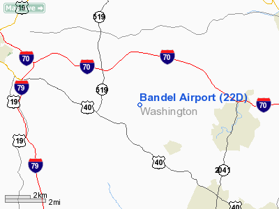
Location & QuickFacts
| FAA Information Effective: | 2008-09-25 |
| Airport Identifier: | 22D |
| Airport Status: | Operational |
| Longitude/Latitude: | 080-05-46.1990W/40-07-50.2580N
-80.096166/40.130627 (Estimated) |
| Elevation: | 1210 ft / 368.81 m (Estimated) |
| Land: | 40 acres |
| From nearest city: | 3 nautical miles SE of Eighty Four, PA |
| Location: | Washington County, PA |
| Magnetic Variation: | 07W (1985) |
Owner & Manager
| Ownership: | Privately owned |
| Owner: | Bruce Bandel |
| Address: | 284 Shipe Run Rd
Washington, PA 15301 |
| Phone number: | 724-945-6677 |
| Manager: | Bruce Bandel |
| Address: | 284 Shipe Run Rd
Washington, PA 15301 |
| Phone number: | 412-877-4584 |
Airport Operations and Facilities
| Airport Use: | Open to public |
| Wind indicator: | Yes |
| Segmented Circle: | No |
| Control Tower: | No |
| Landing fee charge: | No |
| Sectional chart: | Detroit |
| Region: | AEA - Eastern |
| Boundary ARTCC: | ZOB - Cleveland |
| Tie-in FSS: | AOO - Altoona |
| FSS on Airport: | No |
| FSS Toll Free: | 1-800-WX-BRIEF |
| NOTAMs Facility: | AOO (NOTAM-d service avaliable) |
Airport Communications
Airport Services
| Airframe Repair: | NONE |
| Power Plant Repair: | NONE |
| Bottled Oxygen: | NONE |
| Bulk Oxygen: | NONE |
Runway Information
Runway 01/19
| Dimension: | 2260 x 100 ft / 688.8 x 30.5 m |
| Surface: | TURF-DIRT, Fair Condition |
| |
Runway 01 |
Runway 19 |
| Traffic Pattern: | Left | Left |
| Markings: | Nonstandard, Poor Condition
SOME RWY MARKINGS COVERED BY GRASS. | Nonstandard, Poor Condition
SOME RWY MARKINGS COVERED BY GRASS |
| Obstruction: | 145 ft hill, 2806.0 ft from runway, 226 ft left of centerline, 19:1 slope to clear | 53 ft trees, 21.0 ft from runway, 85 ft right of centerline |
|
Radio Navigation Aids
| ID |
Type |
Name |
Ch |
Freq |
Var |
Dist |
| PNU | NDB | Washington County | | 255.00 | 08W | 3.2 nm |
| MKP | NDB | Mc Keesport | | 287.00 | 07W | 19.8 nm |
| VV | NDB | Camor | | 299.00 | 08W | 22.0 nm |
| BHU | NDB | Benje | | 382.00 | 07W | 40.6 nm |
| CFX | NDB | Cadiz | | 239.00 | 07W | 42.6 nm |
| AGC | VOR/DME | Allegheny | 037X | 110.00 | 09W | 9.3 nm |
| HLG | VOR/DME | Wheeling | 059X | 112.20 | 07W | 23.0 nm |
| AIR | VOR/DME | Bellaire | 118X | 117.10 | 07W | 33.9 nm |
| MMJ | VORTAC | Montour | 057X | 112.00 | 08W | 22.0 nm |
| IHD | VORTAC | Indian Head | 019X | 108.20 | 06W | 35.2 nm |
| MGW | VORTAC | Morgantown | 053X | 111.60 | 05W | 36.2 nm |
| EWC | VORTAC | Ellwood City | 105X | 115.80 | 08W | 42.1 nm |
Remarks
- EXTSV GLIDER OPNS WEEKENDS.
- LOCAL AIRCRAFT & GLIDERS MONITOR FREQ 123.3.
- PAEW ADJ RY 01/19 INDEFLY.
- VFR OPNS ONLY.
Images and information placed above are from
http://www.airport-data.com/airport/22D/
We thank them for the data!
| General Info
|
| Country |
United States
|
| State |
PENNSYLVANIA
|
| FAA ID |
22D
|
| Latitude |
40-07-50.258N
|
| Longitude |
080-05-46.199W
|
| Elevation |
1210 feet
|
| Near City |
EIGHTY FOUR
|
We don't guarantee the information is fresh and accurate. The data may
be wrong or outdated.
For more up-to-date information please refer to other sources.
|
|


