 |
|
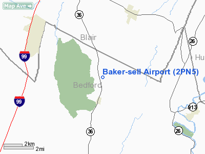
Location & QuickFacts
| FAA Information Effective: | 2008-09-25 |
| Airport Identifier: | 2PN5 |
| Airport Status: | Operational |
| Longitude/Latitude: | 078-21-39.0490W/40-14-54.2800N
-78.360847/40.248411 (Estimated) |
| Elevation: | 1371 ft / 417.88 m (Surveyed) |
| Land: | 0 acres |
| From nearest city: | 1 nautical miles N of Woodbury, PA |
| Location: | Bedford County, PA |
| Magnetic Variation: | 09W (1985) |
Owner & Manager
| Ownership: | Privately owned |
| Address: |
|
| Manager: | Edwin D. Sell |
| Address: | Rd 1, Box 102
Woodbury, PA 16695 |
| Phone number: | 814-793-3960 |
Airport Operations and Facilities
| Airport Use: | Private |
| Wind indicator: | Yes |
| Segmented Circle: | No |
| Control Tower: | No |
| Landing fee charge: | No |
| Sectional chart: | Detroit |
| Region: | AEA - Eastern |
| Boundary ARTCC: | ZOB - Cleveland |
| Tie-in FSS: | AOO - Altoona |
| FSS on Airport: | No |
| FSS Toll Free: | 1-800-WX-BRIEF |
Airport Services
| Airframe Repair: | MINOR |
| Power Plant Repair: | MINOR |
Runway Information
Runway NE/SW
| Dimension: | 2000 x 100 ft / 609.6 x 30.5 m |
| Surface: | TURF, |
| |
Runway NE |
Runway SW |
| Traffic Pattern: | Left | Left |
|
Radio Navigation Aids
| ID |
Type |
Name |
Ch |
Freq |
Var |
Dist |
| SYS | NDB | Stoystown | | 209.00 | 08W | 27.3 nm |
| RV | NDB | Stroh | | 407.00 | 10W | 36.7 nm |
| INP | NDB | Indiana | | 242.00 | 08W | 39.6 nm |
| CBE | NDB | Cumberland | | 317.00 | 07W | 40.2 nm |
| BHU | NDB | Benje | | 382.00 | 07W | 42.4 nm |
| AOO | VOR | Altoona | | 108.80 | 07W | 5.3 nm |
| HGR | VOR | Hagerstown | | 109.80 | 07W | 40.5 nm |
| REC | VOR/DME | Revloc | 043X | 110.60 | 09W | 25.2 nm |
| GRV | VOR/DME | Grantsville | 070X | 112.30 | 06W | 48.7 nm |
| JST | VORTAC | Johnstown | 077X | 113.00 | 06W | 22.1 nm |
| THS | VORTAC | St Thomas | 097X | 115.00 | 07W | 26.7 nm |
| TON | VORTAC | Tyrone | 096X | 114.90 | 07W | 29.3 nm |
| PSB | VORTAC | Philipsburg | 102X | 115.50 | 10W | 43.5 nm |
| IHD | VORTAC | Indian Head | 019X | 108.20 | 06W | 48.7 nm |
Remarks
- VFR ONLY LMTD TO PSNL USE.
Images and information placed above are from
http://www.airport-data.com/airport/2PN5/
We thank them for the data!
| General Info
|
| Country |
United States
|
| State |
PENNSYLVANIA
|
| FAA ID |
2PN5
|
| Latitude |
40-14-54.280N
|
| Longitude |
078-21-39.049W
|
| Elevation |
1371 feet
|
| Near City |
WOODBURY
|
We don't guarantee the information is fresh and accurate. The data may
be wrong or outdated.
For more up-to-date information please refer to other sources.
|
|


