 |
|
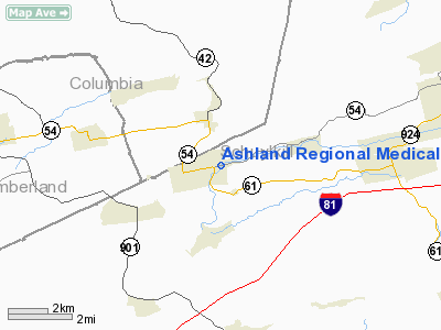
Ashland Rgnl Medical Center Heliport |
Location & QuickFacts
| FAA Information Effective: | 2008-09-25 |
| Airport Identifier: | PA32 |
| Airport Status: | Operational |
| Longitude/Latitude: | 076-19-58.8140W/40-47-00.3150N
-76.333004/40.783421 (Estimated) |
| Elevation: | 1060 ft / 323.09 m (Estimated) |
| Land: | 0 acres |
| From nearest city: | 1 nautical miles S of Ashland, PA |
| Location: | Schuylkill County, PA |
| Magnetic Variation: | 11W (1985) |
Owner & Manager
| Ownership: | Publicly owned |
| Owner: | Ashland Area Community Hosp |
| Address: | Route 61
Ashland, PA 17921 |
| Phone number: | 717-875-5979 |
| Manager: | Elizabeth J. Ruffing, Pres |
| Address: | Dennis Matthews, Ceo
Ashland, PA 19721 |
| Phone number: | 717-875-2000 |
Airport Operations and Facilities
| Airport Use: | Private
MEDICAL USE. |
| Wind indicator: | Yes |
| Segmented Circle: | No |
| Control Tower: | No |
| Lighting Schedule: | DUSK-DAWN |
| Landing fee charge: | No |
| Sectional chart: | New York |
| Region: | AEA - Eastern |
| Boundary ARTCC: | ZNY - New York |
| Tie-in FSS: | IPT - Williamsport |
| FSS on Airport: | No |
| FSS Toll Free: | 1-800-WX-BRIEF |
Airport Services
| Airframe Repair: | NONE |
| Power Plant Repair: | NONE |
Runway Information
Helipad H1
| Dimension: | 75 x 75 ft / 22.9 x 22.9 m |
| Surface: | ASPH, |
| |
Runway H1 |
Runway |
| Traffic Pattern: | Left | Left |
|
Radio Navigation Aids
| ID |
Type |
Name |
Ch |
Freq |
Var |
Dist |
| HXM | NDB | Humbolt | | 366.00 | 10W | 19.6 nm |
| BZJ | NDB | Bellgrove | | 328.00 | 10W | 23.2 nm |
| LQX | NDB | Carbon | | 339.00 | 12W | 26.2 nm |
| PIX | NDB | Picture Rocks | | 344.00 | 09W | 34.2 nm |
| CYE | NDB | Crystal Lake | | 410.00 | 11W | 34.3 nm |
| HZL | VOR | Hazleton | | 109.40 | 09W | 14.9 nm |
| ETX | VOR/DME | East Texas | 039X | 110.20 | 09W | 32.0 nm |
| FQM | VOR/DME | Williamsport | 091X | 114.40 | 09W | 38.9 nm |
| RAV | VORTAC | Ravine | 093X | 114.60 | 11W | 18.4 nm |
| MIP | VORTAC | Milton | 029X | 109.20 | 09W | 20.9 nm |
| SEG | VORTAC | Selinsgrove | 041X | 110.40 | 08W | 25.1 nm |
| LRP | VORTAC | Lancaster | 120X | 117.30 | 09W | 39.9 nm |
| FJC | VORTAC | Allentown | 122X | 117.50 | 10W | 40.1 nm |
| LVZ | VORTAC | Wilkes-barre | 053X | 111.60 | 10W | 41.4 nm |
| HAR | VORTAC | Harrisburg | 072X | 112.50 | 10W | 44.4 nm |
| PTW | VORTAC | Pottstown | 112X | 116.50 | 09W | 48.8 nm |
| MDT | VOT | Harrisburg International | | 110.00 | | 40.3 nm |
Remarks
- NO NIGHT OPNS PERMITTED WITHOUT PRIOR ORIENTATION.
Images and information placed above are from
http://www.airport-data.com/airport/PA32/
We thank them for the data!
| General Info
|
| Country |
United States
|
| State |
PENNSYLVANIA
|
| FAA ID |
PA32
|
| Latitude |
40-47-00.315N
|
| Longitude |
076-19-58.814W
|
| Elevation |
1060 feet
|
| Near City |
ASHLAND
|
We don't guarantee the information is fresh and accurate. The data may
be wrong or outdated.
For more up-to-date information please refer to other sources.
|
|


