 |
|
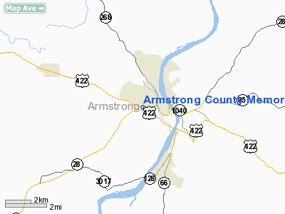
Armstrong County Memorial Hospital Heliport |
Location & QuickFacts
| FAA Information Effective: | 2008-09-25 |
| Airport Identifier: | 81PN |
| Airport Status: | Operational |
| Longitude/Latitude: | 079-32-53.1630W/40-48-40.2310N
-79.548101/40.811175 (Estimated) |
| Elevation: | 1157 ft / 352.65 m (Estimated) |
| Land: | 0 acres |
| From nearest city: | 4 nautical miles W of Kittanning, PA |
| Location: | Armstrong County, PA |
| Magnetic Variation: | 09W (2000) |
Owner & Manager
| Ownership: | Privately owned |
| Owner: | Armstrong County Meml Hosp |
| Address: | One Nolte Drive
Kittanning, PA 16201 |
| Phone number: | 412-543-8500 |
| Manager: | Raymond Cuddy |
| Address: | One Nolte Drive
Kittanning, PA 16201 |
| Phone number: | 412-543-8500 |
Airport Operations and Facilities
| Airport Use: | Private
MEDICAL USE. |
| Wind indicator: | Yes |
| Segmented Circle: | No |
| Control Tower: | No |
| Landing fee charge: | No |
| Sectional chart: | Detroit |
| Region: | AEA - Eastern |
| Boundary ARTCC: | ZOB - Cleveland |
| Tie-in FSS: | AOO - Altoona |
| FSS on Airport: | No |
| FSS Toll Free: | 1-800-WX-BRIEF |
Runway Information
Helipad H1
| Dimension: | 70 x 70 ft / 21.3 x 21.3 m |
| Surface: | ASPH, |
| |
Runway H1 |
Runway |
| Traffic Pattern: | Left | Left |
|
Radio Navigation Aids
| ID |
Type |
Name |
Ch |
Freq |
Var |
Dist |
| INP | NDB | Indiana | | 242.00 | 08W | 24.5 nm |
| BHU | NDB | Benje | | 382.00 | 07W | 29.1 nm |
| MKP | NDB | Mc Keesport | | 287.00 | 07W | 29.4 nm |
| UCP | NDB | Castle | | 272.00 | 09W | 41.4 nm |
| PNU | NDB | Washington County | | 255.00 | 08W | 48.9 nm |
| HBD | NDB | Hubbard | | 408.00 | 08W | 49.1 nm |
| FKL | VOR | Franklin | | 109.60 | 06W | 40.2 nm |
| CIP | VOR/DME | Clarion | 076X | 112.90 | 06W | 20.6 nm |
| AGC | VOR/DME | Allegheny | 037X | 110.00 | 09W | 39.1 nm |
| REC | VOR/DME | Revloc | 043X | 110.60 | 09W | 39.8 nm |
| EWC | VORTAC | Ellwood City | 105X | 115.80 | 08W | 30.2 nm |
| MMJ | VORTAC | Montour | 057X | 112.00 | 08W | 35.3 nm |
| JST | VORTAC | Johnstown | 077X | 113.00 | 06W | 44.1 nm |
Remarks
- PROVIDED PLINE WEST OF LANDING AREA IS MARKED AS OBSTRUCTION.
Images and information placed above are from
http://www.airport-data.com/airport/81PN/
We thank them for the data!
| General Info
|
| Country |
United States
|
| State |
PENNSYLVANIA
|
| FAA ID |
81PN
|
| Latitude |
40-48-40.231N
|
| Longitude |
079-32-53.163W
|
| Elevation |
1157 feet
|
| Near City |
KITTANNING
|
We don't guarantee the information is fresh and accurate. The data may
be wrong or outdated.
For more up-to-date information please refer to other sources.
|
|


